Bernal Heights Needs a Flag, So How About This One?

Bernalflagmap

There’s been a lot of thinking about flag design lately: What are the elements of a good flag? What’s wrong with bad flags? How great a really great flag can be, and how sad and useless a bad flag is.

Much of the current thinking about flag design traces back to celebrity audio person and design aficionado  Roman Mars, who recently introduced us to the very geeky subculture of vexillology  (the study of the history, symbolism, and usage of flags) in a very geeky episode of his 99% Invisible podcast. You can check it out here.

The key lesson from Roman’s crash-course in Vexillology 101 is that good flag design follows five basic rules:

1. Keep it simple
2. Use meaningful symbolism
3. Use two to three basic colors
4. No lettering or seals of any kind
5. Be distinctive

That kicked off a national conversation about flag design; a conversation that grew even more urgent when Roman Mars was invited to give a TED Talk on the subject:

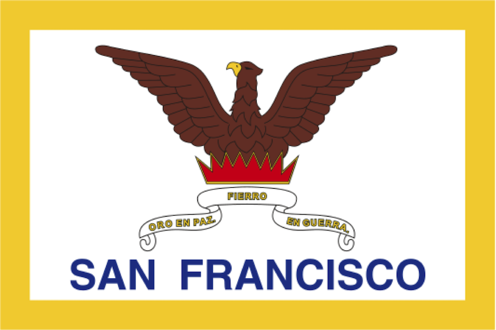
The crux of his TED Talk was that the flags of American cities are generally rather terrible, and San Francisco is a clear case in point. Very few people are familiar with San Francisco’s flag, because San Francisco’s flag is a hot steaming mess that breaks all the rules of vexillological good taste. It looks like this:

sf-flag-real-2

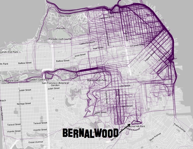
In the spirit of civic improvement, Roman Mars has kicked off a new effort to redesign San Francisco’s flag. But in the meantime, that got your Bernalwood editor thinking: What about a flag for Bernal Heights? Don’t we deserve a flag too?

Of course we do.

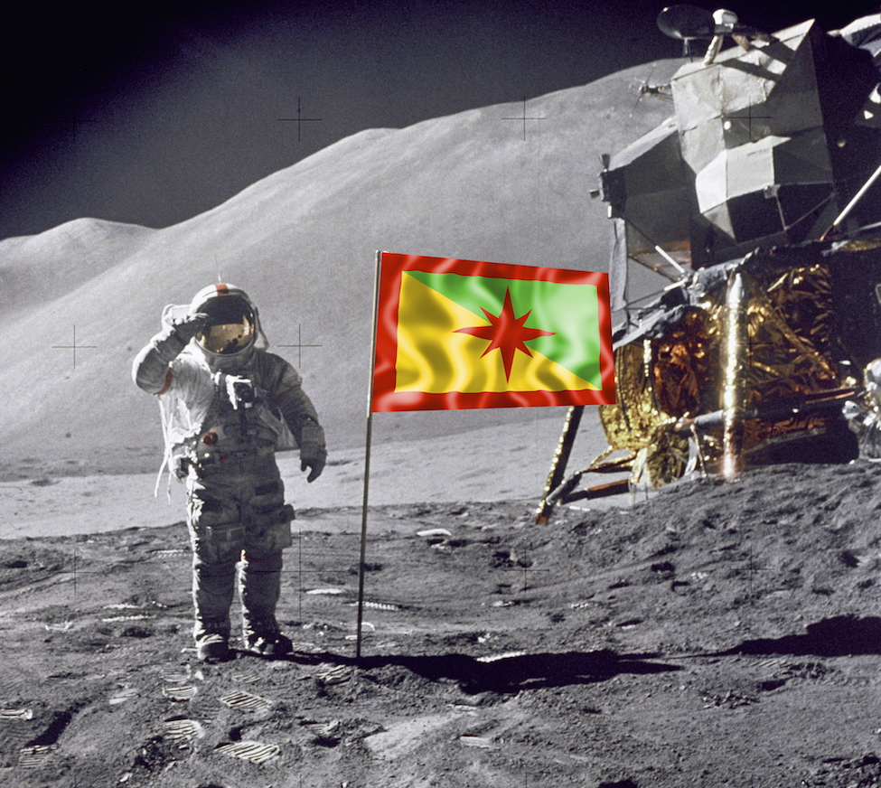
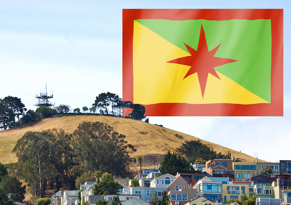
So after internalizing the design rules recommended by vexillologists, I took the liberty of developing a flag for Bernal Heights. I hope you might entertain the idea of rallying around it. Fellow citizens, I propose that all Bernalese should live in peace under this banner, the (Proposed) Great Flag of the Dominion of Bernal Heights:

bernalflag.tl.1

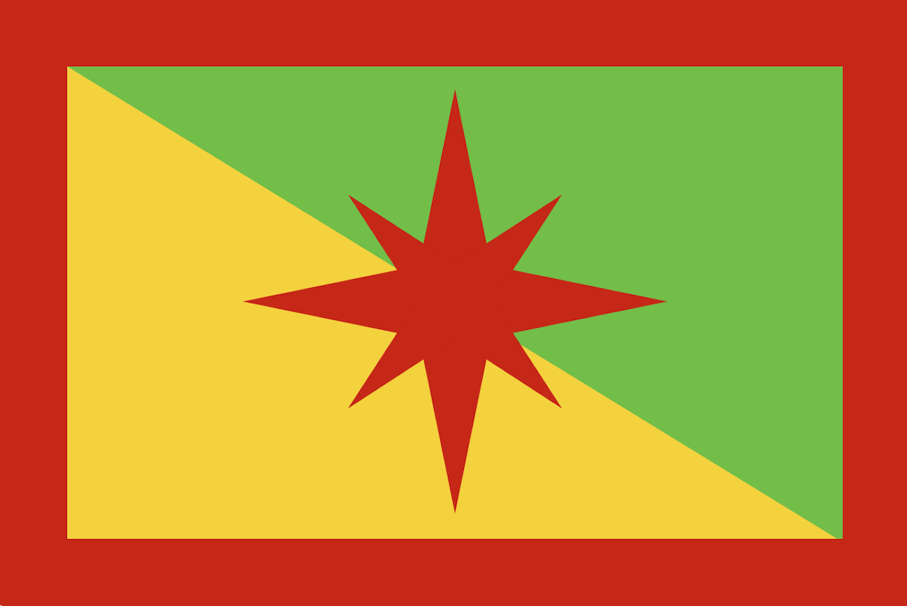
Rather sporty, eh? Dynamic! Bold! Distinctive! Let’s walk through its symbolism:

  • The diagonal fields of green and yellow represent the two annual phases of Bernal Hill: green (winter wet) and golden yellow (summer dry).
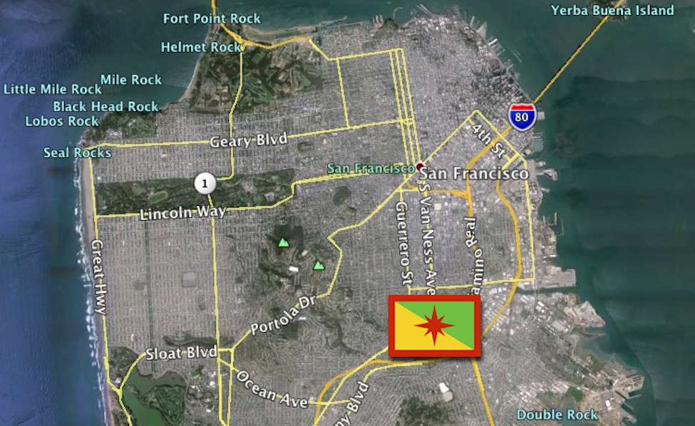
  • The four sides of the red border represent the four roads that define the boundaries of our Bernal territory: I-280, San Jose Avenue, Cesar Chavez Boulevard, and US 101.
  • The star at the center is of course Bernal Hill, shown as a compass rose to represent the 360-degree views of San Francisco visible from the summit. The red color symbolizes both the beloved chert which stabilizes us, and the long tradition of social activism which is an important part of our neighborhood history.

That’s my proposal. I think it’s not too shabby, at least as a first stab at a flag for Bernal Heights. Plus, it would do the trick if you wanted to quietly represent Bernal in your workplace or favorite coffee shop:

bernal.computerflags

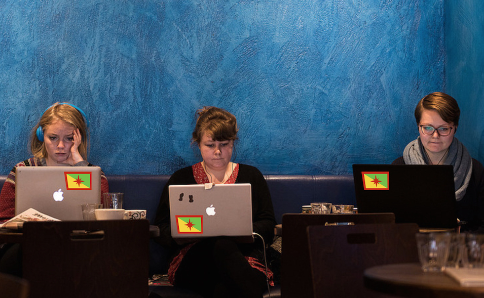
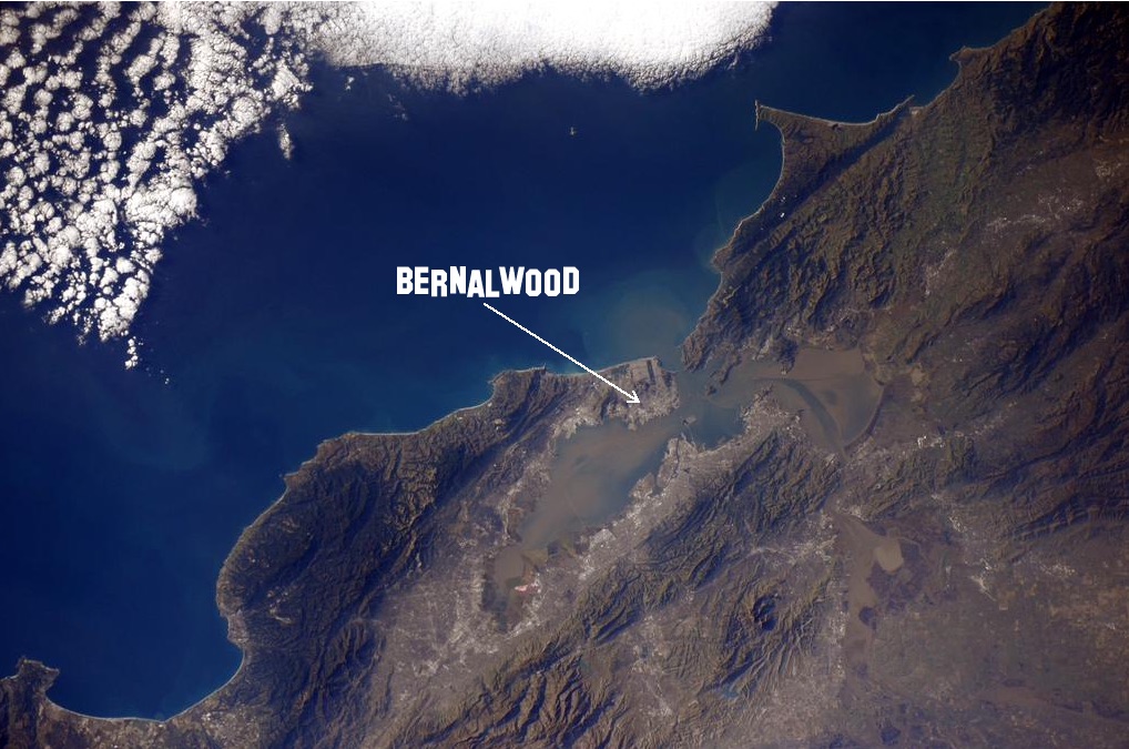
This design travels well too. No matter where you go, or whatever distant lands you conquer, you can take your Bernal Heights pride with you:

manonmoon.flag2

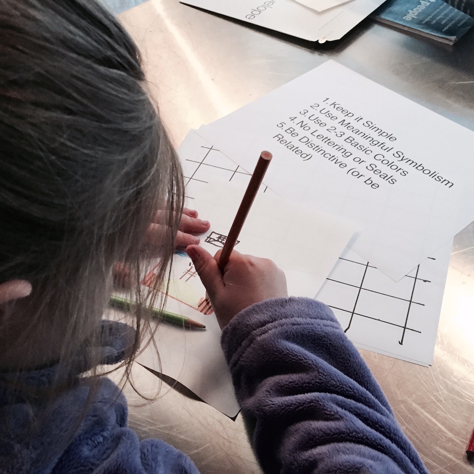
That said, there are some other designs to consider. Bernalwood’s Cub Reporter rose to the challenge, beginning with some small-scale drawings (which are recommended as a starting place to simulate the view of a flag from a distance):

cub.flagmaking

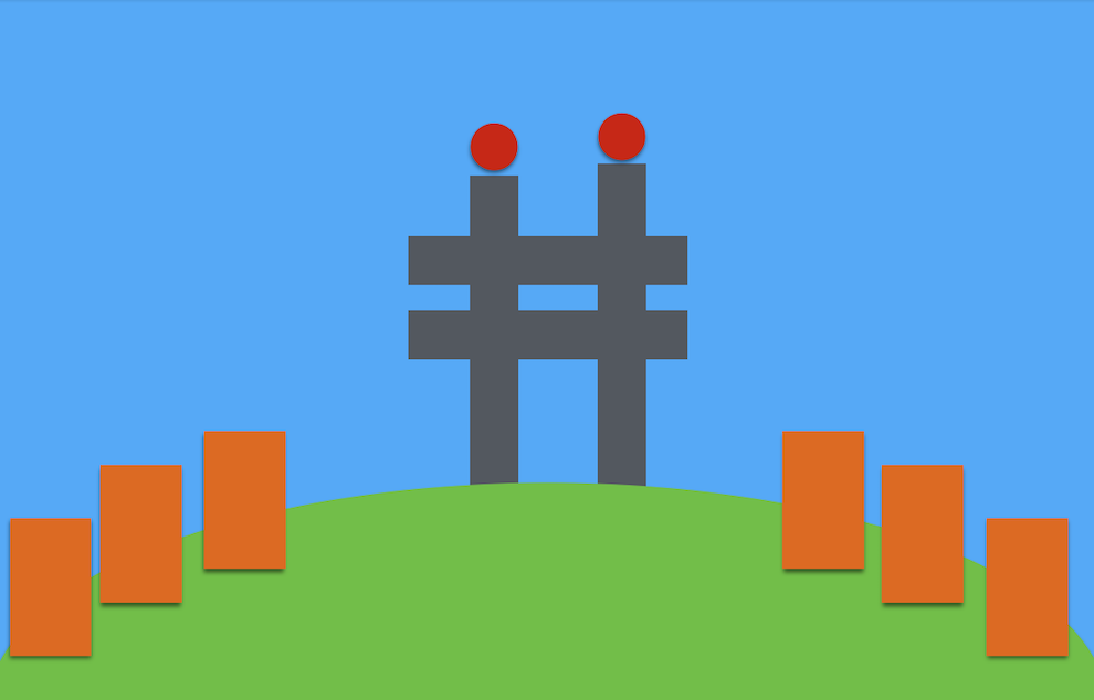
Bernalwood’s Cub Reporter developed two designs. The first is a simplified view of Bernal Hill and Sutrito Tower, with tiny houses nestled along the slopes:

bernalflag.cub1

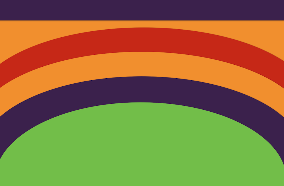
Her second concept is more bold. It’s a colorful interpretation of a perspective she loves; the view looking toward the sunset as you stroll west along the north side of Bernal Heights Boulevard toward Folsom in the evening:

bernalflag.cub2

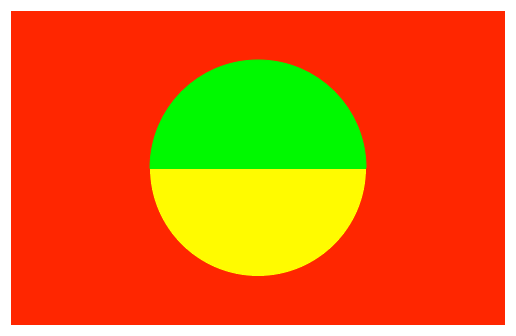
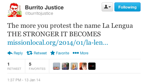
Always game for a goofy graphic design problem, Burrito Justice, rebel spokesblogger for the La Lenguan separatists, also rallied to embrace the Bernal flag design challenge. Picking up on some of the themes in my design, he came up with a clever interactive concept:

bernalflag.burrito1

The symbolic logic? Burrito Justice explains:

Green hill, yellow hill, chert background… You turn the flag over depending on the season.

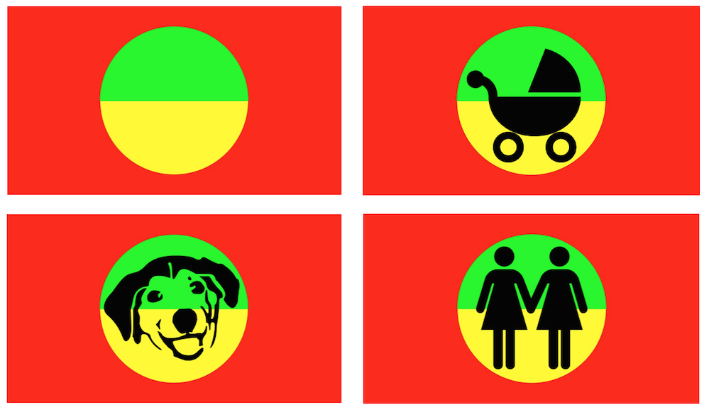
Nice! To bring some further innovation to the idea, Burrito Justice then proposed the world’s first animated GIF flag:

bernal flag

Burrito Justice calls it “a flag for all seasons.”

Your Bernalwood editor called it “hard to sew.”

Burrito Justice explained, “Yeah but imagine the sales, people would need a new one every two weeks!” (Which is actually rather diabolical and brilliant.)

But of course, he couldn’t stop there. Next, Burrito Justice created a few more versions of his flag to celebrate Bernal’s most iconic residents:

Screen Shot 2015-06-04 at 10.33.42 PM

Sigh.

Bet hey, maybe you have a better idea for a Bernal flag?

If so, send it to us here at the Bernalwood Office of Vexillological Research or drop it in the comments, and we’ll share any additional ideas for Bernal Heights flags with the Citizens of Bernalwood soon.
bernalhillflag

IMAGES: Bernalwood Office of Vexillological Research

How to Find Bernal Heights While Orbiting in Outer Space

ISS.SF.2015.Bernalwood

This week, astronaut Scott Kelly flattered all of us in the City and County of San Francisco by tweeting a realtime photo while he passed overhead in the International Space Station:

It’s a lovely image, but astute astrocartographers may notice that the right edge of the photo stops just short of Bernal Heights. We’re not in the shot. Grrrrrr.

Nevertheless, according to every magazine your Bernalwood editor read as a child, we all will have the opportunity to orbit Earth from the safety and comfort of a fabulous space station, someday.

Torus_Interior.jpg.CROP.article920-large

And when that day comes, you should know how to look down from the lofty heights of outer space and quickly find the soils of your terrestrial homeland here in Bernal Heights.

Locating Bernal Heights from outer space is actually pretty easy. The trick is to know what local landmarks to look for.

Bernal Heights sits roughly at the intersection of two imaginary, perpendicular lines that extend from Islais Creek Channel to the east of Bernal Heights and Aquatic Park to the north. Both of these have a distinctive, easy-to-spot profile when viewed from above, so just find the intersection where the lines come together and then… hey, you have located your home, Earth creature:

SF.Satellite.BernalGrid

Ready to practice? Here’s another view from the ISS.

Hadfield.2013.2.lines

Let’s zoom and enhance:

Hadfield.2013.2.bernalwood

Final image; Challenge level, with no gridlines.

ISS.SF.Hadfield.2013

Did you find our glamorous Bernal territories?

ISS.SF.Hadfield.2013.bwood

Great! You now have The Right Stuff. Just strap on your guitar, and you’re ready for orbit:

PHOTO: Top, San Francisco as seen by Astronaut Samantha Cristoforetti in January 2015. 

Which of These Murals Should Help Visitors Discover Bernal’s Lost Tribe of College Hill?

mural_discovery_street

The  Bernalese peoples from the Lost Tribe of College Hill hope to be less lost. Or, more found. Or, at the very least, clearly branded.

This desire is now being expressed in the form of a mural the College Hill Neighborhood Association has commissioned with artist Josh Talbott. The mural will be installed on a cinderblock shed at 3600 Mission Street (at Appleton), and it will act as a visual point-of-entry for southbound traffic. The College Hill News says:

All three of Josh’s designs are meant to make you take notice of our corner of South Bernal—the Lost Tribe of College Hill is ready to be found. And our new College Hill logo—with wayfinding to the Bernal Cut Path—will be incorporated into the winning design.

Want to see Josh’s designs up close? Please join the College Hill Neighborhood Association at the Glen Park Library on Sunday, April 26th, at 4 p.m. to see his artistic inspiration and to log your vote in person.

“Discovery” is the name of the proposed design shown above.

Below, we see two other alternatives, “For Love” and “The Arrow of Time,” respectively:

lovemockup

arrow-with-logo-street-01

Which is the most fabulous? Which will do the most to put our College Hill neighbors on the map? All Bernalese are invited to learn more about the proposed designs and vote for your favorite online by April 30.

PHOTOS: by  Josh Talbott 

Here’s the View of Bernal Hill from the Other End of South Van Ness

bernalfrommarket

Yesterday I went to a meeting at 1455 Market Street, a big high-rise right at the corner of Market and 11th Street. The office was in one of the building’s upper stories, and it had incredible views of Our Faire City.

As I gazed south, I realized I was staring straight down South Van Ness to Bernal Hill, which looked particularly rakish and handsome.

In other words, I was basically eye-to-eye with Bernal Hill from a vantage point directly opposite those stone benches at the curve in the closed section of Bernal Heights Boulevard. You know… the ones that look straight up South Van Ness. Because when you sit on one of those benches, here’s what you see:

southvannorth.edit

That’s South Van Ness slicing through the center, and the photo at the top of this post was taken from the building highlighted by the arrow.

To see both vantage points, let’s take in the view from the Bernalwood SkyCam:

SouthVanAerial.edit2

Bonus Fun Fact! As the crow flies, the distance between the benches on Bernal Hill and 1455 Market is about 11,427 feet, or 2.16 miles.

And now you know how we look from that distance when workers inside 1455 Market look back (enviously) at us.

PHOTOS: Telstar Logistics. Aerial image courtesy of Google Earth

Here’s How Jenni Sparks Drew Bernal Heights In Her Insanely Detailed Map of San Francisco

Jennisparkssf.bwood2

Artist Jenni Sparks has created a very cool new map of San Francisco, and The Bold Italic gives it a shout out:

London-based artist and map-maker Jenni Sparks just released an insanely detailed hand-drawn map of San Francisco. Like, so detailed I expected to zoom in on 14th and Church to find an adorable rendering of the time I fell so hard crossing the street that my shoes fell off.

The map took months to complete (obviously), and is the fourth map Jenni has drawn in collaboration with Evermade, following London, New York, and Berlin. The prints are 2 ft. by 2 ft.

The map goes on sale today, and you can buy one right here.

Because we are glamorous and vain, Bernalwood wrote to Jenni Sparks to request a detail of Bernal Heights. Because Jenni Sparks understands this about us, she kindly passed it along. So here is Bernal Heights, as seen in Jenni’s fabulous new map:

bernalheights.jennisparks2

Purists will grumble that the BART line is positioned a little too far to the west, and our defensive freeway perimeter has gone missing, but Bernalwood will gladly overlook all that in the name of artistic license and general maptastic awesomeness.

Plus, Silver Crest Donut Shop! And I can totally see my house.

Thanks for sharing, Jenni!

MAP IMAGES: Courtesy of Jenni Sparks

Aerial Photo Highlights Our Fabulous Sign on Bernal Hill

bernalsign

Last weekend, Neighbor kc! went for an aerial jaunt in the skies above Bernal Heights. Looking down on our faire neighborhood from his lofty perch at 2000 feet, kc! captured a wonderful shot of the Bernalwood sign that broadcasts our identity to aviators and urbanites alike.

Let’s zoom and enhance for a better view:

bernalwoodsigndetail

Amazing!  Even from waaaaaaay way way up there in the heavens, we still look… ridiculously glamorous.

UPDATE! Goddamn rotten punk kids…

PHOTO: Neighbor kc!

Neighbor Goes for Walk on Lost Streets of Bernal’s Yesteryear

1869-sf-goddard-bernal
Bernal neighbor Michael Nolan has been here for many hundreds of moons, but he recently went for a short walk around west Bernal that sent him even farther back in time:

I walked down Heyman this morning en route to boot camp. It’s a block long street stretching from Prospect Ave. to Coleridge (formerly California), and just south of Virginia. We live here in West Bernal in the Heyman Subdivision of the Cobb Tract of Precita Valley Lands, once part of Jose Bernal’s rancho. I live on Elsie Street (formerly Cherubusco) which lies between and parallel to Bonview (formerly Buena Vista) and Winfield (formerly Chapultepec). Your corrections and amplifications of this history will be appreciated and acknowledged.

A quick comparison of maps old and new verifies many details of Neighbor Michael’s stroll down History Lane(s).

Here’s a west Bernal detail from the 1869 map. Notice Cobb Tract superimposed above the western end of Cortland (which, oddly, is spelled “Courtland,” but only east of North Ave., or modern-day Bocana):

1869-sf-goddard-map-westbernal

Compare that with 2014, courtesy of the Google:

2014map.westbernal What’s up with the Cobb’s Tract business? The lovely Tramps of San Francisco blog ‘splains for us:

The first land sold in Bernal Heights had been transferred by auction at the real estate offices of H.A. Cobb and R.H. Sinton, 102 Montgomery Street, on July 14, 1860. The property consisted of “4, 5, and 6 acre lots on the ‘Bernal Heights’ …  within 15 minutes drive from City Hall … for sale at a very low rate … The lands, for beauty of locality, commanding scenery and fertility of soil, are not surpassed in the county of San Francisco.” In August 1865, another 66 homestead lots were offered in on the “Cobb Tract” of Bernal Heights and buyers were to receive title and a U.S. patent.

Verified!  Here’s an advert from the March 16, 1865 edition of the Daily Alta California:

In contemporary parlance, some might call H.A. Cobb a “speculator.” And the people who bought those homestead lots were “gentrifiers.” Especially if you were a displaced cow.

Anyway, It’s just a good thing Neighbor Michael wasn’t trying to meet his boot camp group at one of our many former California Avenues. He might never have found them.

If you enjoy fun with street history, our friends at the (awesome) Bernal History Project have complied a handy guide that explains where many of today’s Bernal streets got their names. To go even farther back, you’ll want peruse the top-secret spreadsheet Neighbor Michael keeps to track which of today’s Bernal streets used to be called something else. Want to see it? Just face toward Sutro Tower, chant the secret Bernalese password three times, and click here.

VINTAGE MAPS: 1869 map from the David Rumsey Map Collection, via Burrito Justice

Clever Map Reveals Geography of Bernal Heights Coffee Shops

coffeeshopwalkscapes.annotate

Some clever data-visualization geeks at MIT have created a very cool new map that reveals the social geography of San Francisco coffee shops. A Bernalwood-enhanced look at our portion of the map reveals which parts of Bernal align most organically with each of our local coffee shops:

This map shows the location of every independent coffee shop in San Francisco and the walking-shed community associated with it.

Independent coffee shops are positive markers of a living community. They function as social spaces, urban offices, and places to see the world go by. Communities are often formed by having spaces in which people can have casual interactions, and local and walkable coffee shops create those conditions, not only in the coffee shop themselves, but on the sidewalks around them. We use maps to know where these coffee shop communities exist and where, by placing new coffee shops, we can help form them.

We applied two steps to generate the data displayed by the map. First, we used the Google Places API to locate all coffee shops in a given city. Second, for each point in the map we queried the walking route and distance to its nearest coffee shop using the Google Distance Matrix API.

In the final map the colored areas represent a region which is walkable to a specific coffee shop (within one kilometer or 0.7 miles). The intensity of color at each point indicates its distance from its corresponding coffee shop.

Cool! But not perfect. The map was created by algorithms, not humans. So it reveals the logic of physical proximity, not social preference (thought the two often and naturally overlap). Also, the data might be a little old, because the transformative Cafe St. Jorge on Mission near Cortland is not present.

Nevertheless… cool!  Here’s how all of San Francisco looks without the Bernal annotations:

SFcoffeeshops

Your Official Guide to the Real Microhoods of Bernal Heights

bernal.microhoods.D

Yesterday, realtor Eileen Bermingham posted an article about the geographic subregions that exist in Bernal Heights:

Bernal Heights has many distinct areas within its neighborhood. From the hip enclave of Precita Park to the winding streets on the East Slope, the price of real estate literally varies depending upon which part of Bernal you’re in. So it’s important to lean heavily on sales in your particular part of the neighborhood when you’re accurately trying to determine property values in Bernal.

To help buyers and sellers with that task, I’ve deconstructed Bernal Heights into seven unofficial microhoods, complete with their respective price averages and low/high prices, as well as recent sales volume.

In this way, we are introduced to the comparative charms (and average home prices) of such areas as “The North West Slope,” and “Precita Park,” and “South of Cortland.” Unfortunately, it made us feel so… commodified. Ew.

That said, the idea that Bernal Heights consists of several distinct microhoods actually makes a lot of sense. After all, Bernal is a neighborhood defined by its topography — Remember, our last name is “Heights!” — so there’s an intuitive logic to the notion that different parts of the hill have very different subcultures and identities. Yet we are far more than our cost per-square-foot; we are a federation of nooks and crannies shaped by timeless geological features, historical quirks, and neighborly idiosyncrasies.

So please allow us to propose this homegrown draft guide to the Subdistricts of Bernal Heights, produced in collaboration with Burrito Justice, chief spokesblogger for the La Lenguan separatists. To wit, and roughly clockwise from the map shown above:

Precitaville – With the Mission as a front yard, Precita Park as the living room, and Bernal Hill as a backyard playground, Precitaville is perhaps the most cosmopolitan part of Bernal Heights. Perhaps.

Santana Rancho – Carlos Santana used to live here; Janis Joplin used to party here. The steep slopes and meandering streets of Bernal’s northeast corner have made it a secret haven for generations of local artists, musicians, and eccentrics.

The Sutrito Canine Republic – Located atop Bernal Hill in a public park, The Sutrito Canine Republic is patrolled by packs of very happy dogs who frolic off-leash and worship the microwave antenna array mounted atop Sutrito Tower.

The Hill People of Powhattan – With their homes clustered around Powhattan Avenue in the high-altitude reaches of Bernal Hill’s southeastern quarter, the Hill People of Powhattan are easy to recognize: Just look for their massive, hill-toned calves and slightly elevated demeanor.

Alemanistan – Dry, rocky, and sun-baked, Alemanistan retains a wild, untamed feel. Perched in the shadow of the Spaghetti Bowl, at the crossroads of two major highways, this  is Bernal’s frontier borderland.

Cortlandia – The heart of Bernal’s historic commercial district has now become the ideal setting for a contemporary situation comedy about bourgoise-bohemian urban culture in the early years of the 21st century. Which is funny, except that it’s also rather lovely, and we are very lucky to have it. The residents of Cortlandia are justifiably quite proud of this.

Baja Cortlandia – Perhched just south and slightly below Cortland Avenue, Baja Cortlandia is scrappy place of haphazard hills, multigenerational residents, and intense, superhyperlocal pride.

The Crescent – This area of Bernal Heights  is anchored by both Crescent Street and the Islamic Center and Mosque on the corner of Andover. So many Crescents.

St. Mary’s Park – Developed during the 1920s on the site of the former St Mary’s College campus, this self-contained, bell-shaped enclave feels like a little slice of the Sunset District, right in our own corner of Bernal Heights.

Lost Tribe of College Hill – Separated from the Bernal heartland by Mission Street, yet isolated by freeways from Glen Park, College Hill’s de facto independence is symbolized by a recent redistricting that saw the area transferred to Supervisor Scott Wiener’s District 8.

Holly Park – This ancient district of Bernal Heights is home to one of San Francisco’s oldest parks and a covered reservoir that has long been the setting for much local scandal and drama.

Foggy Vista – Rising above Mission Street on Bernal’s west slope, the groovy people who live here enjoy a commanding view of Nature’s own lava lamp: the massive banks of fog that cascade over Twin Peaks. Residents eagerly await construction of the Esmeralda Funicular to facilitate transit to and from the bustling Mission Street corridor.

La Lengua Autonomous Zone – This territory has been an integral part of the Dominion of Bernalwood since the 19th century, but today the uppity people of La Lengua enjoy limited autonomy under the terms of the 2010 Proclamation to the Vassals of La Lengua.

The Principality of Chicken John – Though located within the territorial boundaries of Bernal Heights, Chicken John’s warehouse residential complex and bus depot on Cesar Chavez functions as a world unto itself. Operating under its own sovereign codes, aesthetics, and social norms, and with it’s own 4.5 star rating on Yelp, The Principality of Chicken John is, in effect, Bernal’s version of the Vatican.

Serpentinia – Named after a long-gone street that used to mirror Precita on the northern side of Army/Cesar Chavez,  Serpentinia is today defined by the major thoroughfare that now slices through its center. After decades of indifference and neglect, recent  infrastructure upgrades on Chavez may bring new cultural vitality to this region.

So there you have it. Neighborly comments, suggestions, rants, and proposed revisions  are most welcome, with an eye toward future iteration of this map.

REVISION NOTE: March 20: Based on comments provided by Bernal neighbors, the former “Outer Cortlandia” was  renamed “Baja Bernal,” and then renamed again to “Baja Cortlandia.” The map has also been updated to include this change.

Clever Infographic Shows Where Runners Run in Bernal Heights

runmapBernalwood.001

The FlowingData website just posted a set of spiffy infographics that visualize where people go running in a variety of fabulous cities:

A lot of people make their workouts public on a variety of services, so there’s definitely accessible data. I use RunKeeper for cycling. I sampled from there.

The maps below are what I got, mostly for American cities, but there are a few European cities in there too (alphabetical order). If there’s one quick (and expected) takeaway, it’s that people like to run by the water and in parks, probably to get away from cars and the scenery.

So, this is New York City:

New-York1

And this is Paris:

Paris

Bernalwood is vain and narcissistic, so we just had to zoom and enhance to create a map that’s all about us.  So where do people who like to run like to run in Bernal Heights?

jogmapdetail

Mostly, around Bernal Hill, via Folsom from Cesar Chavez. Some enjoy the Esmeralda stairs. Precita carries a lot of east-west traffic. The hardcores loop around both Holly Park and Bernal Hill.

MAPS: via FlowingData

UPDATED: New Merchant Association: “We Don’t Know What to Call It Yet, But It Will Certainly Not Be La Lengua”

Well, this is awkward.

The initial seed of discontentment over the nomenclature used to describe the flat portion of the Dominion of Bernalwood along Mission Street has now become an outright counter-rebellion. MissionLocal reports that business-owners along Bernal’s Mission corridor are in the process of creating a merchant’s association, and the group’s first task is to settle upon a name for the area that is something other than “La Lengua”:

Every revolution has its line-in-the-sand moment. For one architect south of Cesar Chavez, the moment came when locals — and even allegedly some city officials — started using “some hipster name” to refer to the neighborhood: La Lengua.

That translates to “The Tongue” in English, and it left a bad taste in the merchants’ mouths. In fact, they are forming their own merchants association — first meeting today — to rebrand themselves and define their commercial interests in the microhood where Bernal Heights and the outer edges of the Mission meet.

“That stupid name really got everyone listening,” said Harlan Hoffman, an architect with an office and a building on Mission Street, who is one of the main members of the association’s formation committee. “In a good way, that kind of spurred us on, and we decided to go ahead with this plan.”

Harlan Hoffman goes on to say:

 “It’s not the Inner Mission, it’s not the Outer Mission — it’s its own thing,” Hoffman said. “We don’t know what to call it yet, but it will certainly not be La Lengua.”

See? Ouch. Awwwwwwkwaaaaaard.

Since the disputed area is, and always shall be, an integral part of the Dominion of Bernalwood, we have no stake in the nomenclature controversy, except to treat it is a local matter that requires local resolution among the indigenous people.

However, we would remind the merchants in the disputed region that there is precedent for what they seek to accomplish, as Bernalwood revealed in this old storefront decal:

Hiding in plain sight on a vacant Mission Street storefront just north of 30th Street, [Neighbor Ben] found a vintage decal which pledges fealty to the “South of Army – Mission Merchants Association.”

Who were these proto-La Lenguans? What can we infer about the people who roamed the flatlands in the days before Army Street became Cesar Chavez Boulevard? The decal’s intimation that “He Knows You – You Know Him” suggests they were a paternalistic tribe that was closely bound by kinship ties and sharply-defined notions of geographic solidarity.

Unfortunately, since Army Street is indeed now called Cesar Chavez, the new merchants association is unlikely to embrace its historic antecedent in toto — which is sort of too bad, because that old graphic is ridiculously fabulous. (Memo to Secession Design: That logo. On a t-shirt. PLEASE!)

Bernalwood has reached out to rebel spokesblogger Burrito Justice, leader of the La Lenguan autonomy movement, for comment on this matter. He promised to release a statement soon, but in the meantime, his activity on Twitter suggests there will be more to come in the days ahead:

Lalenguatweet1

DEVELOPING….

UPDATE: 1/14/14, 10 am: Burrito Justice has released a statement, and meme-ready image, regarding the burgeoning nomenclature controversy:

Harlan, here’s what you don’t get — La Lengua doesn’t care what you think. La Lengua just… is. We didn’t try very hard, and La Lengua took off. We are having fun.

You seem angry, Harlan. But the more you try to hate on La Lengua, the stronger it will become.

obi-wan-la-lengua1

Smile! Look Happy! Google Street View Car Surveys Bernal

streetviewcar

Hopefully you brushed your sidewalks and flossed your expansion joints recently, because several neighbors spotted the Google Street View car in Bernal Heights over the weekend, presumably to update our visual data to reflect our look in late 2013.

Fortunately, Neighbor Mark did his part to ensure we present a clean, well-groomed appearance to cyber-tourists and future historians:

PHOTO: Street View car on Alabama at Precita on Saturday, by Don Derheim.

Unbuilt Bernal Heights: Our Future That Never Was

Burnhambernalwood-1905

The only thing Bernalwood loves more than a good local history lesson is a strong dose of local fantasy science-fiction. Luckily for us, some recent synchronicity has conspired to provide a tasty mixture of the two.  Here’s how it unfolds…

Part One: A few weeks ago, I took Bernalwood’s Cub Reporter to visit the new Exploratorium. While we were there, we wandered down a long hallway and into the Bay Observatory Gallery at the northeast corner of the museum. And in the Bay Observatory Gallery, we found a very cool collection of maps:

exploratorimmaps

As you can see, the Cub Reporter was fascinated with a map visualization created by the amazing Eric Fischer (which quite speaks well of her).

Simultaneously, your Bernalwood editor was intrigued by a map of an ambitious redevelopment plan that envisioned San Francisco as a kind of Paris by the Bay, with grand boulevards and ornate gardens slicing through our familiar street grid. Naturally, I took a particular interest in the Bernal Heights portion of the map:

BernalBurnham1905.A

So much to absorb! To facilitate later study, I snapped a few quick photos, including one of the map legend:

1905MapDetailThe legend identified the map as:

Plan, showing system of highways, public places, parks, park connections, etc., to serve as a guide for the future development of the city, recommended in his report to the Association for theImprovement and Adornment of San Francisco, by D.H. Burnham – September 1905

Hmmmmmmmm. We’ll explore all the details of the map in a moment, but first, let’s consider that curious synchronicity, which arrived in the form of…

Part Two:  Have you heard of 99% Invisible? It’s a contemporary and wonderful radio documentary series created by producer Roman Mars here in San Francisco as a project of public radio KALW and the American Institute of Architects.

99% Invisible is a show “about design, architecture, and the 99% invisible activity that shapes our world,” with an emphasis on that 99% part — which is to say that 99% Invisible is about the history, personalities, and contextual quirks from which meaningful design and architecture emerges. This sounds heady and theoretical, but the show is anything but; it’s quirky and vibrant with an emphasis on people and great storytelling. Listen to it — it will make you see the world with shiny new eyes.

As fate (and synchronicity) would have it, the most recent episode of 99% Invisible is called “Unbuilt,” and it happens to be about unrealized urban master plans in general — and Daniel Burnham’s 1905 master plan for San Francisco in particular. So while listening to 99% Invisible this week, I finally got the backstory about Daniel Burnham’s vision for the future of San Francisco:

Daniel Burnham was the mastermind behind the White City at the 1893 Columbian Exposition in Chicago It was the pinnacle of “The City Beautiful” movement, with big civic centers and grand neo-classical structures to stir the soul.

Burnham was hired by big-time downtown business owners of San Francisco to turn this raggedy (if well-off) city into something majestic. Danial Burnham’s team shows up and they set up shop in a cottage on the summit of Twin Peaks so they can survey the city and craft the perfect plan…which was completed in the fall of 1905.

And the legend goes, all the books were delivered to city hall for distribution on April 17, 1906–the day before the great earthquake pulverized San Francisco.

Burnham’s grand master plan was derailed by the 1906 earthquake. The devastation of the quake might have seemed like a perfect opportunity to implement the more disruptive aspects of his urban design, but the reality was that traumatized San Franciscans simply wanted to rebuild quickly and in a manner that felt familiar. So they did.

Burnham’s San Francisco plan went unbuilt.

But what had he envisioned for the future of Bernal Heights? Let’s zoom and enhance the map I found at the Exploratorium:

burnhambernal2Burnham saw Bernal Hill as the grand southern terminus of two criss-crossing promenades, which presumably would have looked somewhat like The Mall in Washington DC.

The “Mission Parkway” promenade would have run east to west along an axis between 23rd and 24th Streets. Meanwhile, the north-south “Mission Arcade” promenade would supplant today’s South Van Ness Avenue, with a grand interchange crossing the Mission Parkway around 24th and South Van Ness.

Looking even more closely…

burnham.bernaldetail

Precita Park survives in slightly modified form, but Burnham proposed creating a wide garden on the north face of Bernal Hill, roughly along the axis of contemporary Shotwell Street, running continuously from Army (Cesar Chavez) to Stoneman Street.

Burnham also wanted to erect a large, neo-classical building on Bernal Hill to overlook the Mission. He did not indicate what this monumental building would be used for, but we can safely assume it would have been Something Very Important, like a world-renowned collection of Dried Macaroni Arts and Crafts or the urban palace of Lord Mark Zuckerberg, the Duke of Facebook.

A set of smaller monument-style buildings would stand on the northeastern side of Bernal Hill, overlooking a huge playground, while the summit of the hill would feature several small gardens (with grand fountains, perhaps?) for leisurely recreation.

On the south side of Bernal, Burnham envisioned a continuous promenade linking Holly Park to the soutwest side of Bernal Hill, while a similar promenade would link Holly Park to Mission Street before continuing on to an expanded Glen Park open space:

burnhamhollypk

Personally, what I like best about Burnham’s plan for Bernal Heights is how easy it is to visualize. For example, it’s not difficult to imagine the view looking south from 24th and South Van Ness, with that long carpet of green grass rolling toward Bernal, the manicured, European-style garden zig-zagging up Bernal’s north slope, and that neo-classical palace presiding over everything below as Bernal Hill’s feral summit looms proudly behind it.

It would have been magnificent.

It likely also would have been a disaster. The ambiguity surrounding the purpose of Burnham’s neo-classical palace on the north slope of Bernal pervades every aspect of his plan for San Francisco, and it’s unclear who would have actually used all the grand boulevards and promenades he proposed to build in the Mission District. After all, when you really stop to look, his promenades basically extend from Nowhere to Nowhere, and Burnham doesn’t provide much detail to indicate what kind of amenities or infrastructure would activate these sprawling public spaces to give them a reassuring urban bustle.

Indeed, Burnham doesn’t seem to have ever given much thought at all to the stuff that really matters in a city like San Francisco; namely, the myriad small exchanges and interactions that happen at street level, block-to-block, corner-to-corner, and doorstep-to-doorstep. Instead, his 1905 master plan was optimized for viewing from above, as I did when I saw it on the table at the Exploratorium, or as a satellite might see it while snapping photographs for Google Maps, high above, in the empty vacuum of space.

Burnham’s vision of Bernal’s future might have been lovely, but it wasn’t designed with us in mind.

IMAGES: Top: Daniel Burnham Plan, courtesy David Rumsey map collection, via 99% Invisible. All other images, Daniel Burnham 1905 Plan, as photographed at the Exploratorium.