This week, astronaut Scott Kelly flattered all of us in the City and County of San Francisco by tweeting a realtime photo while he passed overhead in the International Space Station:
It’s a lovely image, but astute astrocartographers may notice that the right edge of the photo stops just short of Bernal Heights. We’re not in the shot. Grrrrrr.
Nevertheless, according to every magazine your Bernalwood editor read as a child, we all will have the opportunity to orbit Earth from the safety and comfort of a fabulous space station, someday.
And when that day comes, you should know how to look down from the lofty heights of outer space and quickly find the soils of your terrestrial homeland here in Bernal Heights.
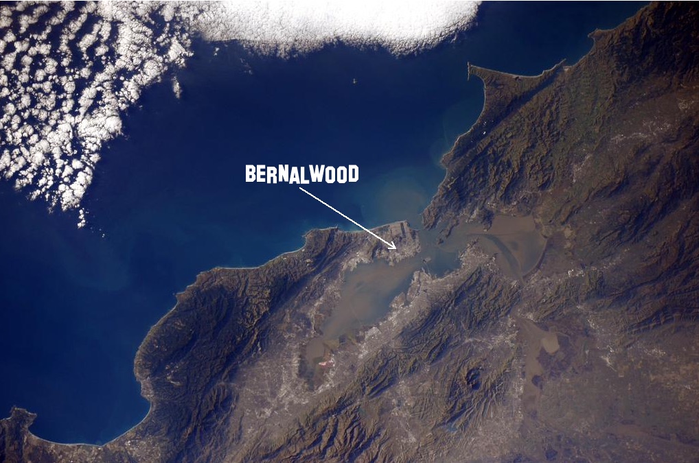
Locating Bernal Heights from outer space is actually pretty easy. The trick is to know what local landmarks to look for.
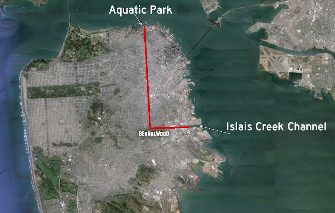
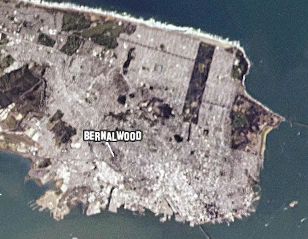
Bernal Heights sits roughly at the intersection of two imaginary, perpendicular lines that extend from Islais Creek Channel to the east of Bernal Heights and Aquatic Park to the north. Both of these have a distinctive, easy-to-spot profile when viewed from above, so just find the intersection where the lines come together and then… hey, you have located your home, Earth creature:
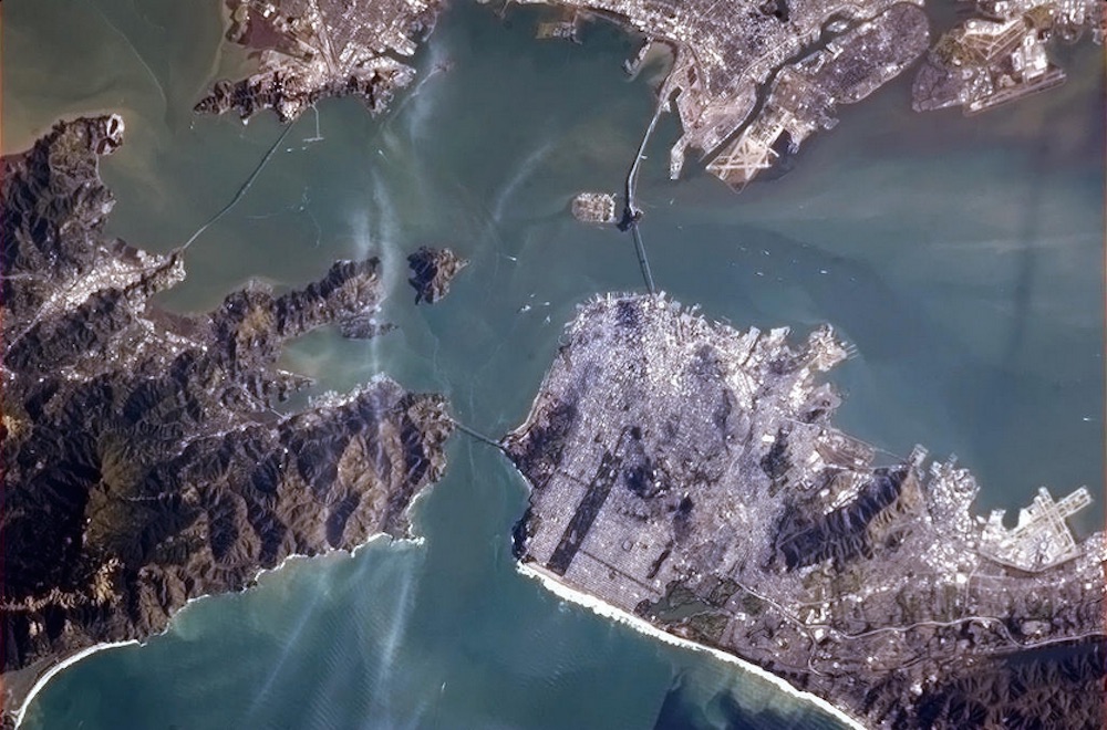
Ready to practice? Here’s another view from the ISS.
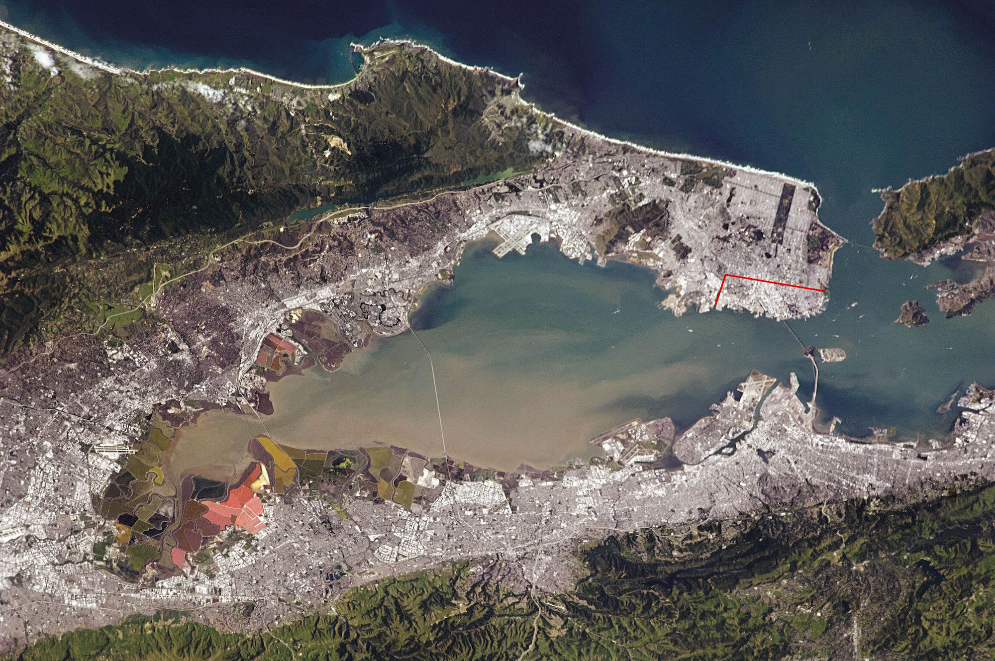
Let’s zoom and enhance:
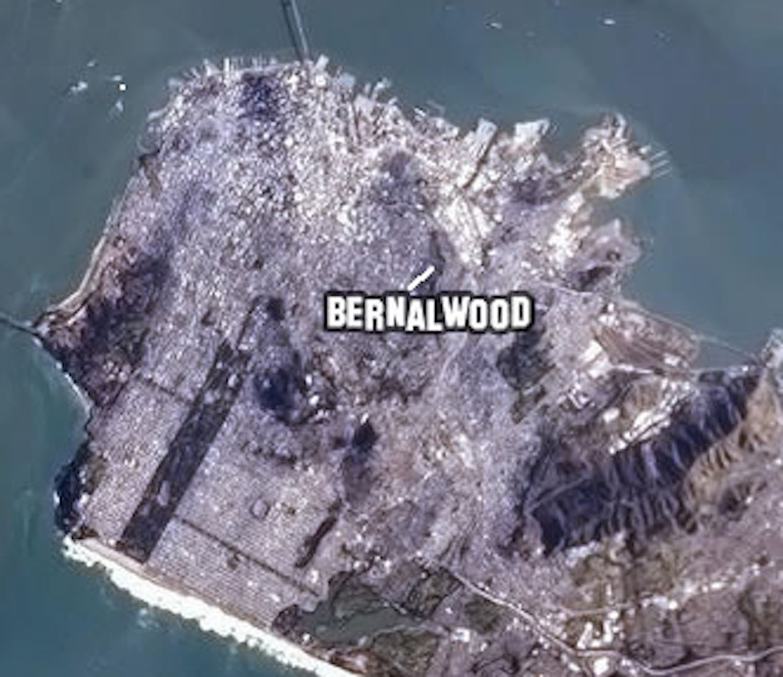
Final image; Challenge level, with no gridlines.
Did you find our glamorous Bernal territories?
Great! You now have The Right Stuff. Just strap on your guitar, and you’re ready for orbit:
PHOTO: Top, San Francisco as seen by Astronaut Samantha Cristoforetti in January 2015.

Marin is so…empty!
I love this! I was indeed zooming through space recently (flight to denver) and, naturally, I searched for the little hill before leaving our local skies. This would have made it easier.