Graffiti Removed, For Now, as Sutrito Tower Facility Gets a Coat of Paint

Sutrito Tower post-graffiti removal

Sutrito Tower has long been plagued by graffiti — not street art, not murals, just ugly, boring tags.

American Tower, which owns the facility, occasionally paints over it, but the company recently allowed some of the tags to linger for a long time. There’s one that says “TRUST NO HOE!” (charming) in this picture from January 2014 that was still there until very recently: IMG_0806

Now, it’s all gone. There’s new fencing, upgraded security lighting, and even barbed wire around most of the perimeter, which isn’t very attractive. Yet it might be worth it, if it actually keeps the taggers out.

If it doesn’t (which seems likely, given this site’s history), why not get rid of the fencing entirely? Like it was when Sutrito Tower was first built, in 1963.

Removing the fence would take the “adventure” out of tagging this building, and make it convenient for neighbors to paint over it without waiting years for American Tower to get around to cleaning up the mess.

Sutrito Tower post-graffiti removal

PHOTOS: Joe Thomas

New Pedestrian Crossing, Stop Signs Proposed for Eastern End of Bernal Heights Park

bernalxwalksite

Tomorrow morning, March 6, at 10 am, the San Francisco Municipal Transportation Agency will solicit input on proposed changes to the intersection of Bernal Heights Boulevard and Bernal Heights Boulevard at the eastern side of the park.

Wait, what? No, that’s not a typo:

hearingannounce

This is the spot.

The hearing happens at 10 am on Friday in Room 416 at City Hall. Here’s the announcement in situ:

Public Hearing

Three years ago, your Eastern Bureau correspondent attended a Rec and Parks meeting about trail restoration on Bernal Hill, where neighbors discussed the safety of the ‘undefined’ eastern entrances to the park. At the time, someone from the City mentioned that there was “lots you can do with paint.”

Now, the moment is at hand to perhaps do something with some paint. And a few stop signs.

PHOTOS: Joe Thomas

In New “Murder in the First” TV Show, Hollywood Cops Live in Real Bernal Heights

Alabama at Ripley MitF

Last year around this time, Hollywood came to Bernalwood to shoot a new TV show. It finally premiered Monday night on TNT, and it’s called Murder in the First. It’s produced by Steven Bochco (Hill Street Blues, NYPD Blue, Murder One, Brooklyn South, City of Angels, LA Law, Philly, and of course, Cop Rock), so of course it’s about cops.

The pilot opens in Bernal Heights, where SFPD inspector Hildy Mulligan (Kathleen Robertson) lives in a cute little house near the top of Alabama St. with her adorable moppet of a daughter. Robertson has been in a ton of things, going back to the original Beverly Hills 90210 and earlier as a child star in Canada. Bonus Canadian content for Burrito Justice: she played Mrs. Hockey (Colleen Howe) in 2013’s “Mr. Hockey: The Gordie Howe Story.”

Murder in the First Pilot

Neighbor Hildy, the hot blonde cop/mom (try saying it; it’s fun), is partnered with Terry (Taye Diggs), whose wife is dying from cancer. It’s pretty heavy. They’re called to a crime scene that’s meant to be a Tenderloin SRO hotel, but if you zoom and enhance, the place turns out to be regularly and frequently patrolled by the Los Angeles Police Department. Watch:

LAPD patrols

The pair do visit some real San Francisco locations as they run down leads on who killed the unsavory character in the hotel. Erich Blunt, a cartoonishly evil tech zillionaire played by Draco Malfoy with an American accent, quickly emerges as a person of interest. He is the CEO of “<APPLSN>,” which has a big campus right next to AT&T Park, and he says things like “Our apps are more than games. They are destinations where users go to get lost in alternate utopian realities.”

Hildy Terry and Erich

He also has enough money to hire one of the pilots from Wings to fly his entourage around on his private jet. But he’s probably too young to get that reference.

Pilot

Meanwhile, the SFPD office where Hildy and Terry work looks like it hasn’t been painted since Harry Callahan worked there. Damn those tech company tax-break giveaways!

Paint Me

I won’t spoil the plot; it’s a police procedural at heart, though apparently they’re going to be spending the whole season solving one murder. (Or two, I guess. Another body does turn up by the end of the first show.) I wasn’t blown away by Murder In the First, but I’ll give it another chance next week.  The ratings were pretty good, no doubt because of all the Bernal Heights cameos.

The pilot airs a few more times this week if you want to catch it on the DVR, and it’s free on iTunes. I’ll leave you with one more glimpse of the lovely view from Alabama at Ripley. Enjoy.

Of course, real Bernal Heights moms are more savvy about their footwear:

New Housing Proposed For Hidden Lot in Northeast Bernal Heights

futurehousing

quinlanblock

Neighbor Margo writes on Nextdoor.com about a plan to build some new houses on a secret lot in the interior of a block in northeast Bernal Heights, alongside Cesar Chavez Blvd.:

The owner of the interior lots bordered by Hampshire, Peralta, York and Cesar Chavez is planning to build on that land soon. He will bring preliminary plans to an open meeting of the East Slope Design Review Board on Wed., May 14, at 7 p.m. at the Precita Community Center, on Precita near the park.

The owner, Patrik Quinlan, came by our house last night and showed us plans for four single family homes of about 2,200 square feet, placed on an angle on the lots, so they would face northeast.

He also plans two small units in a building on top of a driveway through the lot on York Street that would serve as the access to the interior lots. So those would be an odd new sort of home – above a driveway.

On the interior-lot land, the buildings and their driveways would be situated on the property line nearest Cesar Chavez Street. So the people on Cesar Chavez would have a driveway, possibly on the ground and possibly on a ramp (Quinlan wasn’t sure), right on their property lines. Because of the slope of the hill, that driveway or ramp would be way above their heads. So… I think this means that long-term, their lives would be most affected by this.

In the past, Quinlan has presented plans for four or five duplexes, that is 8 or 10 units. So this is much less dense than he’s proposed in the past.

Issues that have come up in the past over development on this land are: fire truck access; where to place garbage containers; parking, of course; views and light; the geologic stability of the hill; potential displacement of underground streams.

Anyway, anyone interested should come to the meeting.

Armed Man Killed by SFPD in Bernal Heights Park

Bernal shooting

A man wearing a gun in a holster was shot and killed by San Francisco police in Bernal Heights Park on Friday night. The Chronicle has the story:

Officers responding to calls about a man with a gun approached him on a paved pedestrian path on the north slope of the park about 7:10 p.m., said police Deputy Chief Lyn Tomioka.

The man appeared to draw his gun as the officers approached, Tomioka said. The officers, fearing for their lives, opened fire.

The man was declared dead at the scene.

Tomioka said she did not know if the man had exchanged fire with the officers, but she said his gun was discovered close to his body. She also could not say how many officers discharged their weapons, but that it was more than one.

Neighbor Isaac’s wife was jogging up the hill shortly before it happened. He reported via Twitter:

Your Eastern Bureau didn’t hear the shots over on Peralta, but we wanted to post a link to the coverage and provide a place for neighbors to discuss the unfortunate events.

UPDATE: Local CBS, NBC and ABC affiliates have their reports up now.

UPDATE: Neighbor Regina sends this picture of police tape at her house:

IMG_20140321_195732634_HDR

PHOTO: Andria Borba, KPIX 5

New, High-Tech Solar Streetlight May Deter Illegal Dumpers. Maybe.

IMG_0868

The north entrance to Bernal Heights Park has been the site of many illegal dumping attacks, over the years, all done under the cover of darkness. But a new high-tech solar-powered streetlight should make the parking area a bit less attractive to debris-dumping hooligans.

IMG_0869

It’s “Off-Grid,” and it’s self-contained, complete with internal batteries. I only noticed it this week, but I almost walked by it without seeing it, so I wonder when it was actually installed. Neighbors?

But here’s the most important thing. It works! It really lights up!

IMG_0656

The extra photons will come in handy since the anti-dumping Eye of Sautrito has been largely repurposed for Burrito Railgun defense.

What You Missed When You Missed Glenn Lym’s Talk About the Lost Geology of Bernal Heights

Glenn Lym addressed a full house at the Bernal Heights branch of the San Francisco Public Library on Wednesday night. His presentation focused on how San Francisco transformed the hilly native landscape into flat land suitable for development.

Much of the first half hour recapped Glenn’s HERE5 documentary, which was brilliant. But having first seen that the day before, a second pass helped me understand the process better. Here’s the story:

In 1849, very little of San Francisco was flat. Sand dunes over 100 feet high made land passage impractical between “downtown” and the Mission. Millions of cubic yards of material was moved to create the flat center of San Francisco we see today.

One remarkable photo in the slideshow showed picnickers on a peak of Potrero Hill that Glenn said no longer exists; a spot that is now either Franklin Square or the Safeway shopping center (previously the site of Seals Stadium). I think this may have been called Irish Hill, but I’m not sure. (John Blackburn corrects me in the comments; Irish Hill was on the East side of Potrero.)

In the second half, Glenn showed Coast Survey-based CAD reconstructions of the lost peaks of Bernal Heights, though he wasn’t sure when they had been removed.

Harrison Ryker’s 1938 photos showed a peak at the top of Ripley Street, above the intersection with Peralta, which was missing on a later photo:

An older gentleman in the back, attested by others to have lived on Ripley, said the hilltop removal began in 1939, stopped during the war, and resumed afterwards — leaving the block between Peralta, Esmeralda, Franconia and Samoset flat by around 1950. The debris was probably used to fill Isais Creek, with some of it possibly used as ship ballast.

The fourth peak, where the Franconia/Brewster public gardens are today, south of Rutledge, was removed prior to 1938. Some industry, possibly hilltop-removal, was visible in an aerial photo that showed the Maxwell advertisement atop Bernal Hill, which suggests it happened in the mid 1920s.

Glenn referred to historical posts by Burrito Justice and Bernalwood several times in his presentation, with special attention paid to Burrito Justice’s posts on the Valencia Hotel collapse and Serpentinia, and Bernalwood’s epic post on the history of Army Street/Cesar Chavez’s awfulness.

Bernal’s superior seismic safety was discussed in the Q&A after the talk, though I don’t think our chert was specifically credited.

Dissident Parrots Take Refuge in Bernal Heights, Have Little To Say

dissidentparrots

It’s been a while since the Dissident Parrots of Bernal Heights dropped by Bernalwood’s Eastern Bureau, but on Tuesday they were seen holding a meeting near a neighbor’s bird feeder.

Normally gregarious and chatty, the video below reveals that the parrots were unusually quiet and mellow.

Bernalwood has been unable to ascertain whether political tensions may have been weighing on the minds of these dissident parrots, or if perhaps they were just chilling out after a visit to the Bernal Heights Collective on the other side of the hill.

Developing…

A 60-Second Tour of Esmeralda Avenue, As Mapped (But Never Built)

Esmeralda plan 1924

Last week’s post about the confusing number of California Avenues in late 19th century Bernal Heights maps prompted an excellent suggestion from La Lengua’s rebel spokesblogger Burrito Justice:

Challenge accepted!

I stayed as close as I could to the original line of Esmeralda without breaking my neck or breaking-and-entering. Actually, I could have gotten a little closer at Peralta by walking the camera through my own apartment; I figured that would’ve been jarring. But I have taken a few stationary time-lapses out my front window, looking west on Esmeralda.

Up at the top of the hill, paper Esmeralda would have gone through the Sutrito Tower fence, or south of it, but I went north in order to hook up with the trail to the Esmeralda steps.

Here’s the final Esmeralda video:

Bernalwood’s favorite tree/shrub/pet cemetary makes an appearance at 0:15-0:18, and the Esmeralda slides appear at 0:54.

The easternmost “block” of Esmeralda, above Holladay and below Brewster and Franconia, is nearly impassable, so I cheated by zooming in and out from either side. A neighbor on what would have been the corner of Esmeralda and Holladay helpfully pointed me to the fire hydrant that marks the end of paper Esmeralda:

So enjoy the complete, contiguous, Esmeralda Avenue. Also available in animated GIF form:

Esmeraldaing2

In 1889, Bernal Heights Was a Confusing Mess of California Avenues

1889 map thumbnail

Last week, map maven Eric Fischer zapped a tweet to La Lengua’s rebel spokesblogger Burrito Justice, sending him a link to an odd 1889 map of Bernal Heights:

In addition to proving that La Lengua has always been part of the Dominion of Bernalwood, the map showed a certain lack of creativity among those who took it upon themselves to name the streets in those days.

On this 1889 map, present-day Coleridge, Mirabel, Shotwell, Esmeralda (from today’s park eastward), Peralta (north of Esmeralda), and Holladay were all called California Avenue. There are even three places where one California Avenue intersects another California Avenue.

1889 map annotated

It’s also a reminder of the tendency of planners to try to impose street grids onto terrain that makes building straight-line streets impossible — a folly which has resulted in the disconnected un-streets seen in another recent Bernalwood post.

I wrote about that phenomenon’s effect on Peralta Avenue last year, and I happen to live at one of the former intersections of California and California (Peralta and Esmeralda).These “paper streets” were a persistent feature on old maps, even as the names of the aspirational streets changed.

In this 1924 map, California Esmeralda goes over the top of Bernal Hill:

Despite the lines on the map, that part of Esmeralda remained wisely unbuilt when Harrison Ryker took aerial photos of Bernal Heights in 1938:

By 1948, unbuilt “paper streets” (map via Eric Fischer again) were shown as dotted lines:

Such visionary views of Bernal Heights are always good for a few knowing chuckles and “what-ifs.” Yet if you think it’s hard trying to get a cab or order a pizza today if you live on an odd stretch of Esmeralda, just imagine how much worse it would have been if you had to give directions that involved a delivery to the intersection of California and California.

Bernal Bräu: How the Thomas Brothers Make a Damn Good Beer in Bernal Heights

bernalbrau

My brother and I brew beer in Bernal Heights. We do this to carry on the proud Bernal tradition of the North Star Brewery, which operated a century ago on Army Street near today’s South Van Ness.

Also, we like good, local beer. So we make our own.

I don’t know how many other Bernal brewers are out there, but we’re not alone. In fact, I know we’re not even the only ones making homebrew on our block.

Here’s how it’s done:

Thomas Brothers Brewing

My kitchen is all electric, which isn’t ideal. It takes nearly an hour to bring just a couple of gallons of liquid to a boil.

Thomas Brothers Brewing

This ordinary food-grade 5-gallon bucket is our primary fermenter. It needs to be clean and sanitized so bacteria don’t compete with the yeast and turn our beer sour.

Thomas Brothers Brewing

Sean stirs the wort. (That’s what you call beer-in-progress before it’s fermented.)

Thomas Brothers Brewing

Note the use of Hetch Hetchy water for the win.

We steeped this bag of grain in the water as we brought it up to a boil. Now we sparge it — rinse hot water over and through it to extract sugars. Most of the sugar in the wort will come from malt extract, which we’ll see in a minute.

Thomas Brothers Brewing

But first, we pause to take in the sunset.

Thomas Brothers Brewing

Malt extract, made from malted barley, is mostly sugar; it’s the main food for the yeast, which eat sugar and produce alcohol. Professional brewers and some advanced homebrewers do a “mash” to extract the sugars from the malted barley directly.

Using dry malt extract is more expensive, and some might say it’s cheating. But it saves a lot of time and equipment. My electric stove would take forever to get the larger volume of dilute mash runnings up to a boil, so we’d probably have to get a propane burner and do the boil outside.

Thomas Brothers Brewing

Once all the sugar is dissolved and the sweet wort is boiling, it’s time to add the hops.

Hops

The hops go in the bag, and the bag goes into the boil:

Hops in the bag
Hops in the boil

We use four different types of hops, added between 60 minutes and 5 minutes before the end of the boil.

After an hour, we take the pot off the heat, and drain and sparge the hop bags. Then we set the covered pot in the sink, which we’ve made into an ice bath for cooling.

Thomas Brothers Brewing

Then, we go out to dinner. Baby Blues barbecue has become the usual spot, and it seems to bring good brewing karma.

Thomas Brothers Brewing

Side Note: As indicated by his t-shirt, Sean’s a Potrero Hill resident now. We shared the Bernal apartment where I still live (and where we now brew) when we first moved to San Francisco. He’s got Anchor Brewing Co. as a Potrero neighbor. Southern Pacific now brews at their brewpub at 19th and Treat, on the middle ground between our hills. We live in a golden age for beer.

Oh, here’s me, still at dinner:

IMG_0490

By the time we’re back from dinner, the wort has cooled enough that we can pour it into the primary fermenter, top it up with more Hetch Hetchy water, and add the yeast.

airlock bubble

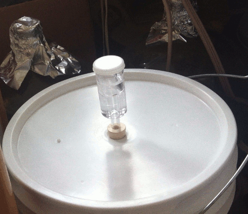
The beer will sit in the primary fermenter for about a week, until the airlock on top stops bubbling.

Then we siphon it into the secondary fermenter, a glass carboy, and add more hops (called “dry-hopping,” although the hops don’t stay dry). We’ll leave it in the secondary for two weeks, and then either bottle or keg it.

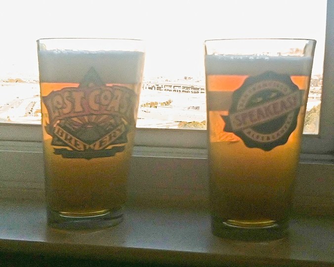
This latest batch will go in the keg, to be ready to drink around February 15. If we’d bottled it, we’d need to wait another week or so for it to get fizzy.

Thomas Brothers beers for June 2012

We used to make pretty labels for the bottles, but they’re a pain to soak off when it’s time to clean the empties for the next batch. Now we just write the style, month, and year on the cap  (eg. “IPA 1/13”) with a stylish Sharpie.

Besides, it’s what’s inside the bottle that’s important. After six years of tinkering with our recipe, Thomas Brothers IPA is a damn good beer if I do say so myself.

I don’t want to jinx anything, but the last two batches of Thomas Brothers IPA were brewed on October 14 and 24 — the days of the first games of the National League Championship Series and World Series, respectively. The Giants went on to win it all.

We brewed this latest batch on Sunday, after the 49ers won the NFC Championship. I plan to cheer on the 49ers at next Sunday’s Super Bowl with a glass of our World Series brew. It is proven. It is tested. We know it works. Knock on wood.

PHOTOS: Joe and Sean Thomas

Moon Over Sutrito Tower

Sutro, Sutrito and Luna

This has been an auspicious moon, I think. It saw the Giants win the National League Championship and the World Series. It was nearly full for Halloween, and it looked great dancing with the fog in my time-lapse shot a week or so back.

The moon enters its last quarter this afternoon. Yesterday it was waning gibbous, setting mid-morning. I drove around the warehouses of Butchertown, then just past 280 to find the conjunction pictured above: Sutro and Sutrito Towers, with the moon setting behind.