Sarah from the Bernal Heights History Project recently posted this photo, soliciting input to help pinpoint the location where the picture was taken.
Obviously, it’s a view looking east, so that pretty much narrows it down to either Potrero Hill or Bernal Heights. Based on my own armchair historiography, I’d say it is definitely a view from Bernal Heights, likely taken sometime in the late 19th or very early 20th century.
The perspective seems just right for Bernal Hill, but the key detail, I’d posit, is the elevated railroad trestle that stretches across the photo near the shoreline, roughly following the same route used by the present-day Caltrain. The area shown is present-day Bayview, but before it was filled in (in no small part with debris from the 1906 earthquake), the area was a vast, swampy marsh — which is why the railroad was built on an elevated trestle. Let’s zoom and enhance for more detail:

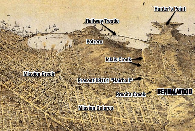
This panoramic illustration from 1868 shows the marshland of Islais Creek and the railway bridge that spanned it:

So that’s my guess. Do you see any other details that might help identify where this photo was taken?
UPDATE: Bernalwood contributor Joe Thomas (who lives in a house with an east-facing view) notes that there is a warehouse visible in the vintage photo:

From where Joe sits, it sure looks like that warehouse is still there, on Hudson at Toland!

Here’s the Google Streetview. Note the right-justified configuration of the doors:

PHOTO: Top, via Bernal Heights History Project