Fat Albert Loves Bernal Hill

DSC_0691

DSC_0681

Eye to Eye Fat Albert

Okay, let’s tell it straight: Bernal Hill isn’t a great place to watch the Blue Angels during Fleet Week. Sure, it’s comfy if you want a wiiiiiiide perspective, but most of the action happens near Fisherman’s Wharf, so the Navy’s F-18s look like little bugs zipping across the skyline. Plus, Bernal is so far south, we don’t even get many good flyovers during the airshow. (PRO TIP: F-18 flyover aficionados should try taking in the spectacle from the green on Treasure Island. Whooooosh!)

Yet for fans of “Fat Albert,” the lumbering C-130 transport plane the Blue Angels deploy to haul their gear, Bernal Hill is a prime viewing spot. Fat Albert uses Bernal Hill like a giant pylon as it loops around the City, and that means lots and lots of dramatic flyovers. In that respect, despite the fog that cut the airshow short on Sunday afternoon, Fleet Week 2011 did not disappoint. Hi neighbor!

Hello Albert

Here’s Fat Albert with that mysterious giant shrub thingy on the northeast part of Bernal Summit — together at last:

Fat Albert over Bernalwood

Oh, just in case you’re wondering what it’s like in the cockpit of Fat Albert as it zooms around like it does, this video should satisfy your curiosity. Just buckle in and follow the bouncing hula girl on the dashboard:

Hey Hey Hey! See you next year…

PHOTOS: Top two images, Ben Buja. All others, Telstar Logistics

Skywriting Over Bernalwood

It’s a little challenging to read, but Rihannon Charisse captured some Fleet Week-related skywriting over Bernal today:

Sky writing over Bernal! “GREETINGS SALUTES THE CENTENNIAL OF NAVAL AVIATION”

That “Centennial of Naval Aviation” thing is a fascinating historic tale with a fun local twist, and earlier this year my alter ego, Telstar Logistics, wrote all about what happened during that big day on San Francisco Bay in January 1911.

Here’s a little preview:

Happy Fleet Week!

PHOTOS: Rihannon Charisse, history.navy.mil 

How to Navigate the Cesar Chavez “Big Dig”

Chavez Big Dig

Chavez Big Dig

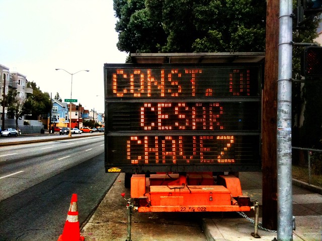
And so it begins. Construction started recently on an extensive new project to replace the main sewer line that runs beneath Cesar Chavez Boulevard between Guerrero Street and the US 101 Hairball interchange. Along the way, Chavez will also get a major remodel, transforming it into a tree-lined, pedestrian- and bike-friendly thoroughfare that will look kind of, sort of, pretty much like that new stretch of Ocatvia Boulevard that connects Hayes Valley to Market Street.

It will take time, but remember this mantra: Infrastructure Is Sexy. When the project is done, we’ll not only have a dashingly handsome new sewer main, but Chavez will also look more happy and more better. Between then and now, however, it will be a dirty, traffic-snarled mess. Thankfully, our next-door neighbors at  Noe Valley SF have pulled together a handy overview of the project, and what to expect along the way. They’ve kindly allowed us to republish it here, to facilitate your long-range strategic planning:

The sewer work is scheduled to begin in late June, starting at Hampshire and working west. The construction crews will work on three- or four-block chunks at a time. These blocks will have no parking during the work, which will involve digging a trench 10 to 13 feet wide to accommodate the 72 to 84-inch-diameter pipes being installed.

In addition, on the south side of Cesar Chavez, the existing pipes will be relined. Workers will need to block traffic for this as well.

From Hampshire to Treat, the trench is expected to be closer to the north side of the street; west of Treat, the trench is expected to be closer to the middle of the street. Two travel lanes in each direction will be maintained on Cesar Chavez throughout the project, but the lanes will move according to where the trench is. The existing three lanes of traffic west of the project will be gradually merged into two lanes in the construction area.

For the crossing of Mission Street, workers will avoid digging a trench to minimize disruption to Muni and BART service. Instead, they will dig two pits, one each at Capp and Bartlett, and install the pipe with a trenchless method.

In addition to Cesar Chavez, sewer construction work will take place on the following streets in the area as part of this project:
* Harrison: from Cesar Chavez to 26th
* Valencia: from Cesar Chavez to Mission
* Fair: from Mission to Coleridge
* Coleridge: from Fair to Coso
* Coso at Coleridge

Each block should take five to six weeks, and the first large segment from Hampshire to Folsom should take about nine to 10 months. When each three-block chunk is completed and reopened, the street will be striped according to the new streetscape striping, with parking lanes, bike lanes, two car travel lanes in each direction, and turn pockets or turn restrictions as outlined in the approved plan. As part of the streetscape improvements, the greening, repaving, and median work won’t begin until the sewer work reaches Folsom, about nine months after it begins.

The sewer work on Cesar Chavez would take 15 to 16 months, and the streetscape work another nine months, totaling about two years. Work hours will be Monday through Friday, 8 am to 6 pm, with some possible weekend work. City officials emphasized that residents will have local access, and, on the occasions when driveways must be blocked, the contractors will contact households individually to work with them on solutions.

Notices that will be distributed before the project starts will include a 24-hour number for questions and complaints. The city will conduct meetings […] every three or four months to update and obtain feedback from the community.

Alex Murillo of the DPW Office of Communications and Public Affairs will be the contact person for the project, and he gave out his office phone number (415/437-7009) and cell number (415/627-8106). Brave man! He can be reached at Alex.M.Murillo@sfdpw.org. The project is also up on the DPW website: http://www.sfdpw.org/index.aspx?page=1166.

The project manager for the streetscape aspect is Kris Opbroek, who can be reached atKris.Opbroek@sfdpw.org or 415/558-4045.

PHOTOS: Telstar Logistics

Into the Skies with the Bernalwood Air Force

Above California

Tidal Flats

Terrain Below

Above Suburbia

Did you know that Bernal Heights has an air force? We do! Happily, it’s not the militarized sort — at least not yet. (Take note, uppity La Lengua separatists!) There are several pilots who live in the ‘Wood, and they take to the skies when the view from atop Bernal Hill just isn’t high enough.

I went flying with one Bernal aviator last weekend; a gentleman whom I met via this blog. Wing Commander Fiid lives in South Bernal, and after driving down to Palo Alto Airport, we took off in a cozy Cessna 172, bound for the Central Valley town of Willows, about 170 miles north.

Cessna at Palo Alto

Here’s Wing Commander Fiid, confirming our flight path with BERSAC (Bernalwood Strategic Air Command):

Mr. Williams

Alas, we had to bypass Bernal Heights itself, as our lovely neighborhood was covered in a thick and unphotogenic blanket of fog. So instead, our flightpath took us to the east, along I-680, where we looked eye-to-eye with Mt. Diablo:

Mount Diablo

Then we circled a few times over the mothball fleet at Suisun Bay, capturing some great angles on the battleship USS Iowa:

Mothball Fleet

Mothball Fleet

Luckily, other Bernal aeronauts have swooped over the neighborhood on days when the skies were more cooperative. Here are some photos taken by aerial photographer and Bernal resident Jon Hope that capture the scene above our eastern frontier, looking north from Cortland:

Here’s an intimate portrait of the giant bald spot atop the Lowe’s store on Bayshore. “Rogaine on Aisle Six!!”

PHOTOS: Telstar Logistics and John Hope

Sexy, Stoner-Friendly New Parklet Installed on 29th Street

Reader Rita sends along some news about the first parklet to appear in the Dominion of Bernalwood:

Down here in the flats (or La Lengua, or south Mission, or whatever our neighborhood gets called these days) our first parklet was just installed at Café Seventy8 on 29th Street!  Anette Roeber and her co-owners worked with the neighborhood, a local architect: Hugh  Hynes of PROTOinc and another neighbor Matt Walsh who worked with Dan Piche and Jon Petterson, all of Saturn Construction to build out the parklett this weekend.  Finishing touches and plants will be installed on the 30th when the Tiffany Avenue neighbors are celebrating theer one year anniversary of planting of the sidewalk gardens.  Then it will just be a matter of when the city installs the bike corral in the space close to the corner!

Nice work, people. That looks great! Note also, the new parklet is literally across the street from the Bernal Heights Collective. Stoner bonus!

PHOTOS: Reader Rita

Trove of Historical Photos Show Streetcars in Bernal Heights

Cortland Avenue at Bennington Street, 1940. Red Hill Books is now on the corner at 401 Cortland. Discount Club is now where the "Drugs" sign is at 439.

Cortland Avenue at Andover Street, 1941. The 9 Valencia line car heading west. The woman waiting to board the car is in front of what is now Head to Toes Beauty (451 Cortland ), Skip's Tavern (453 Cortland Ave.), and Bernal Yoga (461 Cortland Ave.)

Mission near 29th Street, 1948. Behind the car is the Lyceum Theater (1907-1964), now the site of the Safeway parking lot

Last week’s talk at the Bernal Public Library about the history of streetcar service along Cortland Avenuewas really excellent. Interesting, informative, and a vivid reminder of how the texture of the neighborhood is so heavily shaped by its infrastructure.

Plus, as an added bonus, historian and presenter Jack Tillmany gave everyone who attended his talk a nifty souvenir: MUNI streetcar transfers from 1946 that were marked for use along the former 9-Cortland line:

Cool! Happily, if you couldn’t make it to the talk, our neighbors at the ever-awesome Bernal History Project have compiled a fabulous greatest-hits collection of photographs that show streetcars in service along the streets of Bernal Heights.

Hop on board and take that website for a ride.

HISTORIC PHOTOS AND CAPTION TEXT: Bernal History Project. Transfer photo: Telstar Logistics

Homegrown “I BART SF” Shirt for Transit Fashionistas

Here’s a revolutionary-chic fashion statement for Northside commuters and Southside fans of the 30th Street BART station.

Creator Jeffrey Doker says:

I live in the ‘Wood (Shotwell and Precita). I recently made a BART-themed shirt that I think SF people might love. I know BART doesn’t actually service Bernalwood directly, but I figured I’d give it a shot.

Jeffrey shoots… and scores! Want one? They are available in several flavors.

PHOTO: Jeffrey Doker

Learn About the Streetcars That Once Clanked Down Cortland

Did you know that Cortland Avenue once had a streetcar line? OMG! So true! Vicky Walker, Bernalwood’s Minister of History, brings this announcement about a very cool presentation that will happen at the Bernal Heights branch library on Wednesday night, June 15, at 7 pm:

Bernal History Project is proud to present a free slideshow and talk by S.F. transit and movie theatre historian Jack Tillmany (author of Theatres of San Francisco).

Bernal residents got their first taste of public transportation more than a century ago when streetcar tracks were laid down the middle of Cortland Avenue, and United Railroads trolley line #24 (Cortland/Divisadero/Richmond) linked three San Francisco neighborhoods. Soon after, line #23 (Richland/Valencia/Fillmore) completed the picture.

Jack will explore the roots of today’s #24 & #23 lines during the first forty years, when trolleys ran on tracks and the #9 line caused no end of confusion by running on Cortland and Richland at the same time. He will also bring “freebie souvenirs for those who show up.” He promises they are “most appropriate, authentic, and not to be found anywhere else.” Here’s a great interview with him courtesy of our friends at the Western Neighborhoods Project.

An important note: This presentation covers only the Cortland and Richland streetcar lines. Jack will present a separate show soon that covers the 30 (Army from Third St. to Bryant), the 25 (Bryant to Bayshore and then to San Bruno), and Muni’s H line, which terminated at Potrero and Army streets but was later extended down Bayshore to replace the 25. Sorry, NoCo residents — your turn will come!

The slideshow will be held in the meeting room of the Bernal branch library, 500 Cortland (at Andover); turn left at the bottom of the stairs. It starts promptly at 7 p.m.; note that the meeting room is small, so get there early to guarantee a seat!

This presentation is dedicated to the memory of San Francisco transit historian Phil Hoffman, who hosted one of BHP’s first slideshows and was always happy to help with our research.

PHOTOS: Top: Streetcars on Cortland, 1938 (via San Francisco Public Library); Bottom, a streetcar after it jumped the tracks on Cortland at Folsom, 1935 (via Bernal History Project).

Off the Hill: Red Vic Theater May Close, MUNI Drivers Reject Contract, Yes We Have No More Grasshopper Tacos

Let’s review some of the other things happening in Our Faire City, shall we?

An Illustrated Guide to Proper MUNI Etiquette (The Bold Italic)

The Red Vic Theater May Close Forever in July (Cole Valley Alley)

Clueless, Calcified MUNI Drivers Reject Proposed Contract (SF Examiner)

Mark Bittman LOVES Mission Chinese Food (New York Times Magazine)

Treasure Island Development Plan Approved by Board of Supes (SF Gate)

City Health Department Bans La Oaxaqueña’s Grasshopper Tacos (MissionMission)

Hipsters and Old Drunks Intersect at Clooney’s on Valencia/25th (Uptown Almanac)

Cool Video of SF’s Former Pacific Stock Exchange Trading Floor (SFist)

View from the Space Station, or Somewhere in The Mission? (Burrito Justice)

IMAGE: MUNI Etiquette by Bold Italic

Dude, Share My Car

Need a car? Live in Bernalwood? Maybe you should take my neighbor’s Scion xD, which is currently parked on Virginia Avenue near Winfield. It’ll run you just eight bucks an hour, which includes gas, insurance, and 20 miles/hour.

Such transactions used to be illegal, but no more, thanks to a recent state law. As a result, companies like RelayRides, which facilitate peer-to-peer car sharing, are sprouting up like daisies (or, rather, goldfields) this year. Similar outfits include Spride Share and Getaround (which even has a Tesla Roadster available).

It’s a great way to use four wheels when you need them, without actually owning a car—a win for both you and the environment! Or, if you have a vehicle but you bike to work from Bernal, leaving your ride parked for hours at a time, it’s potentially a great way to offset some of the costs of ownership.

I say “potentially” because peer-to-peer car sharing is still a relatively new phenemenon, and things could get hairy when it comes to owners’ liability for losses that occur when others use their car.

For more on that, as well as more details on how peer-to-peer car sharing works, read my post on Wallet Mouth.

PHOTO: Bronwyn Ximm

Nomenclature Update: Introducing “The Spaghetti Bowl”

IMG_0092

The Meeting of 2 Freeways

The East Bay has The MacArthur Maze, and North Bernal has The Hairball. Now reader Vizetelly has put forth a proposal for the 101/280/Alemany junction in South Bernal:

I nominate the name “Spaghetti Bowl” for the Alemany-101 interchange.

The Bernalwood Nomencature Committee reviewed this proposal, and it was heartily endorsed. Let it be The Spaghetti Bowl from this day onward.

Oh, and if you happened to get stuck in that particularly nasty traffic this morning — caused by a horrible accident on southbound 101 near Candlestick, and photographed below by chuck b — you had some time to get to know The Spaghetti Bowl all too well:

IMG_0100

PHOTOS: Top, chuck b, Agus Sutano, Troy Holden, Below, chuck b