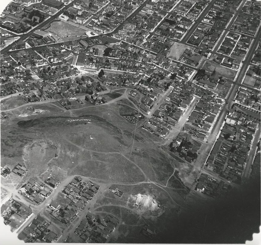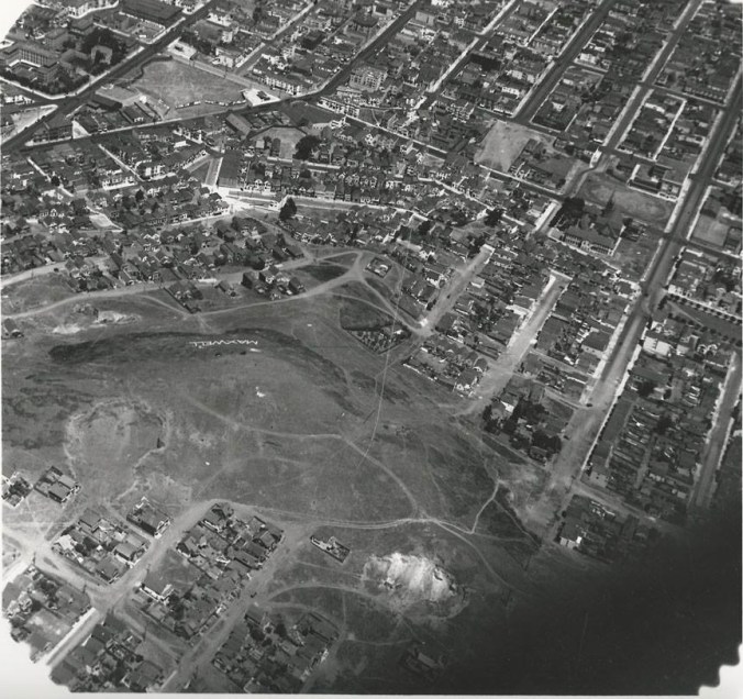
Courtesy of our friends at the Bernal Heights History Project, we bring you this never-before seen aerial view of Bernal Hill. The photo comes via a private collection that was shared with BHHP, and it was likely taken sometime during the mid 1920s.
Why the mid-1920s? And when, exactly? There are a few clues that hint at the date, but first, let’s zoom and enhance to take a closer look:
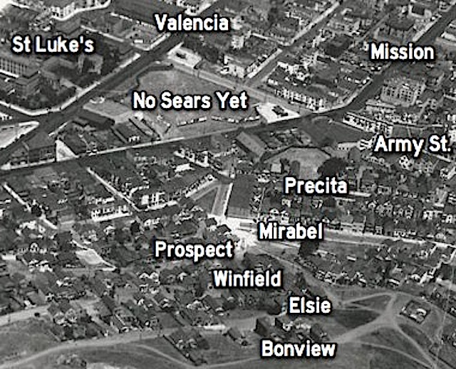
Okay, so the most obvious indication of the date is the fact that the Sears Department Store has not yet been built on Mission Street near Army (Cesar Chavez). The Sears opened in 1929, yet in this photo the site is not yet under construction, so that likely means this photo was taken at least a few years before the grand opening.
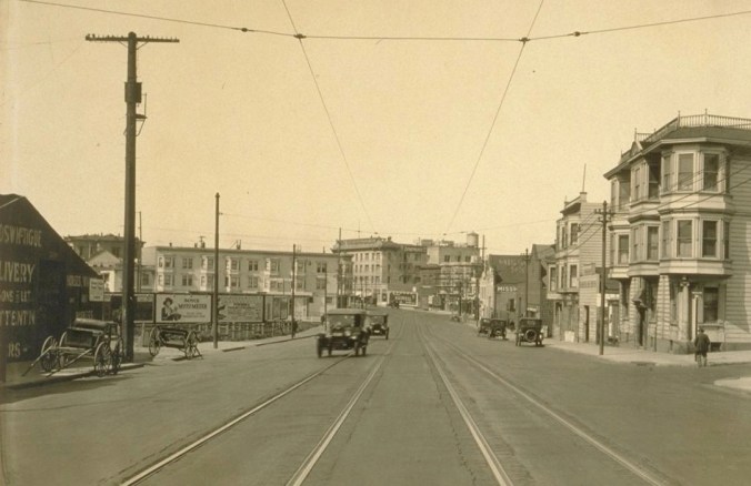
The 1920s were a period of rapid transformation for this particular corner of Bernal. As La Legua rebel leader and archival history geek Burrito Justice has documented, suring the first two decades of the 1900s, Mission Street just south of Army had been home to a cluster of horse-related businesses — stables, harness manufacturers, and the like. Here’s what Mission Street at Precita looked like in May, 1923. Notice all the carriages in front of the McTigue Livery on the left:
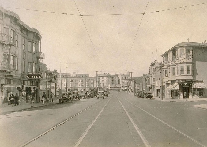
Within a few years, the horse-related industry was quickly supplanted by car-related industry. Here’s the same spot, in August, 1927. McTigue Livery has been replaced by Mission Chevrolet. There are also two new three-story apartment buildings next door, which today are the proud homes of El Rio and Virgil’s Sea Room (former Nap’s):
But returning to our new aerial photo, notice that none of this new development is present. The McTigue stable building from 1923 appears to have been torn down, but the the three-story El Rio/Virgil’s buildings have not yet been built:
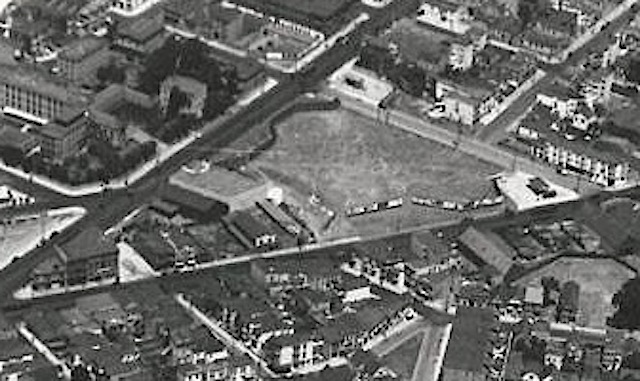
All that tells us our photo is likely from sometime between 1923 and 1927.
Meanwhile, to the northeast…
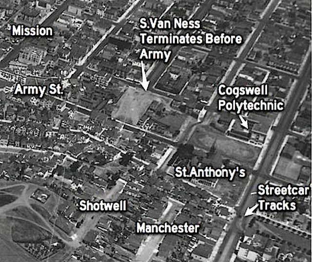
South Van Ness (which was still called Howard Street at that point) still does not yet connect to Army — as had been the case back in 1888. The grand church of St. Anthony’s stands on Army near Folsom, right across the street from the campus of the Cogswell Polytechnical College. Streetcar tracks loop around Precita Park via Folsom, and those darn pedestrians have worn a path in the grass while taking shortcuts across the western end of the park.
That takes us to the summit of Bernal Hill, as seen from the southeast:
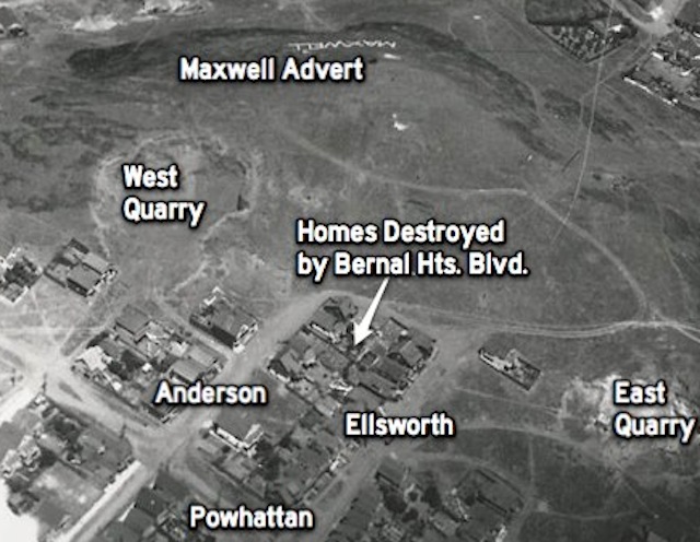
There’s no Bernal Heights Boulevard yet; that was a WPA project during the 1930s. Here, however, we can see a cluster of houses between Anderson and Ellsworth that was condemned and removed to make way for the road a decade later.
Two small quarries had been excavated from the south side of the hill, and as we all know, the scars from those operations remain quite vivid to this day.
Most surprising of all, however — at least to our precious contemporary sensibilities — is the giant advertising lettering at the top of this detail, on the northwest face of Bernal Hill, promoting Maxwell automobiles. Apart from revealing a great deal about period attitudes toward landscape vista preservation, the Maxwell sign is also a useful chronology clue, since Maxwell was absorbed and discontinued by Chrysler in May, 1925. That suggests our photo likely predates the Maxwell shutdown.
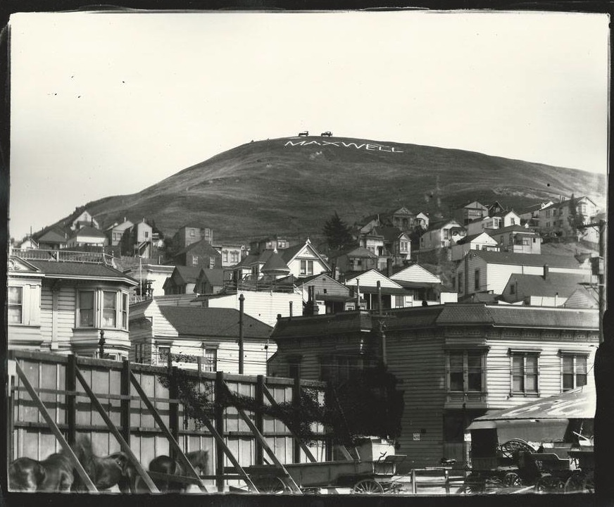
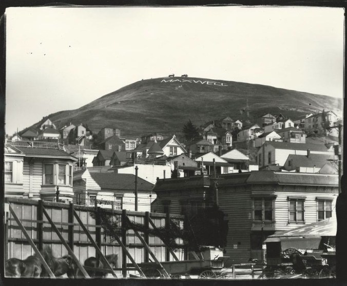
Here’s a clearer shot of the Maxwell sign, as seen in the 1920s from around the intersection of Army and Valencia, again courtesy of the Bernal History Project. Notice those insane tilt-up automobile silhouettes at the summit of Bernal Hill!
Putting all the pieces together, we’re going to go out on a limb to say that this new photo likely dates from around 1924.
This is a photo-forensic field day for one and all, however, so if you see any other interesting details, or any other clues that might assist or conflict with our photo dating, please chime in via the comments.
Finally, hooray, Bernal Heights History Project!
 Last month, Potrero Hill photographer Daniel Leu snapped a terrific photo of the moon and Venus setting over Bernal Hill.