D9 Candidate Josh Arce Proposes 30th Street BART Station and Housing Plan

arce30thst

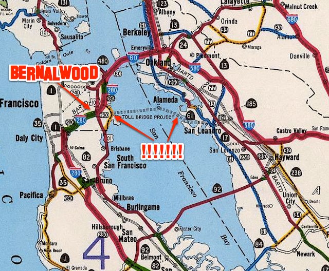
For 80 years, the citizens of Bernal Heights and La Lengua have fantasized about creating a train station on Mission Street around 30th Street. Indeed, the fantasy is even older than BART itself. Yesterday, the idea of a BART 30th Street Station was revived again.

Standing in the half-empty parking lot of our historically joyless Safeway, D9 Supervisor candidate Joshua Arce unveiled his “Mission Street South of Cesar Chavez Plan,” a proposal to build 2000 of units of new housing in La Lengua and add a new BART station at 30th Street.

MissionLocal was there for the announcement:

The development, part of a proposed “Mission Street South of Cesar Chavez” plan, would “not touch any existing housing,” Arce said. The housing built would be a mix of market-rate projects and affordable housing.

“There’s never really been a plan for this neighborhood,” he added, standing with some 20 supporters in the Safeway parking lot at 3350 Mission St. where the new station would go. The Safeway itself could be incorporated into the new station, Arce said, or a new store could be built elsewhere.

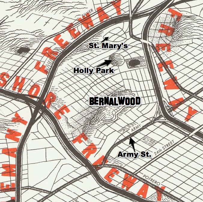
The triangular slice of the Mission District between Mission and Valencia streets below Cesar Chavez Street — known by some as “La Lengua,” the “tongue” of the Mission — has no integrated transit plan, Arce said, and is ripe for housing needed to address the “displacement crisis” in the gentrifying neighborhood.

“This is a neighborhood that can play a part in the solution,” he said, saying the BART station could be the cornerstone of a new corridor. “What if that solution is just right here below our feet? And that solution, I propose, is the potential for a brand new BART station right here at Mission and 30th streets.”

The plans for the new transit station and housing are preliminary. Arce said the development “might take a long time” and estimated that the BART station alone could cost $200-$300 million. He said a mixture of developer’s fees from new market-rate housing in the corridor and state or federal funds could finance the project.

Innnnnnteresting! Bernalwood contacted Arce to find out more about his proposal. “I sat down with neighbors, local business owners, workers, and transit riders to talk about this unique part of the District,” he said. “What became clear in each and every single conversation is that people feel there is no clear plan for the housing, local business, and transportation needs of the neighborhood.”

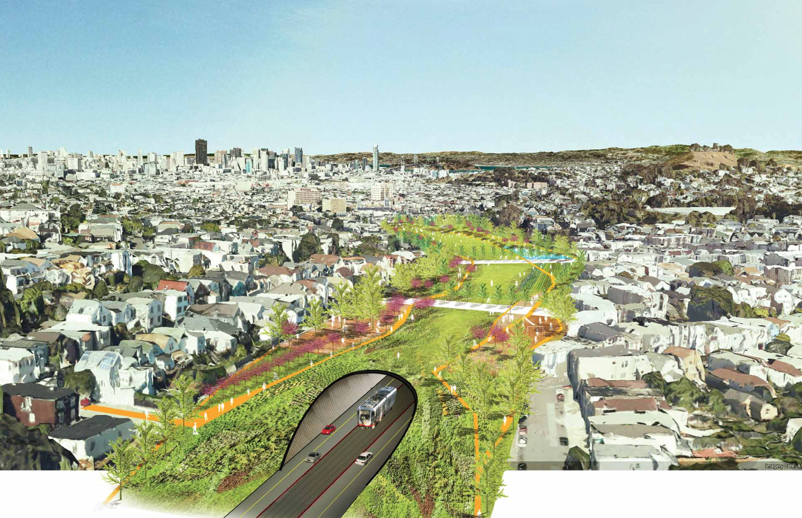
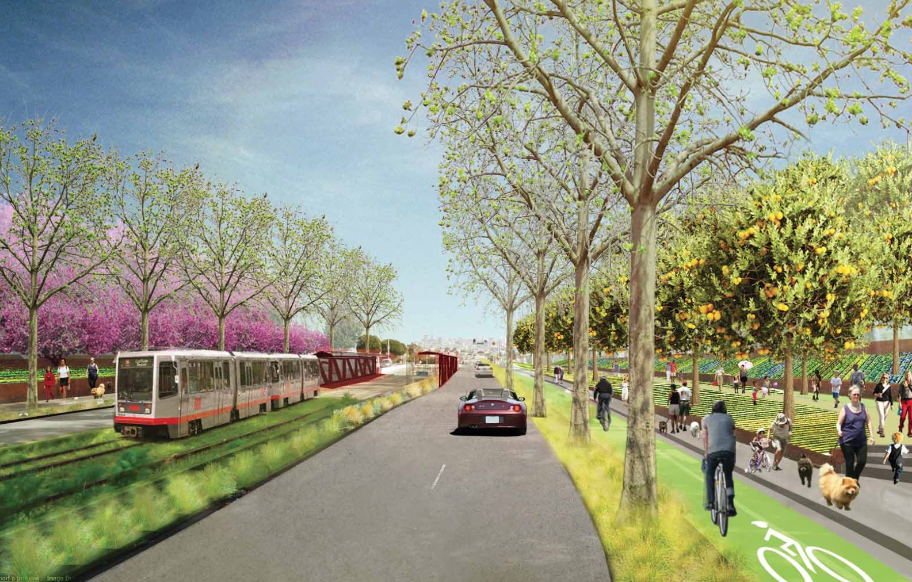
Arce says the 2000 units of housing would be built on under-utilized sites in the area that have already been identified by the San Francisco Planning Department.  Today, these sites are parking lots, empty buildings, and locations that could be repurposed  for alternative or mixed uses. Here’s the Planning Department’s site map:

20131105_Mission_OpportunityMap

The basic idea, Arce says, is that the new housing and the new station would be mutually inter-dependent. BART is pretty tapped out financially, so investment in housing and local businesses would generate impact fees that would be used to pay for affordable housing and funding for a new BART station.

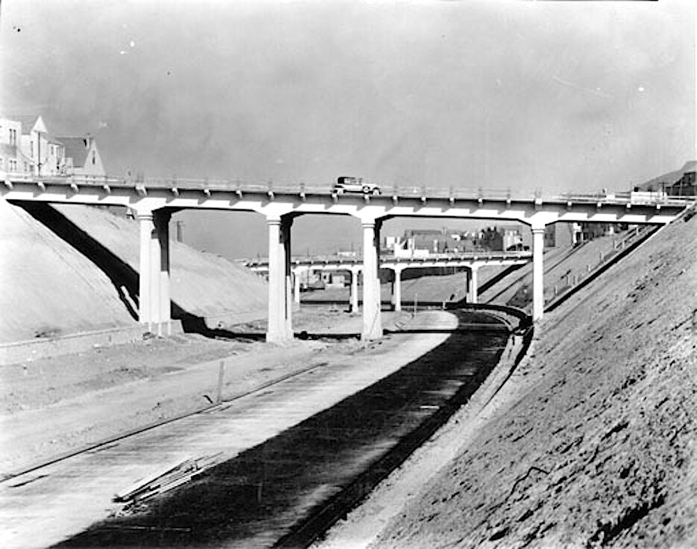
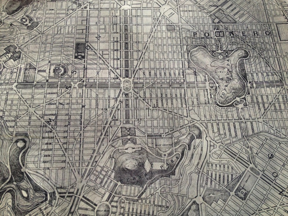
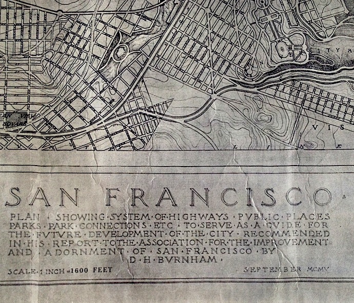
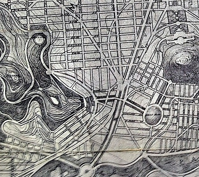
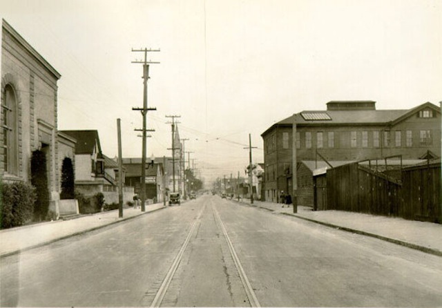
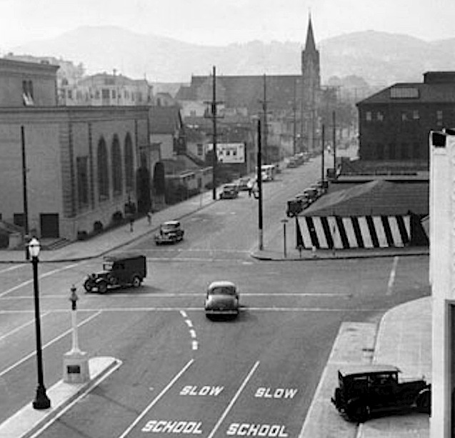
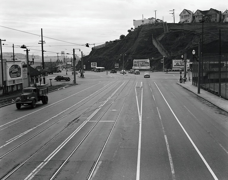
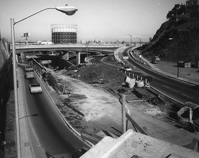
Of course, Bernalese have been dreaming about convenient access to a rail link for decades. Here’s a futuristic image from 1948. That’s Cortland Avenue heading up the hill to the right:

bernalstation1948

Let’s zoom and enhance, to take a closer look at our retrofuture:

bernalstationplan2

San Francisco abandoned the whole Mission Freeway idea, thank goodness, but It sure would be nice to be one of those whispy people in the rendering, fashionably boarding and disembarking from a train that stops right at Bernal’s front doorstep.

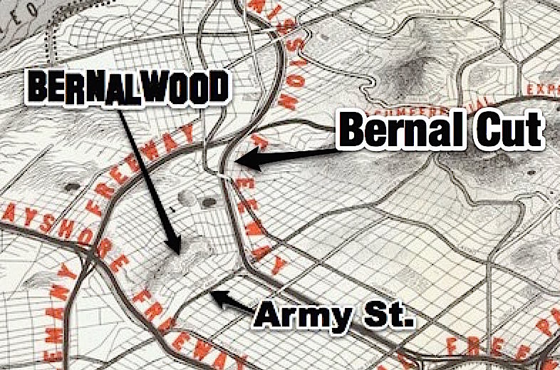
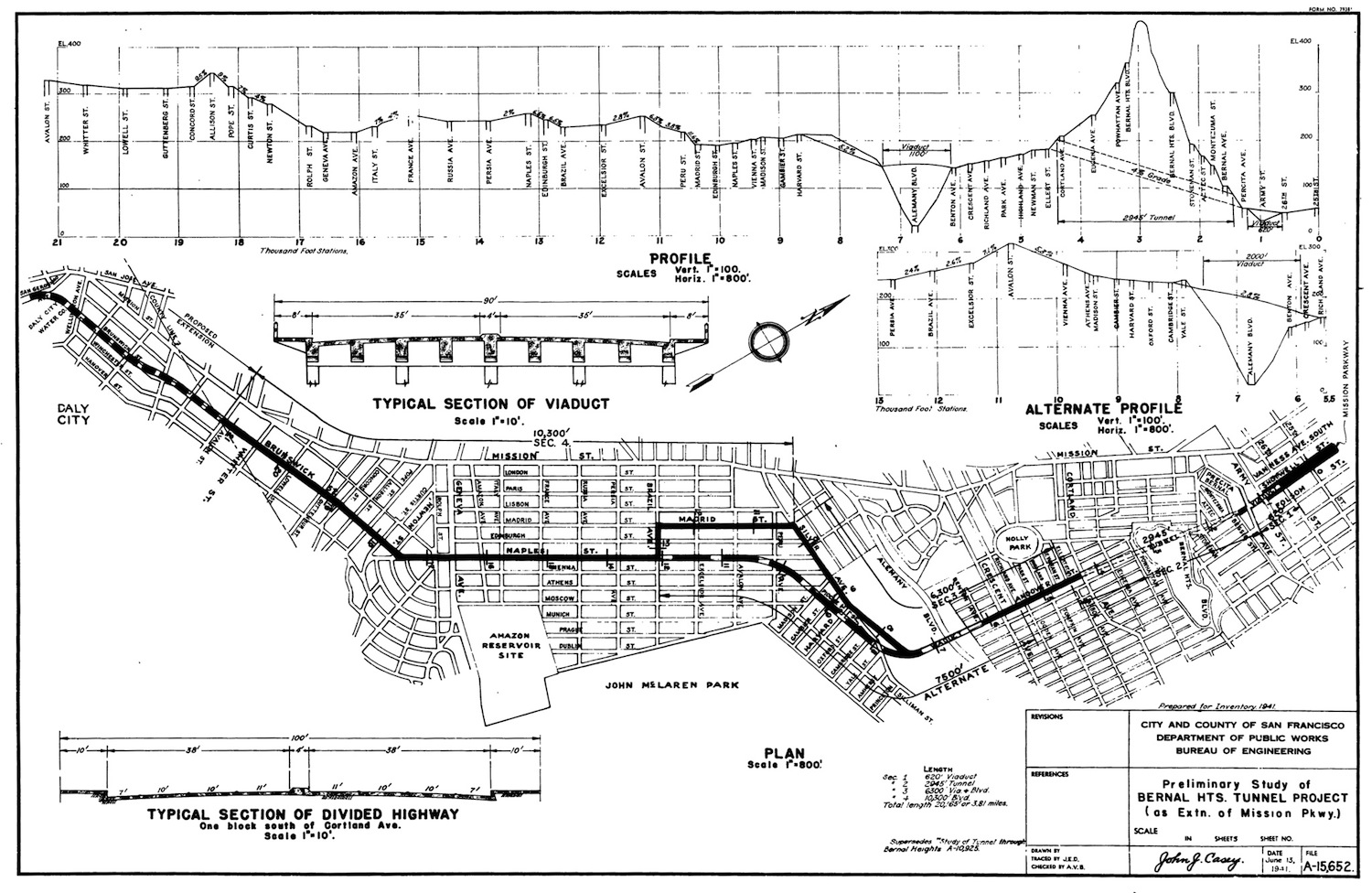
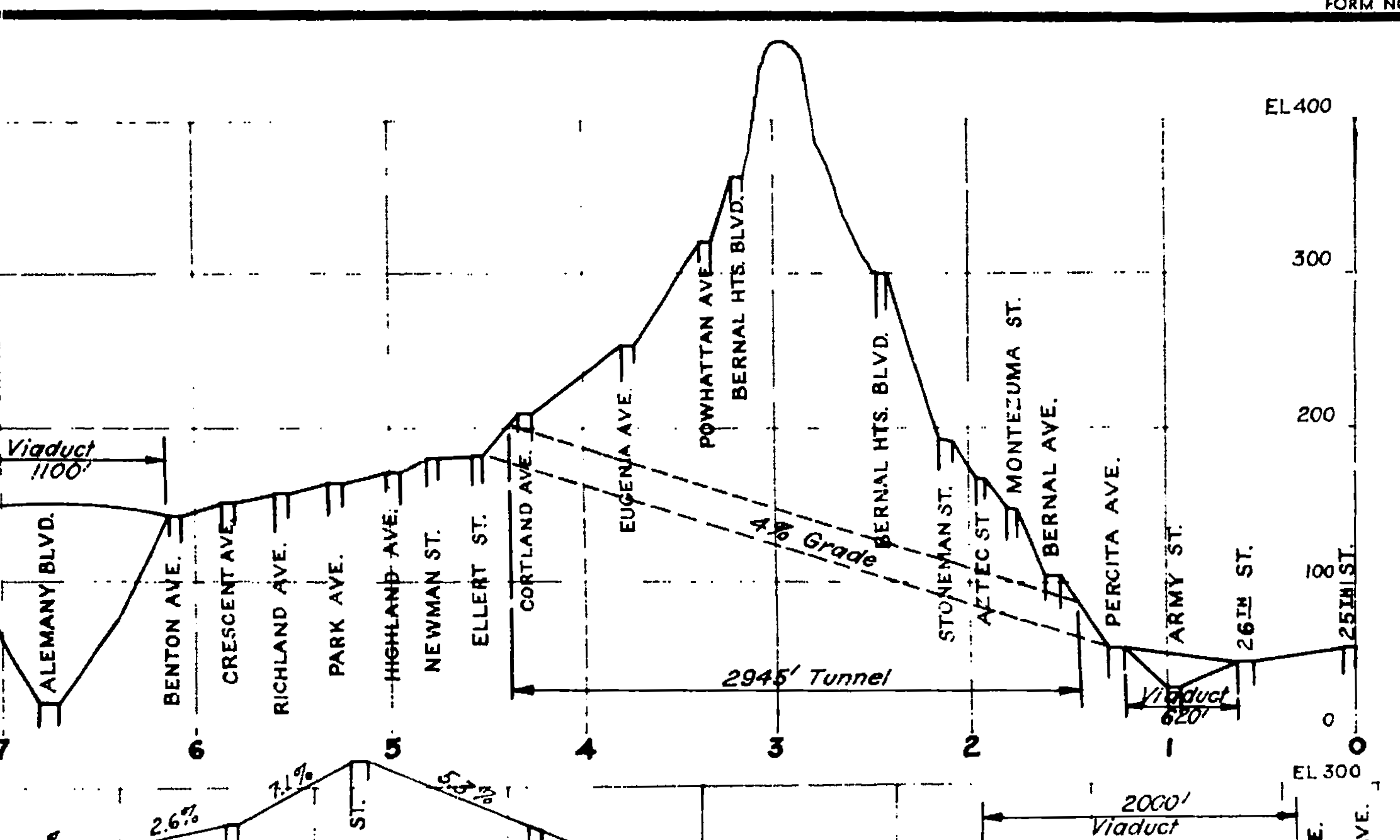
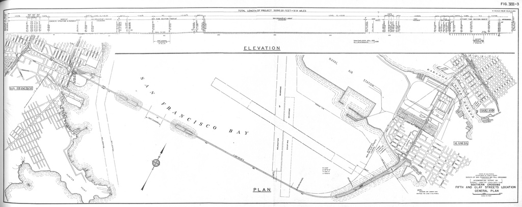
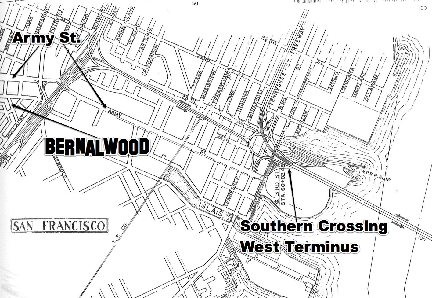
The idea of adding a 30th Street Station to the existing BART line that runs under Mission Street has been studied from time to time, most recently in 2003:

30th.feasibilityThe 2003 study estimated that a 30th Street Station would cost around $500 million to build, in part because of the challenging grade on the site. The 2003 study also assumed that 30th Street station would include a secondary “pocket track” that could be used for parking or reversing trains as needed.

Arce says that based on conversations he’s had with BART officials, things may be different today. The requirement to level the grade of the track would not be as extreme, the pocket track could be eliminated, and tunnel-boring technology (like the machines used to create the new Central Subway downtown) could simplify construction. The result could be a 40% to 60% reduction in the cost of building a 30th Street Station.

Well, maybe. Hopefully. There’s a lot to like about all this, because we desperately need more housing, and a new BART stop would dramatically improve transit for thousands of current Bernal residents. But is this for real, or is it just a campaign stunt?

“This is a beginning,” Arce says. “Doing all this will take time, maybe a long time. But every plan starts with a first step, and we think this a great place to start.”

IMAGE: 1948 station proposal image courtesy of Eric Fischer.

Glen Park Neighbors Propose Plans to De-Uglify the Bernal Cut

SJBhack

Once upon a time, during the Age of the Ancient Druids, the peoples of southwestern Bernal Heights and northeastern Glen Park were united as one. During that time, our Bernal lands extended continuously to the west, and the Lost Tribe of College Hill was not yet lost. Bernal soil filled the void that divides us today.

The void that divides Bernal from Glen Park today is called the Bernal Cut, and it now carries a streetcar line and auto traffic that speeds along San Jose Avenue to and from I-280. It is very unlovely:

bernalcutstreetview

Originally, the Bernal Cut was a Southern Pacific railroad line carved out of a low shoulder of Bernal Hill’s west slope during a series of late ninteeenth century excavations. Here’s a view of the Bernal Cut during the railroad days, looking north toward modern-day La Lengua from the Richland-Miguel overpass in April 1922:

bernalcutnorth1922

Throw in some smokey steam locomotives, and you can see why The Cut became particularly daunting to cross. This is a train chugging through the Bernal Cut in 1905:

bernalcuttrain1905

Then came the age of the automobile, and in the late 1920s, the cut was widened and expanded to create an arterial road into San Francisco’s urban core. Here’s another north-facing view, this time from 1929, when the construction of the roadway was almost complete:

bernalcut1929

The vision at the time was that the Bernal Cut would become the first stage of a new Mission Freeway that would carry high-speed traffic into downtown San Francisco. Here’s a crop from a 1948 planning map that shows how all that would have worked, in rather horrifying detail:

1948_san_francisco_trafficwaysplan2

Basically, in much the same way that Army/Cesar Chavez used to suck because it was designed to feed a freeway that never actually got built, so too the Bernal Cut now sucks because it too designed to serve a future that never really materialized. The Bernal Cut has been dominated by vehicular traffic for more than 100 years. That may have been a necessary and worthwhile thing, yet it also divided the neighborhoods on either side, and for the neighbors who live there, it’s a big bummer.

Fortunately, there are a few armchair urban planners and civil engineers who live on the Glen Park side of the Bernal Cut — an area which they (quite revealingly, and charmingly) call “Bernal Glen.”  In recent years, our kin in Bernal Glen have hatched a few brilliant plans to re-unite the mainland people of Bernal Heights with our descedents from Bernal Glen. One such plan is described here by Bernal Glen neighbor Erika Ehmsen:

In 2013, a College Hill/Bernal Glen neighbors asked renowned landscape and urban design firm SWA Group to visit San Jose Ave. SWA designers and planners walked with neighbors along San Jose Ave., the Bernal Cut Path, the Arlington Path, and our bridges and pedestrian overpass to experience the grim current state of San Jose Ave.—from its freeway-like speeds to its trash-strewn and encampment-prone slopes and sidewalks.

SWA designers asked us to suspend our current reality in order to reimagine and reinvigorate our blighted speedway. We showed SWA the Glen Park Community Plan and asked them to envision an extension of that plan that could incorporate the slopes above San Jose Ave. while reflecting our College Hill Neighborhood Association’s greening and safety goals. And then SWA got to work sketching the plans in that above Google Doc presentation—all pro bono.

Here is that SWA presentation; it is rather trippy and mind-expanding. One proposed scenario would involve re-filling the Bernal Cut with soil after creating a tunnel for the tracks and roadway underneath. It’s just a simple “cut and cover” tunnel design, basically — but the cut part comes pre-excavated 150 years ago.

This idea would seamlessly re-unite Bernal with Bernal Glen by eliminating the trench between them, while also creating 13 acres of new land that could be used for a mixture of new housing and parks. And though the proposal itself doesn’t suggest this, in theory at least, the sale of land to build that much-needed new housing could actually go a long way toward paying for the whole thing.

Here’s what it might look like, as visualized by SWA:

bernalcuttunnelMind blown?

If a tunnel seems too sci-fi, another scenario envisioned in the exercise would narrow the roadbeds and terrace the walls to create land for urban agriculture. This is what tomorrow’s “Bernal Cut Farms” might look like:

bernlcutfarms

Innnnnnnnnteresting, no? We might quibble about some of the details, but the big breakthrough here is that it gets you thinking about the Bernal Cut in all sorts of crazy new ways. There’s a lot of land in there! And it’s really under-utilized! So many possibilities, even while retaining The Cut’s core transportation functionality. Yes! Yes! Yes!

Meanwhile, and more recently, Bernal Glen neighbor Mike Schiraldi decided to pick up on this basic idea and pare it back to the bare essentials to develop his own plan for how to heal the Bernal Cut. Mike says:

Well, the Glen Park Community Plan spends a couple paragraphs dreamily talking about undoing San Jose Avenue, but doesn’t get into any details or explain the benefits. So while I’m not the first to talk about ripping it out (duh), I tried to get down to brass tacks, to see how it could actually get done. And I wanted to illustrate how transformative it would be, since it can be hard to see that from the Glen Park Community Plan.

Inspired by the improvements that recently transformed the once-awful Cesar Chavez/Army into today’s much more glamorous boulevard, Mike’s let’s-do-this idea is to do the same basic thing to the speedway portion of San Jose. To slow traffic and make it easier to move between the two microhoods, he proposes re-connecting a few of the surrounding streets via new intersections with San Jose.

Specifically, his plan would create a new traffic light/intersection at Natick, Arlington, and Wilder Streets in Glen Park and one linking College Ave. in Bernal with Mateo Street in Glen Bernal. He calls this scenario “San Jose Boulevard”:

Both of the two new connections could be full intersections, with traffic lights, allowing traffic to flow in any direction between San Jose, Natick, Arlington, and Wilder, or between San Jose, College, and Mateo. There could be crosswalks too, so pedestrians and cyclists can get across without having to use an overpass, which is awkward, often dirty, and can be scary at night.

Oh, and to further activate the areas and create even more pedestrian activity, Mike also proposes adding a new J-Church stop along his new San Jose Boulevard, since the streetcar already runs there anyway:

Large sections of Glen Park which are currently underserved by transit would suddenly become extremely transit-accessible, both because of the new J-Church stop, and the new crossing opportunites.

You can read all about it in Mike’s brainstorming presentation, where he makes the case in a lot more detail. It’s clever. It’s not complicated. It may even re-activate the Bernal Cut as a shared space that joins the Dominion of Bernalwood with our kin from Bernal Glen. Let’s do (something kind of like) this!

This Proposed Freeway Tunnel Under Bernal Heights Would Have Destroyed My Home

BernalTunnel.1941

Courtesy of Eric Fischer, king of the map geeks, your Bernalwood editor was alerted yesterday about a 1941 map detailing a freeway proposal that would have required the construction of a 2945 foot-long automobile tunnel under Bernal Hill.

Unlike other unrealized plans to tunnel through our neighborhood, this scheme would have created a tunnel running underneath the most central parts of Bernal Heights, via Andover starting at Cortland on the south side, and exiting beneath Shotwell on the north:

BernalTunnel.1941.detail

On the bright side, the exaggerated side-cut elevation of Bernal Hill is rather cool:

BernalTunnel.elevation

There’s a lot of obvious things for everyone to dislike about this idea. Yes, of course, cutting the neighborhood in half and clogging it with smog-belching automobile traffic would have been terrible and all… but the real issue for me is that the northern portal of the Bernal Heights Tunnel would have been located on the exact location of my Precita Avenue home:

BernalTunnel.me

Indeed, it appears that the very spot where I write this sentence right now would have been appropriated to make way for a four-lane concrete slab carrying traffic in and out of the northern tunnel opening.

All in the name of progress, naturally.

What this means, of course, is that in some sort of alternate science fiction timeline, the tunnel project was approved and completed, resulting in the condemnation and demolition of my home. Which means I never ended up in Bernal Heights, and Bernalwood never existed, and we would not be enjoying this lovely day together.

Of course, in an alternate-alternate science fiction timeline, it’s also possible that I used a chronological wormhole to return to 1941 as a time-traveling NIMBY to prevent the construction of the Bernal Heights Tunnel from happening in the first place. It’d be kind of like Arnold Schwarzenegger in Terminator, only I’d be armed with vast wads of inflation-appreciated cash and an intimate understanding of bureaucratic minutiae. (As an added bonus, I’d probably also warn them about Pearl Harbor.)

Or perhaps that’s not science fiction at all. Perhaps the only reason we are enjoying this lovely day together at all is because some Future NIMBY actually did travel back in time to prevent the tunnel from ever being built!

The mind reels…

PHOTOS: via the ever-fabulous Eric Fisher

Unbuilt Bernal Heights: Our Future That Never Was

Burnhambernalwood-1905

The only thing Bernalwood loves more than a good local history lesson is a strong dose of local fantasy science-fiction. Luckily for us, some recent synchronicity has conspired to provide a tasty mixture of the two.  Here’s how it unfolds…

Part One: A few weeks ago, I took Bernalwood’s Cub Reporter to visit the new Exploratorium. While we were there, we wandered down a long hallway and into the Bay Observatory Gallery at the northeast corner of the museum. And in the Bay Observatory Gallery, we found a very cool collection of maps:

exploratorimmaps

As you can see, the Cub Reporter was fascinated with a map visualization created by the amazing Eric Fischer (which quite speaks well of her).

Simultaneously, your Bernalwood editor was intrigued by a map of an ambitious redevelopment plan that envisioned San Francisco as a kind of Paris by the Bay, with grand boulevards and ornate gardens slicing through our familiar street grid. Naturally, I took a particular interest in the Bernal Heights portion of the map:

BernalBurnham1905.A

So much to absorb! To facilitate later study, I snapped a few quick photos, including one of the map legend:

1905MapDetailThe legend identified the map as:

Plan, showing system of highways, public places, parks, park connections, etc., to serve as a guide for the future development of the city, recommended in his report to the Association for theImprovement and Adornment of San Francisco, by D.H. Burnham – September 1905

Hmmmmmmmm. We’ll explore all the details of the map in a moment, but first, let’s consider that curious synchronicity, which arrived in the form of…

Part Two:  Have you heard of 99% Invisible? It’s a contemporary and wonderful radio documentary series created by producer Roman Mars here in San Francisco as a project of public radio KALW and the American Institute of Architects.

99% Invisible is a show “about design, architecture, and the 99% invisible activity that shapes our world,” with an emphasis on that 99% part — which is to say that 99% Invisible is about the history, personalities, and contextual quirks from which meaningful design and architecture emerges. This sounds heady and theoretical, but the show is anything but; it’s quirky and vibrant with an emphasis on people and great storytelling. Listen to it — it will make you see the world with shiny new eyes.

As fate (and synchronicity) would have it, the most recent episode of 99% Invisible is called “Unbuilt,” and it happens to be about unrealized urban master plans in general — and Daniel Burnham’s 1905 master plan for San Francisco in particular. So while listening to 99% Invisible this week, I finally got the backstory about Daniel Burnham’s vision for the future of San Francisco:

Daniel Burnham was the mastermind behind the White City at the 1893 Columbian Exposition in Chicago It was the pinnacle of “The City Beautiful” movement, with big civic centers and grand neo-classical structures to stir the soul.

Burnham was hired by big-time downtown business owners of San Francisco to turn this raggedy (if well-off) city into something majestic. Danial Burnham’s team shows up and they set up shop in a cottage on the summit of Twin Peaks so they can survey the city and craft the perfect plan…which was completed in the fall of 1905.

And the legend goes, all the books were delivered to city hall for distribution on April 17, 1906–the day before the great earthquake pulverized San Francisco.

Burnham’s grand master plan was derailed by the 1906 earthquake. The devastation of the quake might have seemed like a perfect opportunity to implement the more disruptive aspects of his urban design, but the reality was that traumatized San Franciscans simply wanted to rebuild quickly and in a manner that felt familiar. So they did.

Burnham’s San Francisco plan went unbuilt.

But what had he envisioned for the future of Bernal Heights? Let’s zoom and enhance the map I found at the Exploratorium:

burnhambernal2Burnham saw Bernal Hill as the grand southern terminus of two criss-crossing promenades, which presumably would have looked somewhat like The Mall in Washington DC.

The “Mission Parkway” promenade would have run east to west along an axis between 23rd and 24th Streets. Meanwhile, the north-south “Mission Arcade” promenade would supplant today’s South Van Ness Avenue, with a grand interchange crossing the Mission Parkway around 24th and South Van Ness.

Looking even more closely…

burnham.bernaldetail

Precita Park survives in slightly modified form, but Burnham proposed creating a wide garden on the north face of Bernal Hill, roughly along the axis of contemporary Shotwell Street, running continuously from Army (Cesar Chavez) to Stoneman Street.

Burnham also wanted to erect a large, neo-classical building on Bernal Hill to overlook the Mission. He did not indicate what this monumental building would be used for, but we can safely assume it would have been Something Very Important, like a world-renowned collection of Dried Macaroni Arts and Crafts or the urban palace of Lord Mark Zuckerberg, the Duke of Facebook.

A set of smaller monument-style buildings would stand on the northeastern side of Bernal Hill, overlooking a huge playground, while the summit of the hill would feature several small gardens (with grand fountains, perhaps?) for leisurely recreation.

On the south side of Bernal, Burnham envisioned a continuous promenade linking Holly Park to the soutwest side of Bernal Hill, while a similar promenade would link Holly Park to Mission Street before continuing on to an expanded Glen Park open space:

burnhamhollypk

Personally, what I like best about Burnham’s plan for Bernal Heights is how easy it is to visualize. For example, it’s not difficult to imagine the view looking south from 24th and South Van Ness, with that long carpet of green grass rolling toward Bernal, the manicured, European-style garden zig-zagging up Bernal’s north slope, and that neo-classical palace presiding over everything below as Bernal Hill’s feral summit looms proudly behind it.

It would have been magnificent.

It likely also would have been a disaster. The ambiguity surrounding the purpose of Burnham’s neo-classical palace on the north slope of Bernal pervades every aspect of his plan for San Francisco, and it’s unclear who would have actually used all the grand boulevards and promenades he proposed to build in the Mission District. After all, when you really stop to look, his promenades basically extend from Nowhere to Nowhere, and Burnham doesn’t provide much detail to indicate what kind of amenities or infrastructure would activate these sprawling public spaces to give them a reassuring urban bustle.

Indeed, Burnham doesn’t seem to have ever given much thought at all to the stuff that really matters in a city like San Francisco; namely, the myriad small exchanges and interactions that happen at street level, block-to-block, corner-to-corner, and doorstep-to-doorstep. Instead, his 1905 master plan was optimized for viewing from above, as I did when I saw it on the table at the Exploratorium, or as a satellite might see it while snapping photographs for Google Maps, high above, in the empty vacuum of space.

Burnham’s vision of Bernal’s future might have been lovely, but it wasn’t designed with us in mind.

IMAGES: Top: Daniel Burnham Plan, courtesy David Rumsey map collection, via 99% Invisible. All other images, Daniel Burnham 1905 Plan, as photographed at the Exploratorium.

A Brief History of How Cesar Chavez/Army Street Became So Damn Awful in the First Place

chavez2008

The photo above (Thanks Mark!) shows a view of Cesar Chavez Boulevard looking west from Folsom in 2008, a few years before the current/ongoing sewer and streetscape improvement project got underway. As you can see, it is very unlovely.

In the comments to Monday’s item about the removal of the ugly-ass, freeway-style road sign across Cesar Chavez Boulevard, Neighbor Andy was prompted to wonder how Cesar Chavez Boulevard became so awful and so highway-like in the first place.

The short explanation is simple: Cesar Chavez — formerly Army Street — WAS designed to be a highway. Sort of. The wide thoroughfare as we now know it was carved out in the 1930s and 1940s, with the intention of using the road as a major east-west route to carry automobile traffic, first to the US101 Bayshore Freeway (which was built in the early 1950s), and eventually to the Southern Crossing, a second transbay bridge that was planned to terminate in the area around Army/Chavez and Third Street.

Wait. A second transbay bridge??? At the foot of Army/Chavez?? WHAT??!!

Follow along as we take a quick survey of Army Street history, give-or take a few years here and there:

1859: Here, Precita Creek runs unfettered down the present-day Cesar Chavez Boulevard corridor, providing a primary route for water drainage for the eastern slopes of Twin Peaks. It also functions as a sewer. Present-day Precita Avenue shadows the route of the former Precita Creek. Army Street not created yet, but Navy Street ran parallel:

1888: Precita Creek still a creek. Army street is a jankey east-west road that runs alongside it:

mission-army-1888jpgx

Circa 1900: Precita creek channeled underground, Army street built on top

1931: Check out this amazing view of Army Street, looking west from Harrison, when it was a relatively normal San Francisco City Street (with a streetcar line!). That’s Le Conte Elementary School (now, Leonard Flynn) on the left, with the St. Anthony’s church steeple behind it. The church burned in the 1970s.

armyatharrison-1931

1936 and 1937: Bay Bridge and Golden Gate Bridge open to traffic.

Late 1930s: Army Street widened from a normal 4-lane city street to an 8-lane surface throroughfare. This is why many of the houses on the street are so close to the curb, with no front yards. Eminent domain is a bitch.

1940: View west on Army at Harrison again, showing both widened and unwidened portions. The caption on this photo hopes “the city soon may have the money to finish the widening.” Good times.

AAB-2898

1940s: Flush with bridge-building ardor and postwar can-do, Southern Crossing bridge proposed.

1947: Here’s a view looking south from Potrero Avenue at the Army Street intersection. That’s Bernal Heights in the top right, with the stairs leading up to Holladay. The US101 freeway was built here 10 years later.

potrero.army.1947

1948: A Southern Crossing was envisioned as part of an urban freeway network that would have encircled Bernal Heights in a maze of concrete viaducts, including one that followed Mission Street:

1948_San_Francisco_trafficwaysplanx

This scenario is so grim that we must zoom and enhance to see how bleak it really was (while also admiring the map’s realistic attention to geographic detail). Note the Army Street interchange on the proposed Mission Freeway, at the western end of Precita Avenue. Oh my:

1948_San_Francisco_trafficways_Bernal

1948: Here’s another view of the City’s proposed freeway network, showing more clearly how Army Street would have played an important role as an east-west artery to the Southern Crossing (and how thoroughly all of this would have sucked for Bernal Heights):

trafficwaysplan.1948x

1949: California Department of Public Works map shows the Southern Crossing linked to the Bayshore Freeway via a dedicated highway, with Army Street feeding southwestern San Francisco

SouthernCrossing.1949

Check out the Army Street detail:

1949.SCdetail 2

1950: Shortly before US101/Bayshore Freeway construction begins, aerial view shows the now-complete Army Street widening, and the undeveloped approach to the proposed Southern Crossing:

bernalhill1950x

1953: Army Street, shown from street-level at South Van Ness, a few years after the Army Street widening was completed. Notice how then-and-now photos reveal that today’s nasty-ass Army St. streetscape design is basically unchanged from this time:

Then and Now: South Van Ness at Army Street, 1953

1950s: US101 converted from Potrero Avenue/Bayshore Blvd. routing to the elevated limited-access freeway. A roundabout under the Freeway connects Army, Potrero, and Bayshore.

1960s-1970s: I-280 constructed in San Francisco

1968: Steve McQueen begins iconic “Bullitt” car chase on Army Street at Bryant in Bernal Heights. Location looks just as unpretty then as it does today.

1970: San Francisco Chronicle declares “Southern Crossing Should Be Built,” arguing in favor of a “missing link the Bay Area’s traffic system” that would carry 36 percent of all transbay traffic to San Francisco, diverting 45,000 vehicles a day from downtown.

1971: Even after most other San Francisco freeway projects have been abandoned, California Freeway Planning Map still shows proposed Southern Crossing:

sffreeway1971-1

1972: Sierra Club freaks out over proposed Southern Crossing. Voters reject a bond measure to build a Southern Crossing bridge terminating in Hunter’s Point.

1973: Army Street/US 101 Spaghetti Bowl interchange built, replacing the roundabout that previously linked Army with Potrero Ave. and Bayshore Blvd. The new interchange was intended in part to serve traffic coming from and going to a future Southern Crossing:

army1011973

Late-1980s: No means no. Another proposal to build a Southern Crossing dies amid widespread opposition from environmentalists.

1995: Amid much grumbling, Army Street renamed Cesar Chavez.

1995-2010: Southern Crossing proposals basically dead in the water, although Diane Feinstein advocated the idea yet again in 2000. Cesar Chavez Boulevard remains very ugly.

2012: Big, sexy new sewer main installed under Cesar Chavez:

chavezpipe

2013: Work begins on Cesar Chavez Streetscape improvements intended to strike a better balance between cars, pedestrians, bikes, and adjacent neighbors (not necessarily in that order). When finished, the basic configuration will look something like this:

CesarChavezPlanview

So there you have it.

Looking back on the last 80 or so years, the unifying thread in Army/Chavez history is that, first and foremost, the street was intended to serve as a high-volume route within a regional transportation plan that envisioned freeways and a future transbay bridge as its core elements. Like Precita Creek that runs underneath it, Army/Chavez was designed to carry traffic flowing from Twin Peaks eastward toward the shoreline of the Bay.

In that sense, the conspicuous ugliness of Army/Chavez is simply part of its function, because it was designed serve as a backbone of a car-centric vision of what San Francisco’s future required.

For a whole host of reasons, that’s not quite how the future turned out. So now — at last! — Cesar Chavez is being reimagined around a different vision for a different kind of future; a future in which Chavez continues to serve as an important artery, while also doing more to serve the neighbors who use it and live near it.

Of course, that may or may not be how the future actually turns out. So check back with again us in 80 years for another retrospective.

UPDATE: Let the bonus photos begin!!

Neighbor Joel dug into his photos archives and pulled up some more Army Street gems.

Here’s a view of Army Street during the street widening, circa 1940. Looks to me like Army at Harrison, shortly after the properties on the north side of Army were condemned and removed. (This block then became a rather notorious public housing project.) I believe the building visible just to the left and behind the (now-demolished) school-like building is the northwest corner of Army and Shotwell; that’s the same garage workshop space that’s now home to John’s Jaguar Repair:

ArmyStreet.Harrison

Google Street View confirms the location; notice the two houses on the far right:

chavezharrisonstreetview

Neighbor Joel also sent a clean aerial shot of the Army-Potrero-Bayshore roundabout under the 101 freeway, probably sometime during the 1960s.

Army and 101 interchangeX

A 60-Second Tour of Esmeralda Avenue, As Mapped (But Never Built)

Esmeralda plan 1924

Last week’s post about the confusing number of California Avenues in late 19th century Bernal Heights maps prompted an excellent suggestion from La Lengua’s rebel spokesblogger Burrito Justice:

Challenge accepted!

I stayed as close as I could to the original line of Esmeralda without breaking my neck or breaking-and-entering. Actually, I could have gotten a little closer at Peralta by walking the camera through my own apartment; I figured that would’ve been jarring. But I have taken a few stationary time-lapses out my front window, looking west on Esmeralda.

Up at the top of the hill, paper Esmeralda would have gone through the Sutrito Tower fence, or south of it, but I went north in order to hook up with the trail to the Esmeralda steps.

Here’s the final Esmeralda video:

Bernalwood’s favorite tree/shrub/pet cemetary makes an appearance at 0:15-0:18, and the Esmeralda slides appear at 0:54.

The easternmost “block” of Esmeralda, above Holladay and below Brewster and Franconia, is nearly impassable, so I cheated by zooming in and out from either side. A neighbor on what would have been the corner of Esmeralda and Holladay helpfully pointed me to the fire hydrant that marks the end of paper Esmeralda:

So enjoy the complete, contiguous, Esmeralda Avenue. Also available in animated GIF form:

Esmeraldaing2

In 1889, Bernal Heights Was a Confusing Mess of California Avenues

1889 map thumbnail

Last week, map maven Eric Fischer zapped a tweet to La Lengua’s rebel spokesblogger Burrito Justice, sending him a link to an odd 1889 map of Bernal Heights:

In addition to proving that La Lengua has always been part of the Dominion of Bernalwood, the map showed a certain lack of creativity among those who took it upon themselves to name the streets in those days.

On this 1889 map, present-day Coleridge, Mirabel, Shotwell, Esmeralda (from today’s park eastward), Peralta (north of Esmeralda), and Holladay were all called California Avenue. There are even three places where one California Avenue intersects another California Avenue.

1889 map annotated

It’s also a reminder of the tendency of planners to try to impose street grids onto terrain that makes building straight-line streets impossible — a folly which has resulted in the disconnected un-streets seen in another recent Bernalwood post.

I wrote about that phenomenon’s effect on Peralta Avenue last year, and I happen to live at one of the former intersections of California and California (Peralta and Esmeralda).These “paper streets” were a persistent feature on old maps, even as the names of the aspirational streets changed.

In this 1924 map, California Esmeralda goes over the top of Bernal Hill:

Despite the lines on the map, that part of Esmeralda remained wisely unbuilt when Harrison Ryker took aerial photos of Bernal Heights in 1938:

By 1948, unbuilt “paper streets” (map via Eric Fischer again) were shown as dotted lines:

Such visionary views of Bernal Heights are always good for a few knowing chuckles and “what-ifs.” Yet if you think it’s hard trying to get a cab or order a pizza today if you live on an odd stretch of Esmeralda, just imagine how much worse it would have been if you had to give directions that involved a delivery to the intersection of California and California.

A Brief History of Peralta Avenue’s Discontinuity Problem

If you live on Peralta Avenue in Bernal Heights, you’re probably used to getting phone calls from lost delivery drivers.  They’ve managed to find the 200 block, you’re in the 500 block; how many obstacles could there be between you?

Turns out, there are a lot. That staircase on the right is the 400 block of Peralta. But how did Peralta “Avenue” end up in no fewer than eight non-contiguous segments? In theory, it was supposed to be a (mostly) continuous street:

That’s a 1924 Rand McNally map, courtesy of David Rumsey. Peralta and Esmeralda are highlighted. These roads existed mostly on paper, as planned improvements. Note that “paper” Esmeralda runs right over the top of Bernal Hill: Sutrito Tower would be at the intersection of Esmeralda and Shotwell. Fourteen years later, these roads remained wisely unbuilt:

Harrison Ryker’s aerial photos via David Rumsey and  Google Earth. The actual built portion of Peralta by 1938 was a nice, contiguous three blocks running parallel to, and uphill from, Precita and Army.

The paper streets remained on the maps, but by the 1940s, city planners had begun to distinguish paper streets from real ones by using dotted lines — as seen in this 1948 map, courtesy Eric Fischer:

Unlike Esmeralda, paper Peralta was eventually built, basically along the planned lines — except for where it wasn’t built at all. Parts of it are too steep to be anything but stairs; this was likely made worse when the cross streets were blasted out flat.

A Vision of the Future to Make NIMBY Heads Explode

San Francisco: Mission Freeway (1948)

If you were impressed by the amount of NIMBY energy expended to stop the installation of new cellular antenna towers and Smart Meters, just try to wrap your head around the fury that would be directed toward this proposed project from 1948.

The basic plan was very simple: Along the axis of the Bernal Heights segment of Mission Street, erect a combination elevated freeway and public transit rail line. The incomparable Eric Fischer tracked down this alternate-universe vision of the future, and he explains:

Looking northeast toward Cortland and what would now be called 30th Street BART, between Mission and Coleridge, from the 1948 Transportation Plan for San Francisco.

Yup, that’s Cortland, shooting uphill near the top right corner of the image. This may not have been an attractive plan, or even a desirable one, but on the upside we would have gotten our own eponymous train station out of the deal. Notice:

IMAGES: via Eric Fisher

An Old Plan to Build a New Tunnel Under Bernal Heights

Along time ago, in the office of a city planner far, far away, a plan was hatched to solve San Francisco’s traffic problem.

The year was 1928, and the San Francisco Traffic Survey Committee had mapped out a vision for the future that involved widening selected city streets to adapt them for use as major arterial throughfares.

Bryant Street in the Mission was to become one such proposed artery; it would carry much of the traffic traveling between South of Market and the Peninsula via Bayshore and San Bruno Avenues. But how would all those vehicles get from Bryant to Bayshore (and vice-versa)?

Why, through the Bernal Tunnel, of course!!

Look closely, and it’s right there: A short tunnel running under present-day Franconia Street to whisk motorists through layer upon layer of our beloved Bernal Hill chert. One end of the tunnel would open roughly at the intersection of Holladay and Faith, and the other would disgorge traffic at the site of what is now that weird triangle-shaped gas station at the junction of Precita, Bryant, and Cesar Chavez.

Notice the other plans in store too. Like, for example, completing the street grid across the top of Bernal Hill via a much straightened-out Esmerelda Avenue (presumably after much of the hilltop was quarried and flattened). GENIUS! No Bernal Hill Park! No unseemly wildlife! No feral radish! Just a few dozen more homes, and a much more tidy drive around the neighborhood… all in the name of Progress.

PHOTOS: Unedited version of 1928 map via the ever-fabulous Eric Fisher