Competing Petitions Disagree on New Lane Reduction in Bernal Cut

sanjosecrash280e

Neighbor Chris from St. Mary’s recently wrote Bernalwood to say:

Wondering what you think about the new San Jose Ave exit on 280. It’s like a pinball machine there now, even on off commute hours. Two exit lanes still exit, but now they merge into 1 within 100 feet, and it’s always backed up way before the underpass so you also have to stop suddenly. I get that the car culture needs to change, but it has to happen subtly. My girlfriend found the person at MTA responsible for the new configuration and let him have it.

It’s true; traffic patterns northbound through the Bernal Cut have changed, and there have been multiple big accidents there as a result. Meanwhile, it seems Neighbor Chris’s concerns are not uncommon, because Streetsblog reports

The redesign of San Jose Avenue took a step forward a month ago when Caltrans removed a traffic lane on a Highway 280 off-ramp leading on to San Jose, a.k.a. the Bernal Cut. The plan is the result of decades of neighborhood advocacy for safer streets, but it is running into opposition from motorists who won’t stand for the road diet.

Supporters and opponents of the project are duking it out with online petitions, both launched a month ago. The opposition’s petition currently has a lead on the supporters’ petition. The SFMTA hasn’t released the results from its survey from last fall.

On the bright side, no matter which side of this issue you agree with, there’s a petition you can sign.

PHOTO: I-280 at San Jose Accident, June 19, 2005, by Neighbor Jeremy Ambers

Old Trellis Removed from Esmeralda/Winfield Mini-Park

trellisremove2

trellisremoval

Although we were warned this would happen, and although funding is now in place to provide for replacement, this is still a tough sight to see: Yesterday workers began removing the decaying trellis from the Esmeralda/Winfield Mini-Park.

*sigh*

While we await more detail on plans to replace the trellis, we can also begin moving through the Kübler-Ross Stages of Grief and Loss. (Current status: Bargaining).

Beyond that, we can also distract ourselves by reading the big feature SFist just published on the fabulousness of the entire Esmeralda stair corridor. It combines a little bit of history, with a little bit of Bernalwood’s previous coverage, with a bunch of pretty pictures, and a whole lot of appreciation. Enjoy:

sfist.esmeralda

PHOTOS: Top, courtesy of Neighbor Matthew; below, courtesy of Neighbor Jan

YES! City Funds Secured to Restore Esmeralda Mini-Park

bernal.1978.slidecrew

Nice work, people.

Thanks in no small part to your vigorous nagging activism, Supervisor David Campos’s office reports that City funds will be made available to restore the endangered trellis at the Esmeralda-Winfiend Mini Park:

We are thrilled to report that we were able to secure funding for replacement of the Trellis through the City’s budget process. Thank you so much for bringing this issue to our attention. It has been a pleasure to see to the neighborhood so united over a common treasure and we really appreciate your advocacy. DPW has assured us that as soon as the funding is allocated to the department, it will replace the Trellis. The original structure is set to come down next week. The final City Budget is approved on July 21st. We will be working closely with DPW to make sure the replacement structure is built as soon as possible.

That’s fantastic news, so let’s all join hands for a collective woo-hoo:

Wooooo-HOOOOOOOO!!!!!

This is also a fitting tribute to the scrappy group of Bernal neighbors who rallied to build the trellis (and the secret Esmeralda slides!) in the first place, almost 40 years ago.

But who were these energetic Bernal ancestors? Who created the gift that is the Esmeralda-Winfield Mini-Park?

That’s them, in the world-famous photo up above.

Many Bernalese will recognize the photo, because to this day it stands as a defining symbol of Bernal Heights activism, engagement, volunteerism, and neighborly solidarity. The image is a magnificent time-capsule, so Bernalwood encourages you to zoom and enhance it at your leisure from the safety and comfort of your own computer screen to explore all the wonderful details it reveals.

The photo was taken in 1978, just as work on the slide and mini-park was wrapping up. Back then, Neighbor Michael Nolan was one of the chief organizers of the project, and you can see him in the photo on the far left:

bernal.1978.slidecrew.nolan

Today Neighbor Michael still lives in Bernal, where is often seen leading the pom-pom squad for the Elsie Street Glee Club and contributing to the Bernal Heights History Project (among many other things):

nolan2014.2

To help modern-day Bernalese understand all the dedication and bureaucratic wrangling it took to create the Esmeralda Mini-Park in the first place, Bernalwood nagged asked Neighbor Michael to give us a behind-the-scenes view of the project’s creation-story:

In the wake of a fun-filled though unsuccessful run for District Supervisor in 1977, I threw my surplus civic energy into making the Esmeralda Mini-Park happen.

I won that campaign. The Northwest Bernal Block had worked mightily for years on the project, believing that between Precita and Holly Parks, there was no area for children to play. But various bureaucratic and legal snafus had stymied the project, even though there was sufficient city funding and support.

Getting the Board of Supervisors to “vacate” what was still officially a “street” and turn it into a park was crucial, because that’s what was required to limit the potential liability of adjoining homeowners and win their okay.

I convened a dedicated crew of nearby neighbors who worked with landscape architect Andrew Butler and Planning Department liaison Lu Blazej .  Tom Chiosso of DPW brought tools, materials, and community development grants from the City.

Bernal neighbors volunteered to prepare the land, build the double slide, erect a play structure, and install the planter boxes and trellis on the Winfield Landing.

We’d hoped that our popular Mayor George Moscone would inaugurate the double slide, but we lost him and Harvey Milk in the tragic assassinations of that fall. In early 1979, Mayor Dianne Feinstein and District 9 Supervisor Lee Dolson did the honors.

Here’s what that moment looked like, when Di-Fi took an inaugural slide:

difionslide

So that brings us to today.

Though our funds are (fingers-crossed) secured, we still have a ways to go until the Esmeralda-Winfield Mini-Park is restored to its proper glory. Let’s stay focused, let’s stay engaged, and let’s do whatever it takes to make sure this mini-park remains glorious for another 40 years.

City Plans to Demolish Trellis at Esmeralda/Winfield Mini Park, Has No Plan to Rebuild

trellis2

Uh-oh.

The delightful Esmeralda/Winfield Mini Park is suffering from old age, and an indifferent City bureaucracy has no plans to keep the mini-park in proper order. In fact, the City plans to tear down part of the park in coming days. Eeek!

This will be a great loss for Bernal Heights, so Neighbors Nancy and Joan catch us up on what’s happening, and how you can help:

The wooden structures at the MiniPark were built with community input in the late 1970s. The structures haven’t been maintained, leaving them to deteriorate into their current state.

Now the trellis is slated to be removed within a week! The planter box surrounding the big pepper tree is also due to be removed, timeline unknown. The remaining picnic table and benches haven’t been mentioned as part of the takedown, but they have rot as well.

With a kick-ass slide, a stairway that goes up to Bernal Hill, and a place to sit, rest and hang, the MiniPark is a real gem in our neighborhood. It needs a serious upgrade, but the City hasn’t committed any funds or created any plans other than a piecemeal teardown. SF Public Works sent out a memo to the neighborhood saying:

cityletter3

Without our pressure on the City to make the rebuild a priority, the plaza will slowly disappear or be fixed in a haphazard fashion.

Please send an email NOW, to Supervisor David Campos at David.Campos@sfgov.org telling him his office needs to look into funding the replacement of the deteriorated structures at the Winfield/Esmeralda MiniPark.

Look for future Bernalwood posts to let you know how to stay involved.

This is sad and bad.

As a historical reminder, this announcement from 1979 tells us much about the community origins of the Winfield Mini-Park, and how the City once paired with Bernal neighbors to help make the park so lovely. Let’s hope that can happen again:

Esmeralda Mini-Parkflier020379

PHOTO: Neighbors Nancy and Joan

Highland Street Bridge Now Closed Until Further Notice

highlandclosed

Last time we warned you about this, it turned out to be a false alarm. But for reals this time, the Highland Street Bridge across the Bernal Cut is closed for repairs. Bill Hamilton writes:

The Highland Avenue bridge has been completely closed off for the foreseeable future … so please plan or alter routes accordingly. No vehicular OR pedestrian thru-traffic between Mission and Arlington at this time. The Bernal Cut Path, of course, remains open, and you can cross Highland, you just can’t get to Arlington. Should be a nice little nightmare for those of us in the immediate area!

If the infrastructure gods look favorably upon the project, the Highland Bridge should reopen toward the end of the year, at which point the Citizens of Bernalwood look forward to renewing our ties with our ancestral kin from Glen-Bernal.

PHOTO (and hat-tip): Neighbor Reed

Remember When Bernal Hill Was Naked and Treeless?

nakedbernal.1970crop

Recently, when Bernalwood mentioned a proposal to add streetscape trees to our southern stretch of Mission Street around College Hill, we mentioned in passing that it wasn’t all that long ago when most San Francisco streets and open spaces were barren and treeless.

Take a close look at the view from Bernal Hill 1969, for example, and you’ll notice that Folsom Street is missing the graceful, willowy trees that now do so much to define its character. Likewise, the photo shown above is a view of Bernal Hill taken at about the same time, and it allows us to visualize how awkward our hill looked before all the trees were planted around Sutrito Tower.

The scene in today’s photo is a special day in August, 1970 when Mission District neighbors were invited to take a sneak peek at the just-completed, but not-yet-open 24th Street BART station. The long lines reflect the intense curiosity that surrounded the opening of BART after many unpleasant years of cut-and-cover construction chaos and disruption along Mission Street.

But let’s zoom and enhance for a closer look at Bernal Hill:

nakedbernal.1970.detail

Ah-HA! Upon closer inspection, it looks as if the big trees that now pair so gracefully with Sutrito Tower were actually present at the time, though just-planted. So in this photo we see the genesis of today’s glamorous Bernal Hill beautification, at the very moment when the trees were just taking root. Hurrah!

We’re sure a few Bernalwood readers had a hand in that tree-planting, so hopefully they’ll tell us more about how that happened in the comments.

In the meantime — and far more strangely — this photo also reveals that there was a fad for footwear-inspired cuisine on Mission Street in the dawning years of the 1970s:

nakedbernal.1970detail2

The Shoe Cafeteria?? Shoes??? As food??? Presumably served in a wide range of styles, with various a-la-carte sauces? Ugh. Goddamn hipsters, ruining the Mission — even back then.

PHOTO: via Eric Fisher

Where Should Some Bernal Bike-Sharing Stations Go?

bernalbiekshare

Bike-sharing programs are supercool, but why should bike-sharing be confined to downtown? Neighbor Matte calls our attention to an opportunity to create some bicycle-sharing locations right here in Bernal Heights:

 San Francisco is getting 4,500 new shared bikes in the next couple years. Currently, Bernal’s closest station is at 7th and Townsend in SOMA, and I think we should change that.

They’re now accepting proposals for new locations and there’s currently about 13 proposed locations in Bernal up for vote.

As a resident of Santana Rancho, I’m partial to the the two proposed on Precita Park (east endwest end), but there are plenty of great options on Mission and in Cortlandia as well.

I urge Bernal residents to check out the selection process and vote to bring bike sharing to Bernal.


Help a Bernal Neighbor Working to Beautify Part of Mission Street

missiontrees

One of the most conspicuous things you notice when you look at older (pre-1970) photos of San Francisco is that there were far fewer trees in our open spaces and along our streets. The city looks somewhat more harsh, and vastly more naked. Tree-planting has done a lot to make our glamorous urban lifestyles more lovely, but some parts of Bernal Heights have not yet received an arboreal upgrade.

Neighbor Erik Williams is leading the charge to get some trees planted along the College Hill stretch of Mission Street, and he could use your help. Neighbor Erik writes:

I live on Mission Street in Bernal Heights, very close to St Mary’s Pub.

I’m currently working with the SF Department of Public Works to have trees planted along Mission between Crescent and Park streets. I feel this would improve the look of the neighborhood. The city is supportive, and we have a good advocate within the department. However, we need other residents to contact the DPW to show support in order to get the plantings funded.

Mission Street is a vital corridor for Bernal Heights, and we have an opportunity to convince the city to invest in making Mission Street more beautiful. DPW will evaluate the corridor for tree planting, provided those of us in the neighborhood write in to show our support.

Although much of Mission Street is tree-lined as it runs through Bernal Heights, there are no trees along the 3800 block, from Crescent Ave to Park St. This area is the top of College Hill, where the Bernal subregions of Holly Park, St Mary’s Park, and College Hill border each other. This area includes many local business such as St Mary’s Pub, Giovanni’s Pizza Bistro, and Balompie Café.

We want to make this a better neighborhood for families and children, and we need your support. Please write in support of this tree planting for the 3800 block of Mission St by emailing the SF department of Public works at: urbanforestry@sfdpw.org.

I’ve created some images to show how the plantings could look. As I’m sure Bernalwood readers will agree, the addition of the trees would add appeal and vibrancy to the neighborhood.

Please take a few minutes to write in and support the tree planting. Feel free to contact me if you have any questions.

PHOTOS: via Neighbor Erik

Glen Park Neighbors Propose Plans to De-Uglify the Bernal Cut

SJBhack

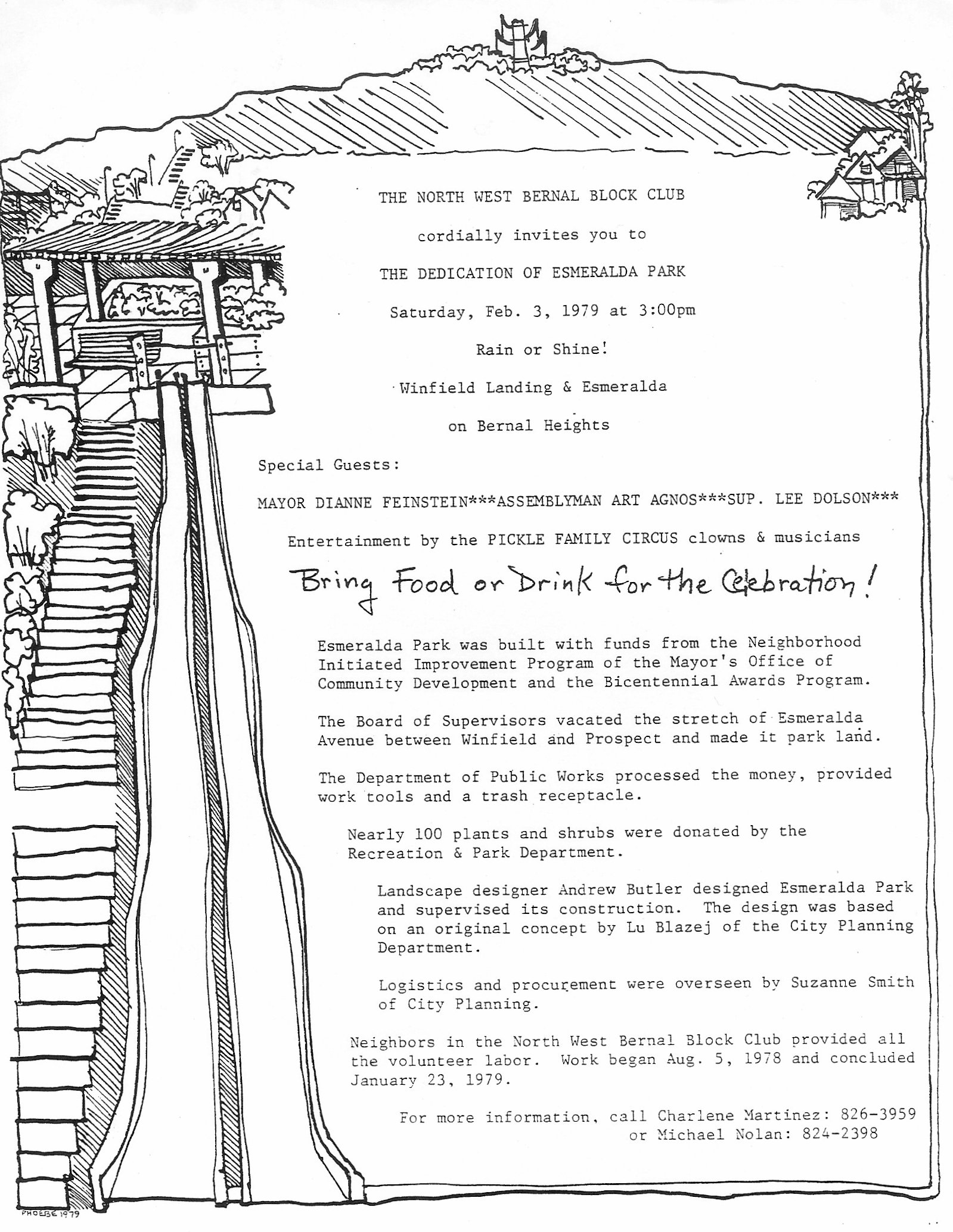
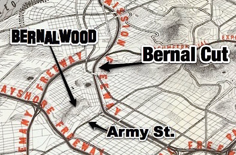
Once upon a time, during the Age of the Ancient Druids, the peoples of southwestern Bernal Heights and northeastern Glen Park were united as one. During that time, our Bernal lands extended continuously to the west, and the Lost Tribe of College Hill was not yet lost. Bernal soil filled the void that divides us today.

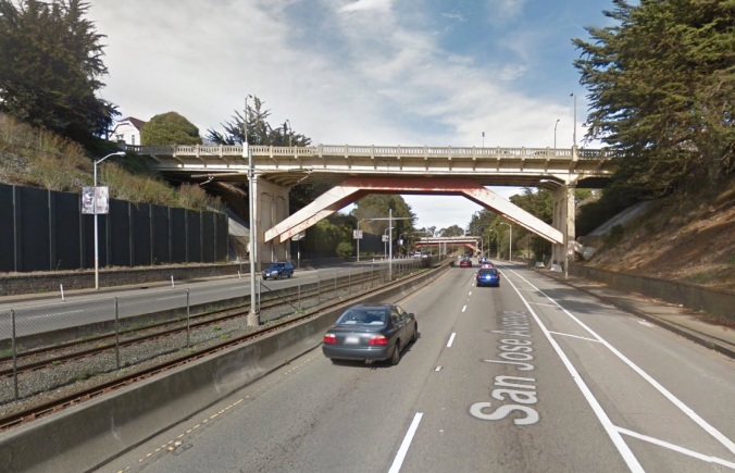
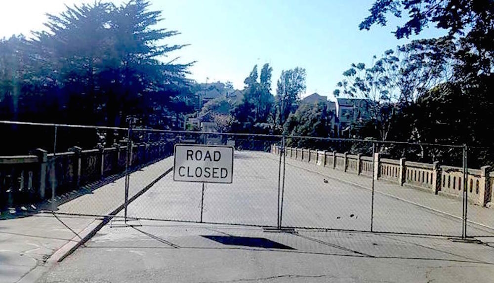
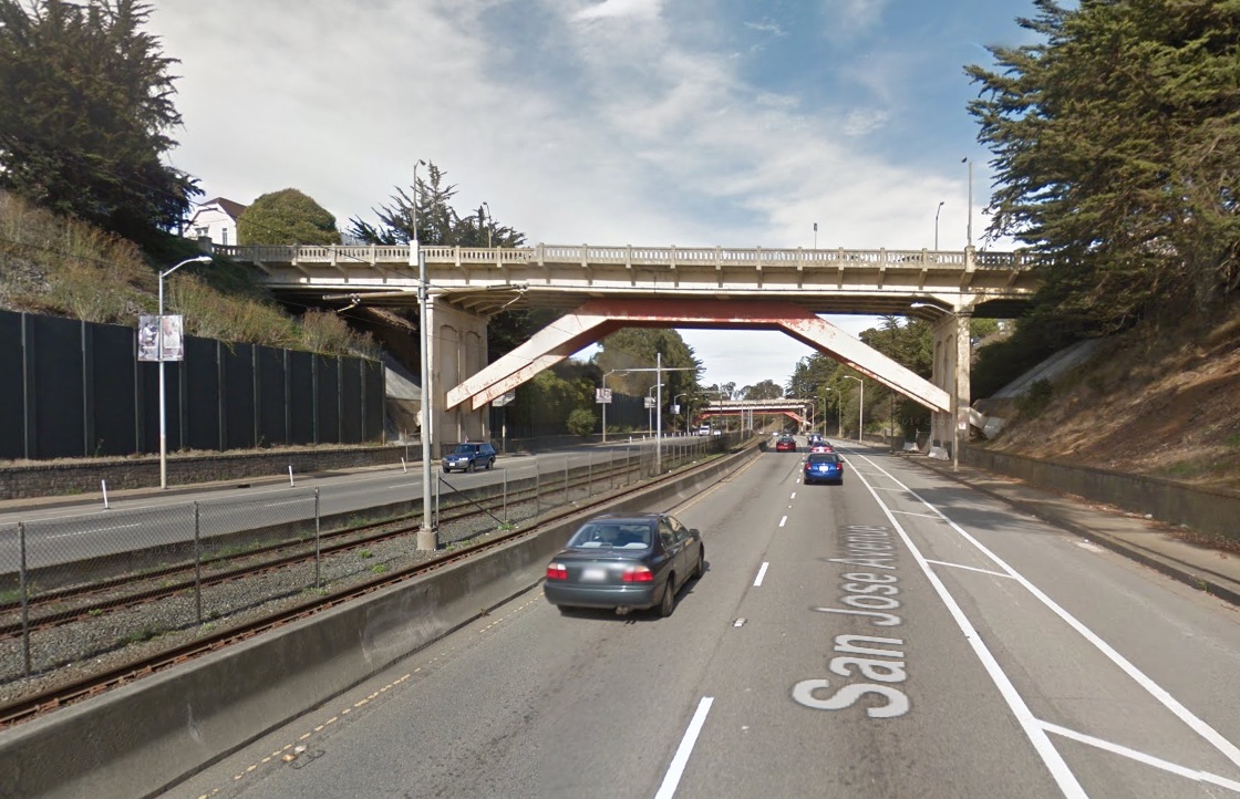
The void that divides Bernal from Glen Park today is called the Bernal Cut, and it now carries a streetcar line and auto traffic that speeds along San Jose Avenue to and from I-280. It is very unlovely:

bernalcutstreetview

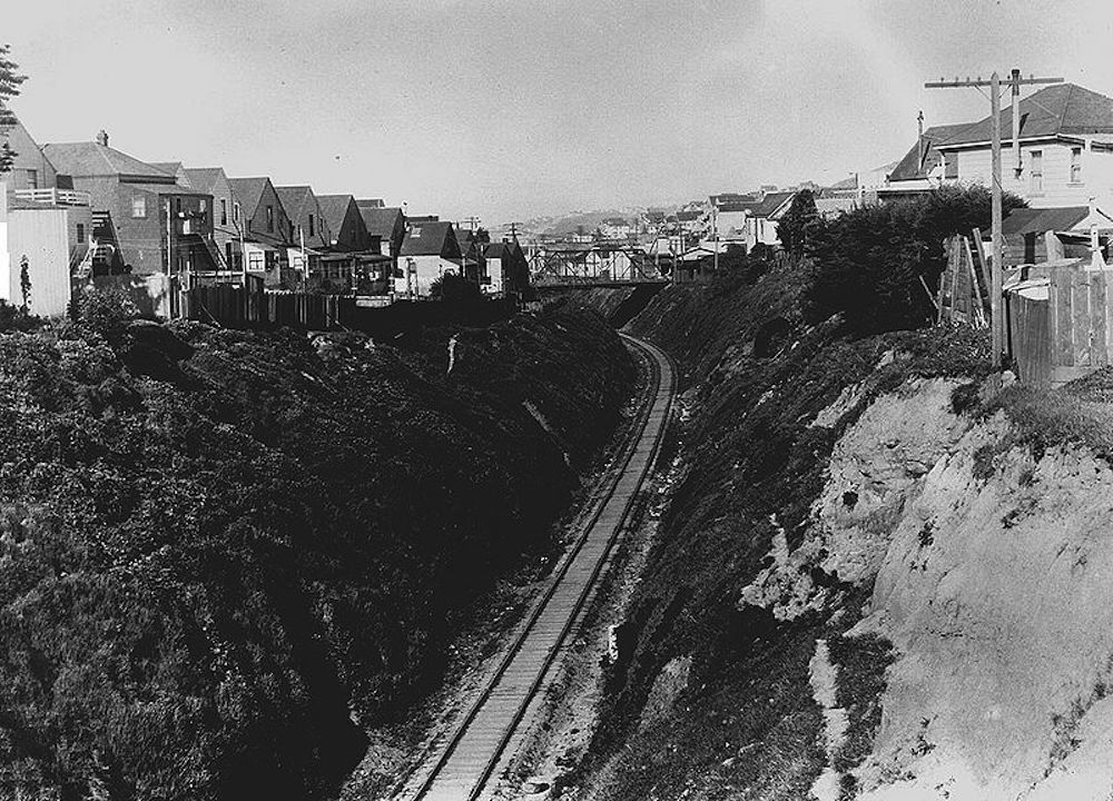
Originally, the Bernal Cut was a Southern Pacific railroad line carved out of a low shoulder of Bernal Hill’s west slope during a series of late ninteeenth century excavations. Here’s a view of the Bernal Cut during the railroad days, looking north toward modern-day La Lengua from the Richland-Miguel overpass in April 1922:

bernalcutnorth1922

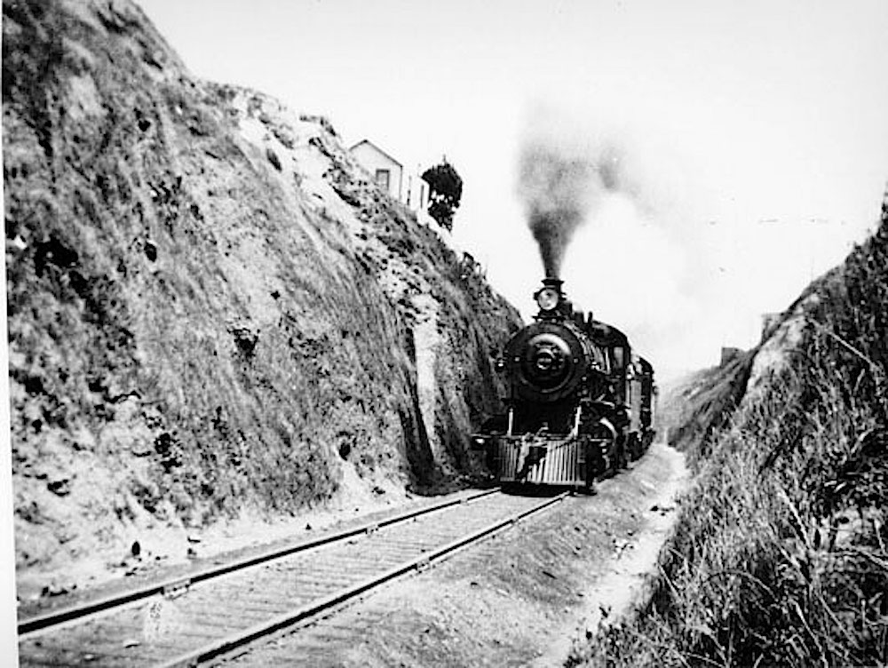
Throw in some smokey steam locomotives, and you can see why The Cut became particularly daunting to cross. This is a train chugging through the Bernal Cut in 1905:

bernalcuttrain1905

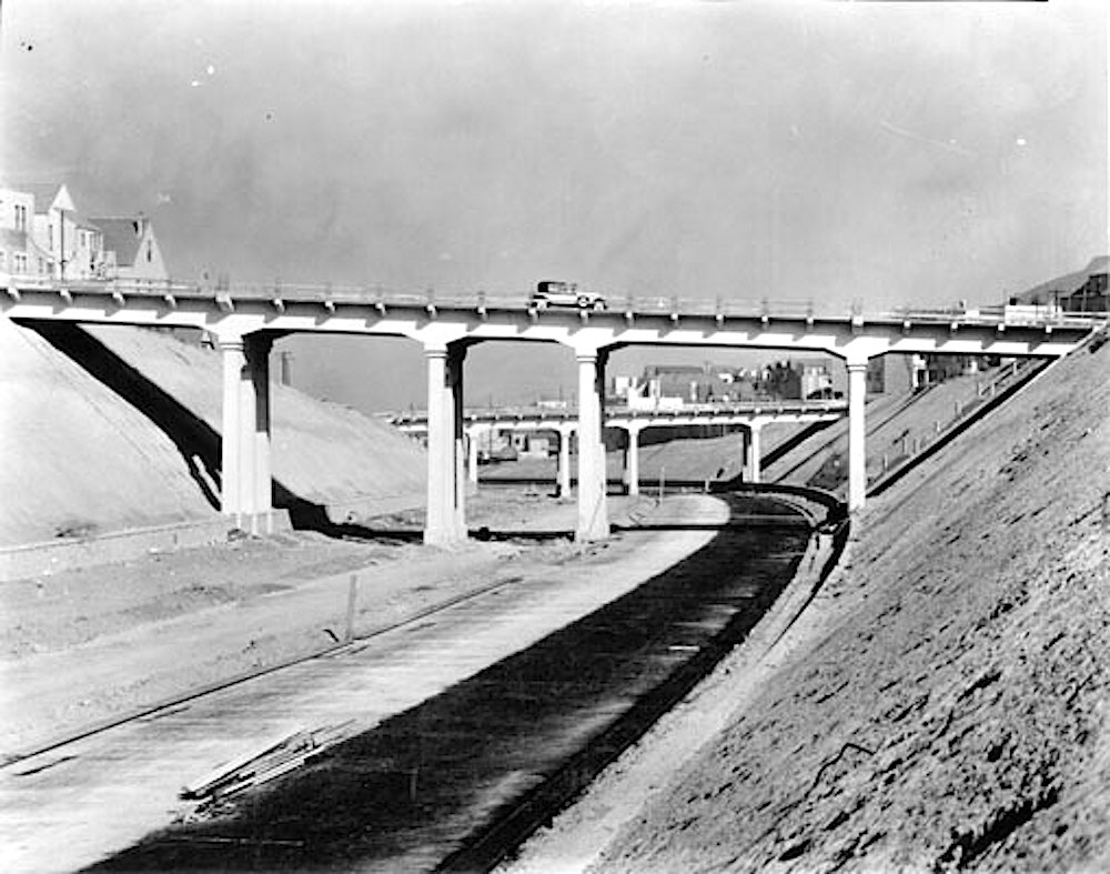
Then came the age of the automobile, and in the late 1920s, the cut was widened and expanded to create an arterial road into San Francisco’s urban core. Here’s another north-facing view, this time from 1929, when the construction of the roadway was almost complete:

bernalcut1929

The vision at the time was that the Bernal Cut would become the first stage of a new Mission Freeway that would carry high-speed traffic into downtown San Francisco. Here’s a crop from a 1948 planning map that shows how all that would have worked, in rather horrifying detail:

1948_san_francisco_trafficwaysplan2

Basically, in much the same way that Army/Cesar Chavez used to suck because it was designed to feed a freeway that never actually got built, so too the Bernal Cut now sucks because it too designed to serve a future that never really materialized. The Bernal Cut has been dominated by vehicular traffic for more than 100 years. That may have been a necessary and worthwhile thing, yet it also divided the neighborhoods on either side, and for the neighbors who live there, it’s a big bummer.

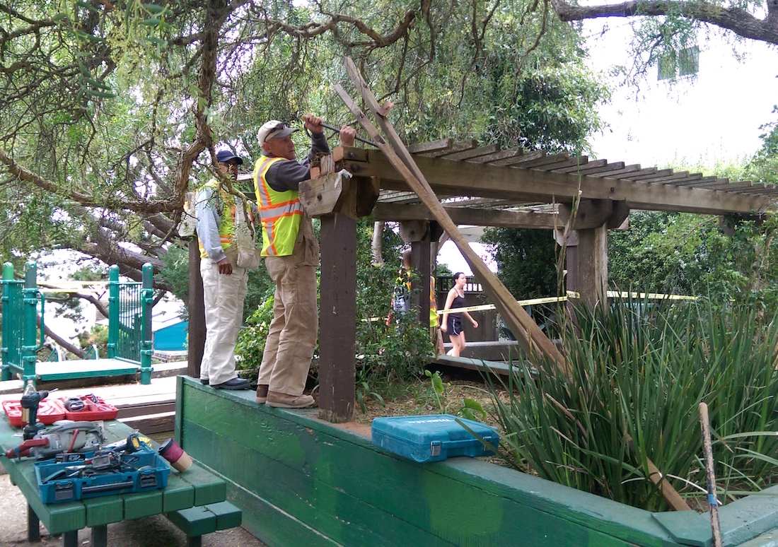
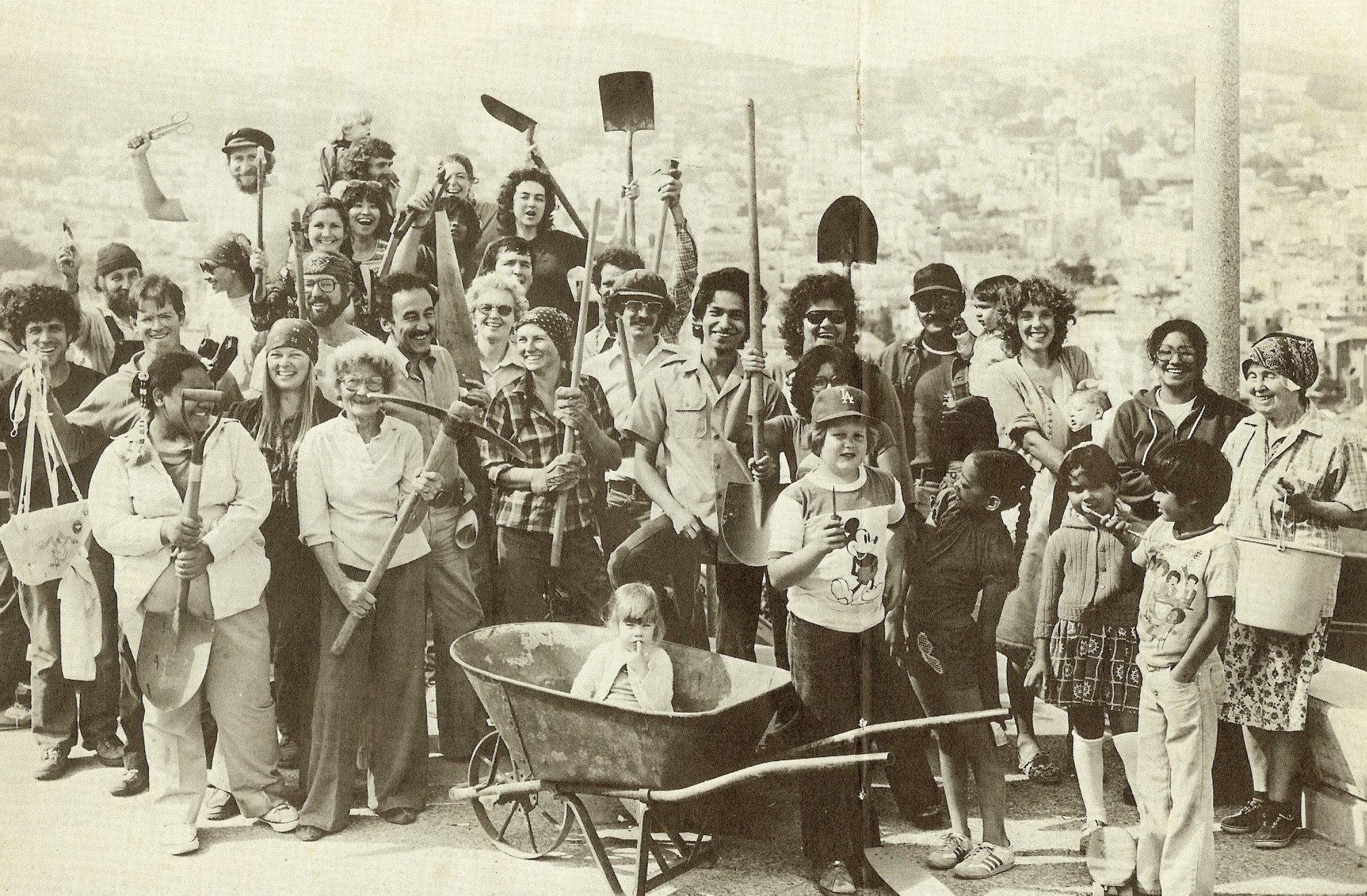
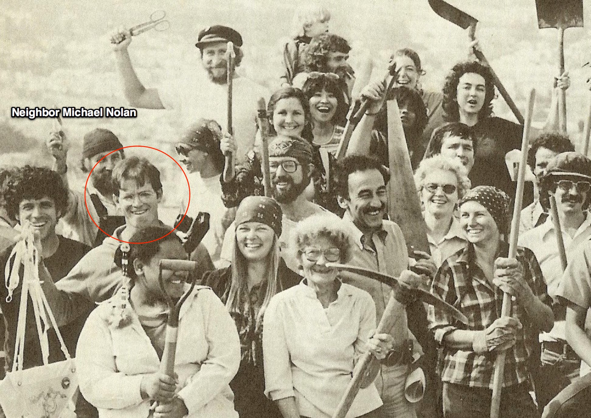
Fortunately, there are a few armchair urban planners and civil engineers who live on the Glen Park side of the Bernal Cut — an area which they (quite revealingly, and charmingly) call “Bernal Glen.”  In recent years, our kin in Bernal Glen have hatched a few brilliant plans to re-unite the mainland people of Bernal Heights with our descedents from Bernal Glen. One such plan is described here by Bernal Glen neighbor Erika Ehmsen:

In 2013, a College Hill/Bernal Glen neighbors asked renowned landscape and urban design firm SWA Group to visit San Jose Ave. SWA designers and planners walked with neighbors along San Jose Ave., the Bernal Cut Path, the Arlington Path, and our bridges and pedestrian overpass to experience the grim current state of San Jose Ave.—from its freeway-like speeds to its trash-strewn and encampment-prone slopes and sidewalks.

SWA designers asked us to suspend our current reality in order to reimagine and reinvigorate our blighted speedway. We showed SWA the Glen Park Community Plan and asked them to envision an extension of that plan that could incorporate the slopes above San Jose Ave. while reflecting our College Hill Neighborhood Association’s greening and safety goals. And then SWA got to work sketching the plans in that above Google Doc presentation—all pro bono.

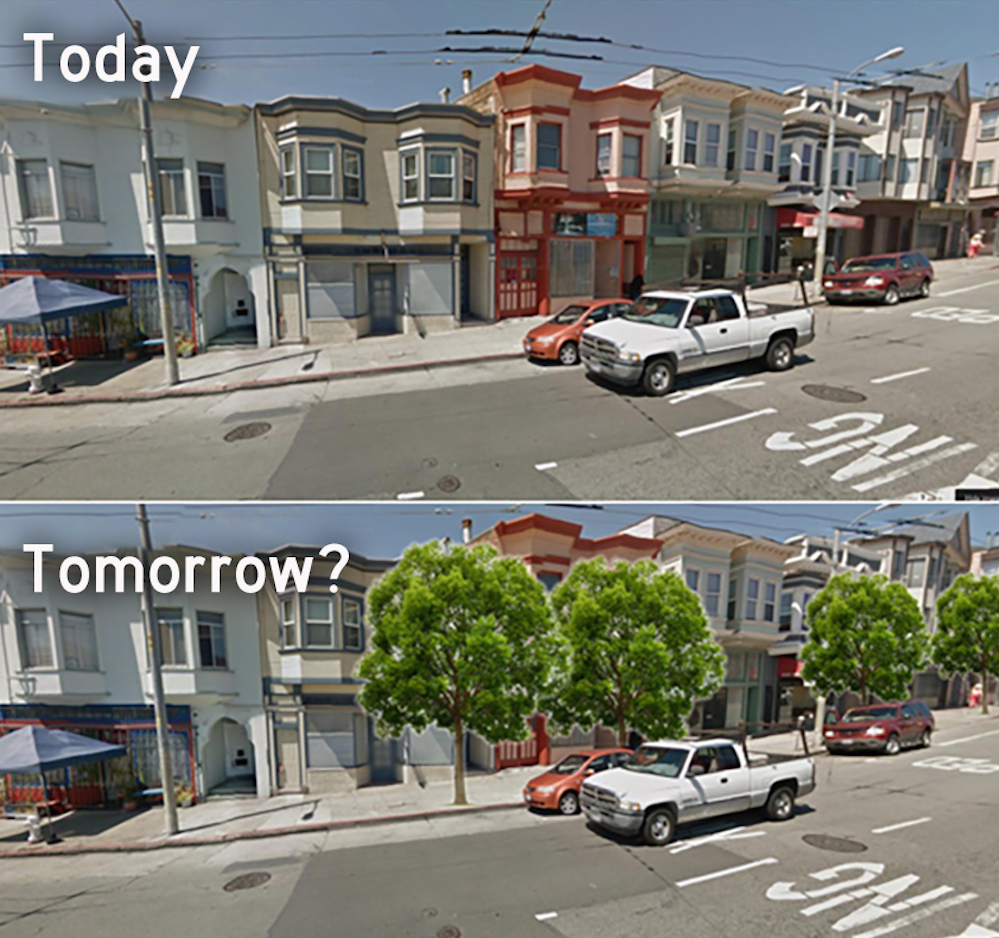
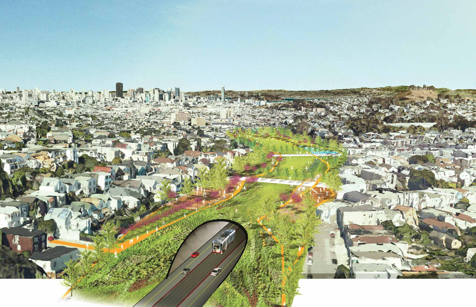
Here is that SWA presentation; it is rather trippy and mind-expanding. One proposed scenario would involve re-filling the Bernal Cut with soil after creating a tunnel for the tracks and roadway underneath. It’s just a simple “cut and cover” tunnel design, basically — but the cut part comes pre-excavated 150 years ago.

This idea would seamlessly re-unite Bernal with Bernal Glen by eliminating the trench between them, while also creating 13 acres of new land that could be used for a mixture of new housing and parks. And though the proposal itself doesn’t suggest this, in theory at least, the sale of land to build that much-needed new housing could actually go a long way toward paying for the whole thing.

Here’s what it might look like, as visualized by SWA:

bernalcuttunnelMind blown?

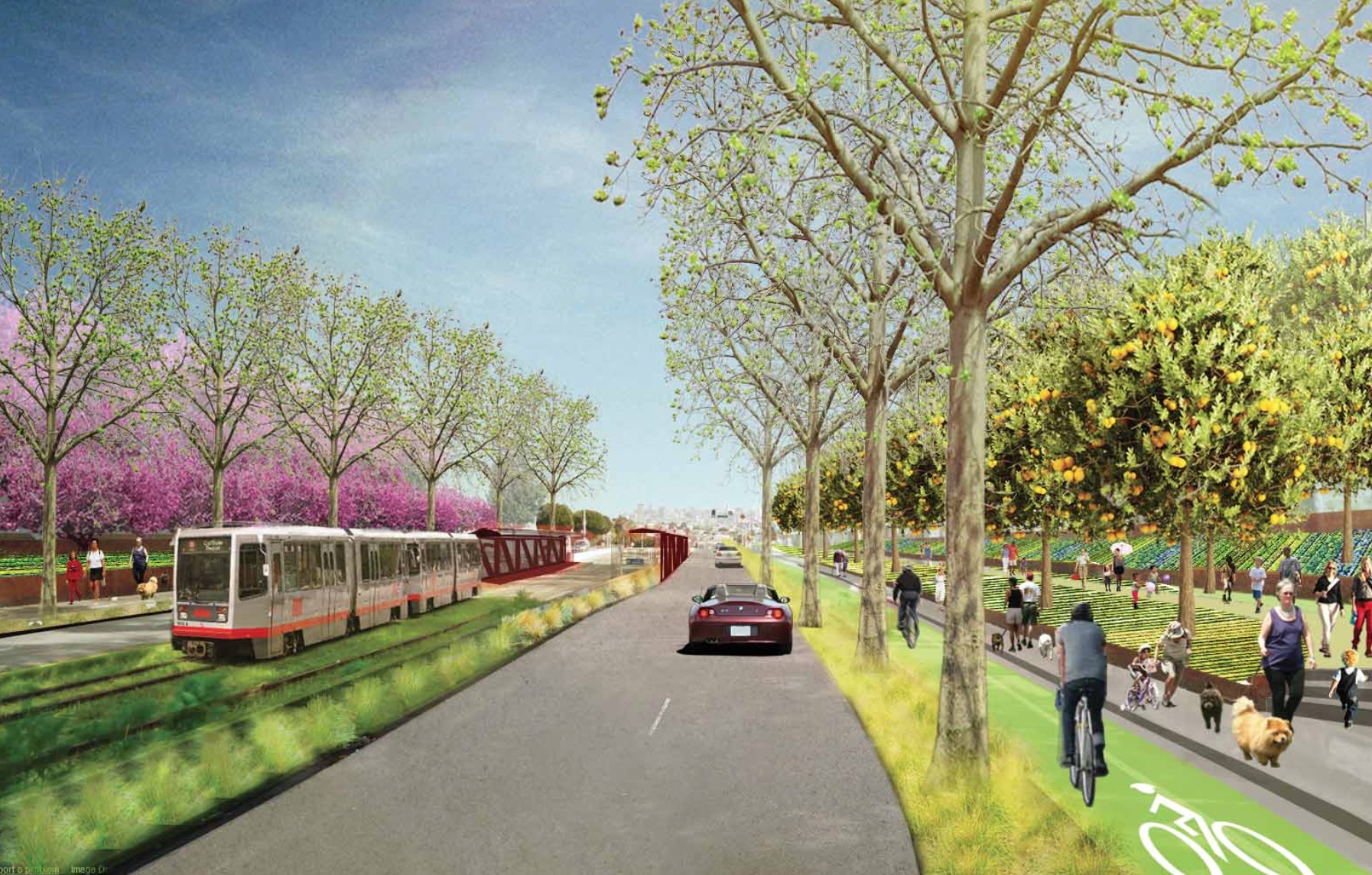
If a tunnel seems too sci-fi, another scenario envisioned in the exercise would narrow the roadbeds and terrace the walls to create land for urban agriculture. This is what tomorrow’s “Bernal Cut Farms” might look like:

bernlcutfarms

Innnnnnnnnteresting, no? We might quibble about some of the details, but the big breakthrough here is that it gets you thinking about the Bernal Cut in all sorts of crazy new ways. There’s a lot of land in there! And it’s really under-utilized! So many possibilities, even while retaining The Cut’s core transportation functionality. Yes! Yes! Yes!

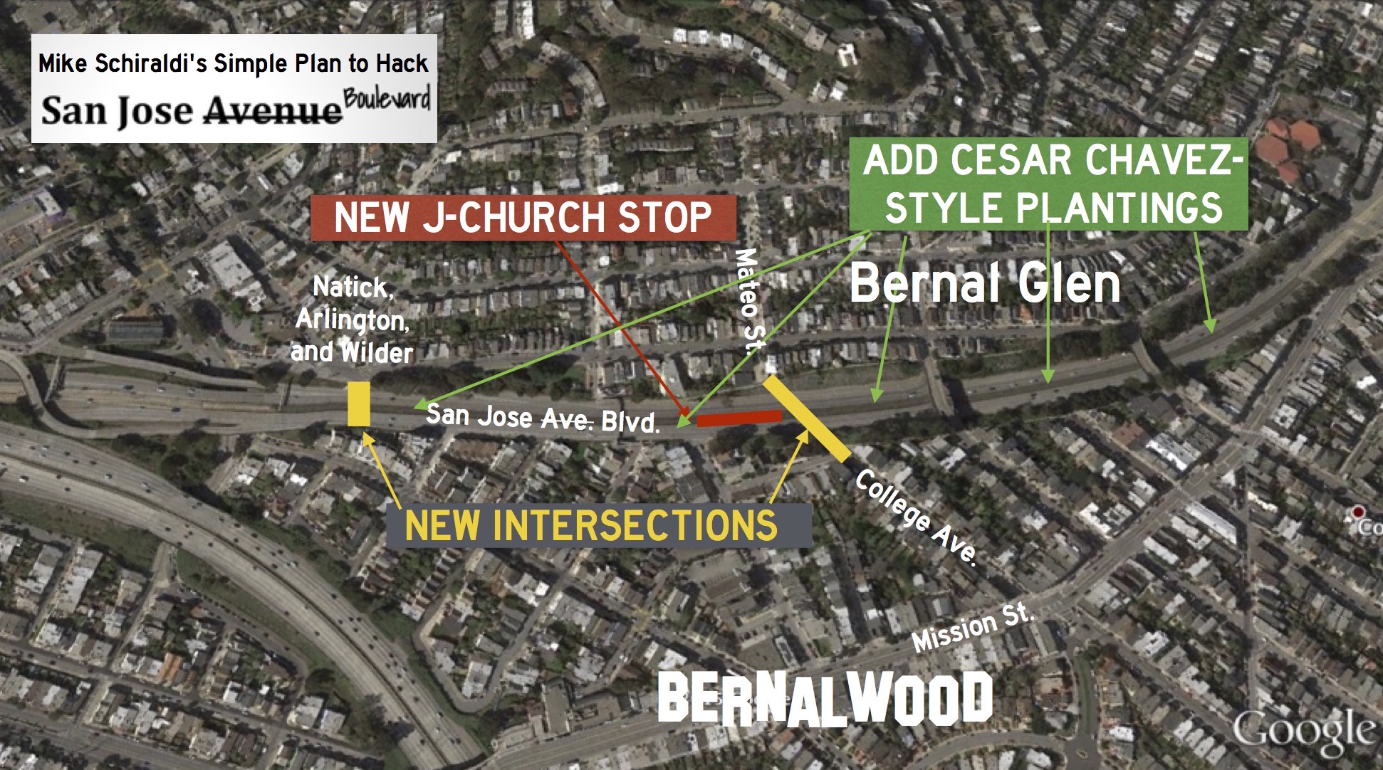
Meanwhile, and more recently, Bernal Glen neighbor Mike Schiraldi decided to pick up on this basic idea and pare it back to the bare essentials to develop his own plan for how to heal the Bernal Cut. Mike says:

Well, the Glen Park Community Plan spends a couple paragraphs dreamily talking about undoing San Jose Avenue, but doesn’t get into any details or explain the benefits. So while I’m not the first to talk about ripping it out (duh), I tried to get down to brass tacks, to see how it could actually get done. And I wanted to illustrate how transformative it would be, since it can be hard to see that from the Glen Park Community Plan.

Inspired by the improvements that recently transformed the once-awful Cesar Chavez/Army into today’s much more glamorous boulevard, Mike’s let’s-do-this idea is to do the same basic thing to the speedway portion of San Jose. To slow traffic and make it easier to move between the two microhoods, he proposes re-connecting a few of the surrounding streets via new intersections with San Jose.

Specifically, his plan would create a new traffic light/intersection at Natick, Arlington, and Wilder Streets in Glen Park and one linking College Ave. in Bernal with Mateo Street in Glen Bernal. He calls this scenario “San Jose Boulevard”:

Both of the two new connections could be full intersections, with traffic lights, allowing traffic to flow in any direction between San Jose, Natick, Arlington, and Wilder, or between San Jose, College, and Mateo. There could be crosswalks too, so pedestrians and cyclists can get across without having to use an overpass, which is awkward, often dirty, and can be scary at night.

Oh, and to further activate the areas and create even more pedestrian activity, Mike also proposes adding a new J-Church stop along his new San Jose Boulevard, since the streetcar already runs there anyway:

Large sections of Glen Park which are currently underserved by transit would suddenly become extremely transit-accessible, both because of the new J-Church stop, and the new crossing opportunites.

You can read all about it in Mike’s brainstorming presentation, where he makes the case in a lot more detail. It’s clever. It’s not complicated. It may even re-activate the Bernal Cut as a shared space that joins the Dominion of Bernalwood with our kin from Bernal Glen. Let’s do (something kind of like) this!

Repairs Begin on Highland Bridge Across Bernal Cut

HighlandBridgeOut

A heads up to all ye with friends and relations on the western side of the Bernal Cut: The Highland Avenue Bridge across San Jose Avenue will be closed for the next six months while workers repair its crumbling concrete guardrails. Our (now even more) lost neighbors from College Hill News have all the details:

At long last, work is about to begin on the Highland Bridge to replace its crumbling guard rails. This weekend, we received the below update from a public information officer at Public Works:

Construction Notice:
MH Construction Management Co. is under contract with San Francisco Public Works for the TRAFFIC RAILING REPLACEMENT PROJECT AT THE HIGHLAND AVENUE BRIDGE. San Francisco Public Works will manage the construction.

CONSTRUCTION SCHEDULE
• Construction is scheduled to begin approximately April 20 2015 and be completed by October 2015.
• Highland Ave Bridge will be closed April 27 2015 for maximum duration of 6 months.

WORK HOURS
• Monday through Friday: 7:30 A.M. to 4:30 P.M.
• Exception: While the scaffolding is being erected over the bridge, construction can occur from 1:00 A.M. to 4:00 A.M. for a few days only.

PROJECT LOCATION
The Highland Avenue Bridge at Arlington Street (off Mission Street).

SCOPE OF WORK
• Install fencing along Arlington Street.
• Place 72-Hour No Parking Notices along Arlington Street between Charles St. and Highland Ave.
• Demolish existing guard rail at Arlington Street.
• Prepare Highland Avenue Bridge Closure.
• Erect Scaffolding (some night work).
• Demolish existing guard rail (both sides).
• Form & place new concrete guard railing.

TRAFFIC IMPACT
• 
The Highland Avenue Bridge will be closed to all traffic for the entire 6 months of construction. Traffic will be temporarily detoured via Richland Avenue Bridge as result of bridge closure that is necessary to perform the work.
• Streets will be posted 72 hours advance with NO PARKING / TOW AWAY SIGNS, with the project work-listed, to alert the public of the construction and parking restrictions.
• Please observe parking and traffic signage and allow extra travel time in case of traffic delays during construction work.

Ugly-Ass Roll-Up Door Removed from Former Park Bench Cafe Space

parkbenchdoor

Sometimes, when you put on your sparkly red shoes and click your heels together three times, your wishes are granted. For a lost girl named Dorothy, that meant returning home to Kansas. For many residents of Precitaville, one such wish would be to remove the heavy steel roll-up door that covers the former Park Bench Cafe on Folsom; the one that makes the streetscape seem so dismal.

Neighbor Nina lives just up the street from the former Park Bench space, and she has spent a lot of time wearing her sparkly red shoes and clicking her heels together. Yesterday she finally got her wish: The heavy steel door was removed from the storefront. Hurrah!

But wait … Does the removal of the steel door mean that something exciting and new is coming to the former Park Bench Cafe space, which has been dormant and empty for several fallow years?!?

Why, yes it does. It means exactly that.

But then the question becomes: What’s gonna happen there?!?

Bernalwood doesn’t have many details right now, but lets just say that if you were to put on your sparkly red shoes and click your heels together three times and wish for a delicious gourmet pizza place founded by another longtime Precitaville neighbor… well, we have reason to believe your wish might soon come true.

PHOTO: Neighbor Nina

This Is The City’s Plan for New Crosswalks and Stop Signs on Bernal Hill (and How It Could Be Improved)

crossing2edit2

Do you remember that City meeting a few weeks back to review the proposed pedestrian-safety changes to the intersection of Bernal Heights Boulevard and Bernal Heights Boulevard at the southeastern side of the hill, near the glamorous Vista Pointe Minipark? Well, Neighbor Tom attended the meeting, and took great notes, and made some spiffy diagrams of new crosswalks and new stop signs, and he thinks the current proposal needs revision. Neighbor Tom says:

First, the facts:

Three Bernal residents spoke, of which I was one. No diagrams were presented or handed out, but two of us were able to look at a diagram (by request) before the meeting started.

Of the three that spoke, all approved of making some improvements. Two of us approved of the stop signs, one felt it unnecessary, but the crosswalk is good. As far as I could tell, there was no resolution on this, just the hearing of opinions.

I created a sketch of the plans from memory. (I don’t like recreating drawings from memory, because it’s inaccurate, but if they’re not going to give handouts, then…)

The yellow parts are roughly what their plans showed. Here’s a version of the diagram with other colors added by me to illustrate my personal opinion.

Tom_annotatedcrossing

My opinion is:

1. Locating the crossing at C will encourage people to walk the red path, with leads to a tricky crossing of Bradford (where a stop cannot be added, due to the #67 bus).

2. Locating the crossing at B instead would encourage the green route, which benefits from the pre-existing ‘stop’ on Bradford, and could be further improved by a cross walk.

The MTA say that the crossing must be located at C, since that’s where Parks and Rec have decided to put stairs.

Yes, stairs! I’m opposed to the stairs, since they will lead users to further steep loose ground, which they then have to ascend (or turn back). They therefore violate the principle of “don’t trick people into thinking they’re safe.”  I’m informed that the stairs will help reduce erosion. I suspect they’ll do the opposite – they’ll encourage more people to take the route.

ILLUSTRATIONS: Neighbor Tom

New Pedestrian Crossing, Stop Signs Proposed for Eastern End of Bernal Heights Park

bernalxwalksite

Tomorrow morning, March 6, at 10 am, the San Francisco Municipal Transportation Agency will solicit input on proposed changes to the intersection of Bernal Heights Boulevard and Bernal Heights Boulevard at the eastern side of the park.

Wait, what? No, that’s not a typo:

hearingannounce

This is the spot.

The hearing happens at 10 am on Friday in Room 416 at City Hall. Here’s the announcement in situ:

Public Hearing

Three years ago, your Eastern Bureau correspondent attended a Rec and Parks meeting about trail restoration on Bernal Hill, where neighbors discussed the safety of the ‘undefined’ eastern entrances to the park. At the time, someone from the City mentioned that there was “lots you can do with paint.”

Now, the moment is at hand to perhaps do something with some paint. And a few stop signs.

PHOTOS: Joe Thomas