In his amazing new Seep City map of San Francisco’s lost creeks, springs and waterways, natural history researcher Joel Pomerantz reveals the places where groundwater once flowed in Bernal Heights.
Here’s the story it tells:
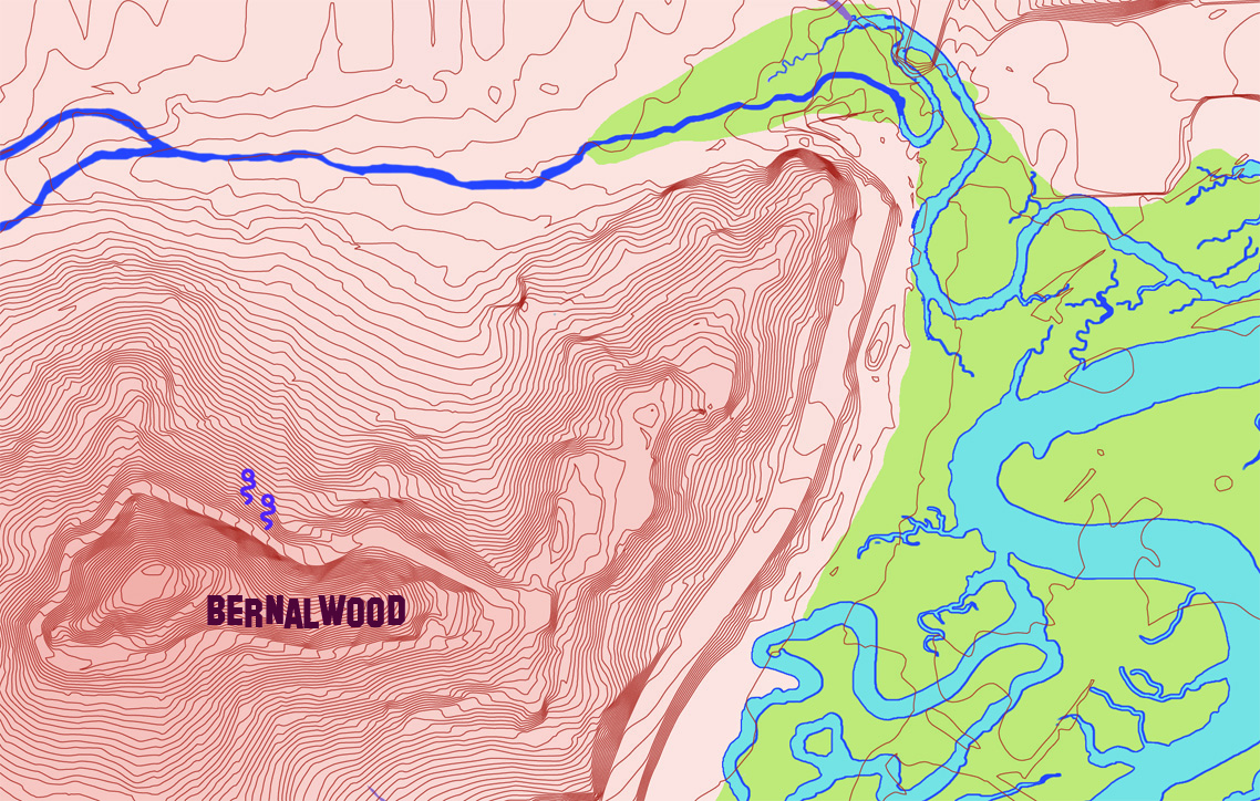
[On the map] today’s land forms are shown with 5-foot-interval contour lines. At this level of detail, we can easily see where human activity has filled extensive portions of the bay and where streets, highways, reservoirs and railroad grades cut into hills.
Our city had significantly more water before it was developed. Consequently, most of the water shown is from historical sources. The purple squiggles are bedrock springs found today. Natural and artificial lakes present today are outlined in white. Creeks of today are highlighted yellow.
Only a couple creeks still flow on the surface today. Finding them can be a challenge without this map. Some are virtually unknown.
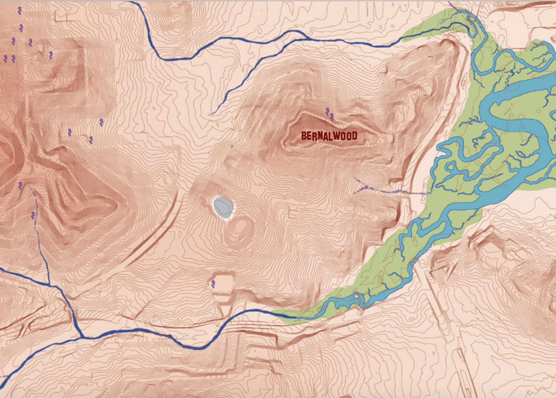
The detail is remarkable. Here’s a close crop of northeast Bernal, with Precita Creek running along the upper part of the map and draining into the intricate Islais Creek watershed (where Bayshore stands today). Notice also the two active springs on the northern slope of Bernal Hill:
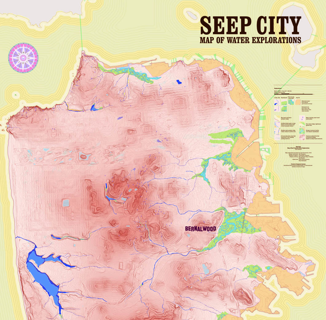
And when you pull back to look at the city as a whole, you see how Bernal fits in to a much larger ecosystem:
Want a copy of Joel’s maptastic creation? Visit his Kickstarter page, where you can order a map in your favorite size.
IMAGES: Courtesy of Joel Pomerantz

I figured out exactly where one of those 2 north slope ‘springs’ erupts. It’s about 1.5m NW of the melted-handgun-bench thingie in Precita Park.
yeah, it’s pretty wet there today
Interesting! I had heard that the city had built on top of streams. Driving through the Cesar Chavez underpass, it’s always dribbly. That maps to the northeast corner of the detail map of Bernal. Looks like to the south towards Excelsior, it is about where Mission Street is. Thank for sharing this!
Cool. Folks seem to think that Precita Creek runs under Precita Park. It doesn’t. It runs under Cesar Chavez. I mean, think about it. Given the way the park is, water could only run diagonally right to Cesar Chavez anyway. So no. Dogs are the reason the park is always chewed up in two or three spots. Not underground water.
This is interesting, we live on Bradford street, and neighborhood lore says there’s a spring at the empty lot on the Norther corner of Bradford and Powhatan. I’m pretty sure the story is accurate as we almost always can hear a steady stream of water running down the storm drains in the front of the house. I wonder if old maps never mentioned the seep and that’s why it didn’t make it onto this map?