Let the Chase Begin!! Bernal’s Bullitt Cameo, Then and Now

Although Bernal Heights has earned many a claim to Hollywood fame, my favorite is the role our neghborhood played in Bullitt, the 1968 Steve McQueen classic. It’s a great flick, but the most famous part, of course, is the epic car chase that screeches and sprawls around the street of San Francisco.

Bernal Heights plays a starring role here, because the chase itself gets underway just on the other side of US 101, near the intersection of Bayshore and Marin (near the site of the current car wash). The vroom-vroom action begins at the intersection  Army/Cesar Chavez and Precita Avenue, when two goons driving a Dodge Charger try to put the move on McQueen in his Ford Mustang. This screen grab shows the very moment when the chase gets underway:

Notice Bernal Hill making a cameo in the background, looking green and properly manicured. But perhaps the most interesting thing about this moment in the film is how little this corner of the neighborhood has changed in the last 40 years:

Fun stuff. From here the chase heads up York Street before turning onto Peralta, and from there it careens around San Francisco without rhyme or reason, as McQueen screeches around the corner in one part of town – only to reemerge in another. neighborhood, miles away.

The chase is a fun ride, and if you want to see it again, you can watch the thing right here:

Drive safely!

Hat Tip: @burritojustice

Trove of Historical Photos Show Streetcars in Bernal Heights

Cortland Avenue at Bennington Street, 1940. Red Hill Books is now on the corner at 401 Cortland. Discount Club is now where the "Drugs" sign is at 439.

Cortland Avenue at Andover Street, 1941. The 9 Valencia line car heading west. The woman waiting to board the car is in front of what is now Head to Toes Beauty (451 Cortland ), Skip's Tavern (453 Cortland Ave.), and Bernal Yoga (461 Cortland Ave.)

Mission near 29th Street, 1948. Behind the car is the Lyceum Theater (1907-1964), now the site of the Safeway parking lot

Last week’s talk at the Bernal Public Library about the history of streetcar service along Cortland Avenuewas really excellent. Interesting, informative, and a vivid reminder of how the texture of the neighborhood is so heavily shaped by its infrastructure.

Plus, as an added bonus, historian and presenter Jack Tillmany gave everyone who attended his talk a nifty souvenir: MUNI streetcar transfers from 1946 that were marked for use along the former 9-Cortland line:

Cool! Happily, if you couldn’t make it to the talk, our neighbors at the ever-awesome Bernal History Project have compiled a fabulous greatest-hits collection of photographs that show streetcars in service along the streets of Bernal Heights.

Hop on board and take that website for a ride.

HISTORIC PHOTOS AND CAPTION TEXT: Bernal History Project. Transfer photo: Telstar Logistics

Amazing Photos from 1878 Reveal Lost Peaks of Bernal Hill

The view from Nob Hill, 1878

Our bloggy hipster friends in the Mission like to make fun of Bernal Heights because of our obsession with lesbianism, dogs, child-rearing, and backyard gardening. That’s fine, because in return we like to make Mission hipsters’ heads explode by announcing: “WE ARE YOUR FUUUUUTTUUUUUURE!” (Johnny O from Burrito Justice pioneered that reply, and it never fails.)

Privately, Bernalwood appreciates those proto-self kids in the Mission, and a geeky interest in local history is a friendly touchstone we all share. So thank you, Uptown Almanac, for turning me on to a series of panorama images taken from the top of Nob Hill in 1878.

The resolution of these photos is amazing, especially when you recall that in 1878, they didn’t even have the Pano app to use with their iPhones! Right? Also amazing is the fact that most all the buildings you see in these photos were destroyed in the 1906 earthquake and fire.

Here’s a detail of the view to the north, looking toward Alcatraz:

Now, let’s look south, to take a closer look at Bernal Heights. Grab the photo, then we’ll zoom, sharpen, and enhance. What do we see???

That first light-grey hill in the background is Bernal Heights. There aren’t many buildings to speak of in 1878 Bernal, nor any trees or large-scale vegetation. But what they did have then that we don’t have now are the two Lost Peaks of Bernal Hill, which are clearly visible just to the east of the present-day summit:

As we learned previously, the Lost Peaks were excavated into oblivion sometime during the 1940s. To reprise:

Bernal Heights had two other major peaks to it, to to the north east of the current peaks – roughly under what is now the flat planes that lie between Peralta, Rutledge and Franconia Streets .  Vicky Walker of the Bernal History Project sent me a couple of their aerial survey maps that show that these two peaks were removed sometime between 1938 and 1948.  Terry Milne said that they have been trying to find records which usually exist for 1900’s large excavations, about where all that hillside was dumped, but so far to no avail.  Note that the peak between Rutledge, Massasoit and Brewster was not just chopped off, but gouged out from the Bernal hillside

Way cool. If you want to explore some more, check out the entire collection of 1878 Panorama Photographs, and prepare to get lost in time.

PHOTOS:  Muybridge Panorama of San Francisco, 1878

Learn About the Streetcars That Once Clanked Down Cortland

Did you know that Cortland Avenue once had a streetcar line? OMG! So true! Vicky Walker, Bernalwood’s Minister of History, brings this announcement about a very cool presentation that will happen at the Bernal Heights branch library on Wednesday night, June 15, at 7 pm:

Bernal History Project is proud to present a free slideshow and talk by S.F. transit and movie theatre historian Jack Tillmany (author of Theatres of San Francisco).

Bernal residents got their first taste of public transportation more than a century ago when streetcar tracks were laid down the middle of Cortland Avenue, and United Railroads trolley line #24 (Cortland/Divisadero/Richmond) linked three San Francisco neighborhoods. Soon after, line #23 (Richland/Valencia/Fillmore) completed the picture.

Jack will explore the roots of today’s #24 & #23 lines during the first forty years, when trolleys ran on tracks and the #9 line caused no end of confusion by running on Cortland and Richland at the same time. He will also bring “freebie souvenirs for those who show up.” He promises they are “most appropriate, authentic, and not to be found anywhere else.” Here’s a great interview with him courtesy of our friends at the Western Neighborhoods Project.

An important note: This presentation covers only the Cortland and Richland streetcar lines. Jack will present a separate show soon that covers the 30 (Army from Third St. to Bryant), the 25 (Bryant to Bayshore and then to San Bruno), and Muni’s H line, which terminated at Potrero and Army streets but was later extended down Bayshore to replace the 25. Sorry, NoCo residents — your turn will come!

The slideshow will be held in the meeting room of the Bernal branch library, 500 Cortland (at Andover); turn left at the bottom of the stairs. It starts promptly at 7 p.m.; note that the meeting room is small, so get there early to guarantee a seat!

This presentation is dedicated to the memory of San Francisco transit historian Phil Hoffman, who hosted one of BHP’s first slideshows and was always happy to help with our research.

PHOTOS: Top: Streetcars on Cortland, 1938 (via San Francisco Public Library); Bottom, a streetcar after it jumped the tracks on Cortland at Folsom, 1935 (via Bernal History Project).

Alemany Flea Market Report: Early June 2011

Alemany Flea Market-June 2011

Alemany Flea Market-June 2011

Alemany Flea Market-June 2011

Alemany Flea Market-June 2011

I had a few minutes to spare on Sunday morning en route to taking Bernalwood’s Cub Reporter to a birthday party in Sunnyside, so we made a quick detour into the Alemany flea market to sample the selection.

Despite the threat of rain, it seemed as though the summer season is starting to kick in, as the supply of merchandise was decidedly more interesting than it has been in weeks past.

The goodies above caught my eye, but the Cub Reporter found herself smitten by an old 45 record.

Alemany Flea Market-June 2011

She’d just learned about “records” at preschool, she explained, and this one had a rainbow on the label, and what could possibly be finer? So for 50 cents, she got her very first 45. The A Side is “Him” by Rupert Holmes. Thank god we don’t own a record player.

I was quite taken by a GIANT aerial photograph of San Francisco International Airport taken in 1967 or 1968 the early 1960s. It was mounted on a heavy metal frame, and it was fascinating. (Cub Reporter shown for scale.)

Alemany Flea Market-June 2011

The detail was excellent! Check out the terminal complex, which did not yet include Terminal 3 (nor, of course, the International Terminal). SFO’s central parking garage hadn’t been built yet either. (Click here for a close-up enlargement.)

SFO Circa 1967The price was tempting — asking $100. But after some inner turmoil, I decided to pass, if only because the piece was so freaking BIG that I’m not sure where I could put it.

Instead, I settled for this circa 1976 Mighty Tonka dump truck. It was one of of the older, all-steel models, with only minor surface rust, and a prime candidate for resurrection as one of our Kustom Tonka hot rods. Plus, it was just $9. The Cub Reporter made me promise to share it. “Deal!” I told her.

Alemany Flea Market-June 2011

PHOTOS: Telstar Logistics

Off the Hill: Best Cheap Eats in the Mission, Carnival Parade on Sunday, Beach Chalet Blues, and a Market Street Makeover

It’s time for Bernalwood’s Friday buffet of warmed-over nibbles from around The City:

The 20 Best Dishes Under $10 in the Mission  (7×7 via MissionLoc@l)

Design Unveiled for New SFMOMA Addition (SF Chronicle)

Don’t Forget the Carnival Parade on Sunday Morning!! (FunCheapSF)

Let’s Roll: Best San Francisco Food Trucks of 2011 (SF Weekly)

The Odyssey of the Original Beach Chalet at Ocean Beach (The Richmond Blog)

Planning Underway to Make Market Street Not Crappy (Streetsblog)

PHOTO: Carnival 2009 in the Mission, by Telstar Logsitics

An Old Plan to Build a New Tunnel Under Bernal Heights

Along time ago, in the office of a city planner far, far away, a plan was hatched to solve San Francisco’s traffic problem.

The year was 1928, and the San Francisco Traffic Survey Committee had mapped out a vision for the future that involved widening selected city streets to adapt them for use as major arterial throughfares.

Bryant Street in the Mission was to become one such proposed artery; it would carry much of the traffic traveling between South of Market and the Peninsula via Bayshore and San Bruno Avenues. But how would all those vehicles get from Bryant to Bayshore (and vice-versa)?

Why, through the Bernal Tunnel, of course!!

Look closely, and it’s right there: A short tunnel running under present-day Franconia Street to whisk motorists through layer upon layer of our beloved Bernal Hill chert. One end of the tunnel would open roughly at the intersection of Holladay and Faith, and the other would disgorge traffic at the site of what is now that weird triangle-shaped gas station at the junction of Precita, Bryant, and Cesar Chavez.

Notice the other plans in store too. Like, for example, completing the street grid across the top of Bernal Hill via a much straightened-out Esmerelda Avenue (presumably after much of the hilltop was quarried and flattened). GENIUS! No Bernal Hill Park! No unseemly wildlife! No feral radish! Just a few dozen more homes, and a much more tidy drive around the neighborhood… all in the name of Progress.

PHOTOS: Unedited version of 1928 map via the ever-fabulous Eric Fisher

The Lost History of The Beatles House on Precita

The Beatles House (1982)

Beatles House, 1982

This is a tale of The Beatles, a house on Precita Avenue, a mural, an artsy kid, domestic terrorists, classic punk rock, and a lost moment of Bernal Heights bohemia…

For almost two decades, the former “Beatles House,” at 191 Precita was covered by a colorful mural of the Fab Four. The mural became a local landmark and tourist attraction; so much so that the Beatles House was used to represent a rehearsal studio in the film “Living on Tokyo Time,” while also garnering mentions on local TV, CNN, and in local newspapers.

Today, the mural is gone… vanished without a trace.

I live down the street from the former Beatles House, so the neighborhood lore about the mural piqued my curiosity about it. Eventually, I found an old black-and-white picture of the house from 1978:

"Beatles House," 1978

The posting triggered a lively discussion in the photo comments that attracted both past and present residents of the property, and soon the woman who actually created the mural chimed in to tell her tale.

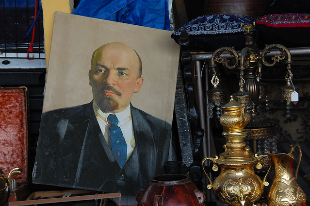
The Beatles mural was first painted in 1974 by Jane Weems, a young woman who lived in the house during the 1970s and 1980s.

In high school, Jane was the drummer/songwriter for a punk band called The Maggots. The band had a local underground hit with their song “Let’s Get Tammy Wynette.” Stereo Sanctity explains:

Formed around the nucleus of drummer Jane Weems and bassist Robert Mostert in ’78, it seems The Maggots proceeded to get through a veritable bus-load of additional members in their short existence, all arriving and departing from within SF’s high school-age punk milieu, raising merry hell in some parental basement and swiftly developing into the kind of band just as concerned with pasting together fake biographies and press releases for themselves and developing their own brand of icky goofball humour as they were with finding shows to play or recording songs.

The Maggots

You can listen to some vintage Maggots here. (Good stuff!) Jane still looked the part in 1982, and apparently she had a favorite Beatle:

Jane Weems

And here’s Jane, hard at work repainting the Beatles House, also in 1982:

Jane Weems, Hard at Work

So what inspired the Beatles House? In an email to me, Jane explained:

“I painted the house in 1974, when I was still in junior high school…. I had painted the walls of my bedroom inside the house, first with yellow submarine, then, I did the Elton John “Goodbye Yellow Brick Road” album cover really big on one wall, and other paintings of the Beatles & Elton John on my walls… they were pretty much covered… so, I asked if I could paint a mural on the house, and my parents said yes… so, I started to draw out what I wanted to paint, with a pencil, all freehand, in the low parts that I could reach… after painting that, my mom rented a scaffold, so I could go up higher to get the whole front done… in the middle of this, I had to go to school every day, so progress was slow.

The S.L.A. ‘s Emily Harris [of Patty Hearst kidnapping fame] lived secretly in a safe house down the street, and used to come by to “watch me paint” and talk to me about the Beatles.

It was fun, both times I painted it… lots of people would stop & watch, or talk to me when I was up there… when I was finished, for years folks would come by, take pix, ring the bell and see what kind of folks lived inside… : ) the SF Bay Guardian gave me a blue ribbon award once for being voted “The best SF remnant of the psychdelic 60′s” even though it was painted in ’74…

Basically, I was just an artistic kid who ran out of room inside, and started on the outside.

And finally, the Where Are They Now? Today, Jane lives in the Midwest, and Beatles House looks like this:

Former "Beatles House," 2007

IMAGES: Vintage photos courtesy of Jane Weems

Please Explain the Mystery of Toni’s Trade Winds

Toni's Trade Winds

Okay, so here’s a question for the Bernalwood old-timers: What was Toni’s Trade Winds?

Its vestigial sign still appears on the facade of 431 Cortland, a weary-looking building right next door to Heartfelt. Anyone know the story behind the old sign, and the business it presumably advertised?

I’m very curious. My hunch is that it might have been a travel agent, but that’s only because whenever I see the sign, that god-awful “Escape (The Pina Colada Song)” by Rupert Holmes starts to play in my head for some reason. I seek the truth, both for it’s own sake… and to (hopefully) to prevent this from happening in the future.

Oh, and extra credit if you can not only tell us what Toni’s Trade Winds was, but also tell a good tale of what it was like inside.

PHOTO: Telstar Logistics

The Cottage by the Reservoir (and the Day it Was Demolished)

Here’s a special celebrity guest post by Vicky Walker of the excellent Bernal History Project. Vicky shares a charming tale about a charming house that sat on Elsie Street, alongside the College Hill Reservoir, for 100 years. As a special bonus, she also brings the Interweb premiere of a home movie that shows the sad day in 1971 when the cottage was torn down. Take it away, Vicky…

The College Hill Reservoir was built on the edge of Holly Park in 1870 by the Spring Valley Water Company; the reservoir-keeper’s cottage at 336 Elsie Street was built next to it in 1871. It is described in Here Today thus: “This simple farmhouse, set in a well-maintained garden, looks as if it really belongs on the San Mateo coast. From its lot next to a reservoir, the home commands a fine view of Twin Peaks.”

It was one of only four Bernal Heights buildings considered to be architecturally significant by the Junior League of San Francisco in 1968 (the others are 450 Murray Street, 34 Prospect Avenue, and 3340 Folsom Street) and the only one of the four that no longer survives.

Peter B. Quinlan (1813-1903) was a longtime employee of the Spring Valley Water Company who rose from the position of plumber to superintendent, registrar, and then financial adjuster. While he never lived in Bernal Heights, Peter Quinlan may have helped a relative find work with the company: one Thomas Quinlan is listed as the reservoir keeper from 1880, and was still living there in 1915.

The reservoir’s expanse of open water seems to have beckoned many Bernal residents. An April 1892 Chronicle story tells of how Thomas’s wife, Caroline (described in the headline as “An Old Woman” – she was 53!), accidentally or deliberately fell in and drowned. “He and his wife frequently wandered around the edge of the basin,” the article reports. “About 4 o’clock the old man missed his wife from the house and went to the pond. To his horror he saw her body floating in the water a short distance from the shore.”

One morning in December 1877, Mrs. Peter Brickley of Cherubusco Street strolled naked (except for a wand tipped with several brightly colored ribbons) up to the reservoir. Once there, she took a leisurely bath first in a water trough and then in the reservoir itself. The reservoir-keeper’s aged father “shut his eyes tight and tried to fight her off with a garden rake,” but she managed to evade him. Finally, one young man jumped in to nab her; she was pulled to shore and wrapped in an assortment of clothing provided by the women of the neighborhood. The article concludes, “Mrs. Brickley was conveyed to the City Prison and thence to the House of the Inebriate, and her neighbors are using well water for a few days.”

In January 1916, the determinedly suicidal Agnes Graham of 24 Heyman Avenue was spotted by Holly Park Station relief firefighter Edward Ford, “who, noticing something queer in her actions as she hurried toward the reservoir,” jumped into the water after her and wrestled her to shore. She survived; he sustained severe bruises.

The San Francisco Public Utilities Commission decided to demolish 336 Elsie after it fell into disrepair; there were attempts to turn the building into a teenage dancehall before it was destroyed. This two-minute home video was shot by sisters Betty Mikulas Kancler and Janet Mikulas Thompson from their home on the other side of Elsie Street, sometime in 1971. It didn’t take long to reduce the century-old building to a pile of timber and rubble, as you can see in this silent home movie filmed on the day the cottage was demolished:

PHOTO: Top, 1891 photo from Bernal hill shows the houses at 418 and 412 Eugenia in the foreground. The keeper’s house is beside the uncovered reservoir, all by itself on Elsie Street. Courtesy of Andrea Cochran. Clean version of the photo here.

Then and Now: Bernalwood’s Wild Wild West, 1975 vs. 2011

Bernal Hill, San Francisco

From the ever-fabulous photo archives of Dave Glass (whom we last met right here), comes this typically fabulous photo of Bernalwood’s west slope, taken during the mid-1970s. Dave’s caption explains:

Foreground is Mission Street near Fair, Bernal Heights district,
One of San Francisco’s working class neighborhoods, Pentax H3v with Kodak TriX film, photograph taken 1975

So how does this working class neighborhood look today?

I went back to recapture Dave’s photo, but it seems he took his shot from an upper-story elevation on the western side of Mission Street. I couldn’t recreate that altitude, so this is what I got. (If you need a consistent point of reference, use on the barn-shaped house roughly in the middle of both images.)

Bernal NorthwestExecutive summary of the last 36 years? There’s been a whole lot of remodeling going on!

PHOTOS: Top, Dave Glass; bottom, Telstar Logistics

Our Seismologist Explains Why the 1906 Earthquake Did Little Damage to Bernalwood

As we noted earlier, today is the 105th anniversary of the Great Earthquake of 1906 — the infamous M7.8 rupture along the San Andreas Fault that severely damaged San Francisco before subsequent fires did the rest of the work destroying much of the City. The devastation was near-complete in the core of San Francisco, but Bernal Heights rode out the disaster relatively unscathed.

There were several reasons for this. Geologically speaking, Bernalwood is actually closer to the San Andreas than downtown, but the solid chert bedrock that makes up Bernal Hill didn’t shake nearly as hard as the soft sediment and artificial fill of the Financial District, Mission, or SoMa. That same chert explains why Bernal residents often miss smaller quakes that rattle people in other parts of the City.

That said, geology was secondary to Bernalwood’s survival in 1906. At the time, Bernal Heights was very much a part of the relatively-unsettled outskirts of town. There were fewer structures in Bernal to be destroyed, and most of the buildings that did exist were wood-framed working-class homes. Even on bad soil — but especially on chert! –wood structures perform better than masonry in strong shaking.

Though it was relatively uninvolved in the destruction, Bernal Heights played a big part in the phoenix-like rebirth of San Francisco in the years immediately following 1906. Amid the transition from the tent camps and wooden shacks that occupied places like Dolores and Precita Parks, people noticed that Bernal had largely escaped the catastrophe, and that it might be a (somewhat) safer place to be during any future earthquakes. Happily, that’s still true today.

PHOTOS: Top, Bernal Hill chert, by Telstar Logistics. Below, earthquake shacks in Precita Park, 1906, via Bernal History Project.